Area Overview for NN4 6EY
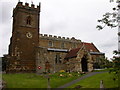
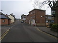
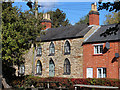
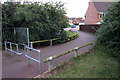
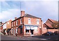
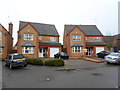
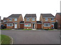
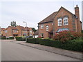
Photos of NN4 6EY


Area Information
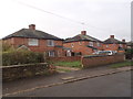
NN4 6EY is a compact residential postcode in England, spanning just 2.8 hectares and home to 1898 residents. This small area is densely populated, with 67,120 people per square kilometre, reflecting a tight-knit community. The area is defined by its residential cluster, offering a quiet, localised living environment. With a median age of 47, the population skews towards adults aged 30–64, suggesting a stable demographic with established households. The high home ownership rate of 85% indicates a community of long-term residents, many of whom live in traditional houses. Daily life here is characterised by proximity to essential services, with nearby shops, transport links, and low crime rates contributing to a sense of security. While the area lacks natural conservation designations, its safety profile and practical amenities make it an attractive option for those seeking a balanced, community-focused lifestyle.
- Area Type
- Postcode
- Area Size
- 2.8 hectares
- Population
- 1898
- Population Density
- 3185 people/km²
The property market in NN4 6EY is dominated by owner-occupied homes, with 85% of residents living in houses rather than rented accommodation. This reflects a community of long-term residents who have invested in their homes, likely contributing to a stable and low-turnover market. The area’s small size—just 2.8 hectares—means housing stock is limited, with no indication of high-density development. Buyers should consider that the focus on single-family homes may appeal to those prioritising space and privacy over proximity to urban centres. However, the compact nature of the postcode means properties are likely to be close to amenities such as retail hubs and transport links, including Northampton Railway Station. For investors, the high home ownership rate suggests demand for property is steady, though the small area may limit options for those seeking multiple properties.
House Prices in NN4 6EY
Showing 40 properties
| Address | Type | Beds | Baths | Last Sale Price | Last Sale Date | |
|---|---|---|---|---|---|---|
| 14 Sorrel Close, Northampton, NN4 6EY | Detached | 7 | 4 | £840,000 | Jul 2025 | |
| 8 Sorrel Close, Northampton, NN4 6EY | house | 5 | 3 | £660,000 | Oct 2024 | |
| 19 Sorrel Close, Northampton, NN4 6EY | Detached | 5 | 3 | £680,000 | Aug 2024 | |
| 26 Sorrel Close, Northampton, NN4 6EY | Detached | 5 | 3 | £710,000 | May 2024 | |
| 24 Sorrel Close, Northampton, NN4 6EY | house | 7 | 4 | £770,000 | Apr 2024 | |
| 12 Sorrel Close, Northampton, NN4 6EY | Detached | 5 | 3 | £730,000 | Sep 2023 | |
| 1 Sorrel Close, Northampton, NN4 6EY | Detached | 5 | 3 | £745,000 | Jun 2023 | |
| 33 Sorrel Close, Northampton, NN4 6EY | Detached | 5 | 3 | £725,000 | Jan 2023 | |
| 10 Sorrel Close, Northampton, NN4 6EY | house | - | - | £710,000 | Sep 2021 | |
| 11 Sorrel Close, Northampton, NN4 6EY | Detached | 6 | 3 | £685,000 | Sep 2019 |
Energy Efficiency in NN4 6EY
Living in NN4 6EY offers access to a range of nearby amenities within practical reach. The area is served by five retail outlets, including Co-op Wootten, Co-op Grange, and Tesco East, ensuring daily shopping needs are met. Public transport is conveniently available through two bus interchanges and a direct rail link to Northampton Railway Station, facilitating both local and long-distance travel. While the data does not specify parks or leisure facilities, the presence of multiple retail and transport options suggests a functional, community-oriented lifestyle. The compact nature of the postcode means residents can easily access services without lengthy commutes. The mix of shops, transport, and low crime risk contributes to a practical, accessible environment, ideal for those prioritising convenience and connectivity.
Amenities
Schools
| Rank | School | Type | Entry gender | Ages |
|---|
Explore more schools in this area
Go to Schools tabDemographics
The population of NN4 6EY is predominantly adults aged 30–64, with a median age of 47. This suggests a mature, settled community with a strong presence of families and professionals. Home ownership is exceptionally high at 85%, indicating a preference for long-term residency over rental properties. The area is composed almost entirely of houses, rather than flats or other accommodation types, which aligns with the demographic profile of older, established households. The predominant ethnic group is White, reflecting a homogenous community. While no specific deprivation data is provided, the high home ownership and low crime risk (83/100) imply a relatively stable quality of life. The absence of younger age groups or transient populations suggests limited demand for schools catering to children under 16, though nearby amenities like Northampton Bus Interchange may serve broader educational needs.
Household Size
Accommodation Type
Tenure
Ethnic Group
Religion
Household Composition
Age
Household Deprivation
NS-SEC
Explore more demographic insights in this area
Go to Demographics tabPlanning
Planning Constraints
- Flood RiskPremium
- Ramsar Wetland SitesPremium
- Area of Outstanding Natural BeautyPremium
- Protected Nature ReservePremium
- Protected WoodlandPremium