Area Overview for NN4 6DT
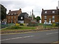
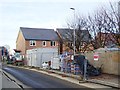
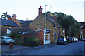
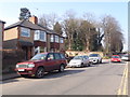
Photos of NN4 6DT


Area Information
NN4 6DT is a small, densely populated residential cluster in England, covering just 1.2 hectares. With 1,643 residents, the area is compact yet vibrant, offering a mix of convenience and community. The population density of 139,070 people per square kilometre reflects its tight-knit nature, where daily life is shaped by proximity to local amenities. This postcode is home to a predominantly older demographic, with a median age of 47 and most residents aged between 30 and 64. The area is largely owner-occupied, with 78% of homes in private hands, and houses are the primary accommodation type. Safety is a key feature, with a low crime risk score of 86 and no flood or environmental hazards. Digital connectivity is near flawless, with a broadband score of 100, ensuring seamless internet access for work and leisure. For those seeking a quiet, secure neighbourhood with practical access to retail, transport, and services, NN4 6DT offers a focused, efficient living environment.
- Area Type
- Postcode
- Area Size
- 1.2 hectares
- Population
- 1643
- Population Density
- 6652 people/km²
The property market in NN4 6DT is dominated by owner-occupied homes, with 78% of properties in private hands. This contrasts with areas where rental demand drives the market, indicating a preference for long-term residency. The accommodation type is primarily houses, which is uncommon in high-density urban areas, suggesting a mix of suburban and semi-rural characteristics. Given the small area size—just 1.2 hectares—the housing stock is limited, meaning buyers must consider nearby zones for additional options. The high home ownership rate implies a competitive market for available properties, with potential for stable value retention. For buyers, this area suits those seeking a secure, established home in a low-risk environment. However, the lack of flats or apartments may limit appeal for investors or those requiring flexible living arrangements. The compact nature of NN4 6DT also means proximity to amenities is a key selling point, though buyers should assess whether the area’s size meets their long-term needs.
House Prices in NN4 6DT
Showing 16 properties
| Address | Type | Beds | Baths | Last Sale Price | Last Sale Date | |
|---|---|---|---|---|---|---|
| 9 Tudely Close, Northampton, NN4 6DT | Detached | 6 | - | £520,000 | May 2018 | |
| 16 Tudely Close, Northampton, NN4 6DT | Detached | 4 | - | £475,000 | Oct 2017 | |
| 5 Tudely Close, Northampton, NN4 6DT | Detached | 4 | - | £430,000 | Jul 2017 | |
| 2 Tudely Close, Northampton, NN4 6DT | Detached | 5 | - | £410,000 | Feb 2017 | |
| 8 Tudely Close, Northampton, NN4 6DT | house | - | - | £415,000 | Nov 2016 | |
| 6 Tudely Close, Northampton, NN4 6DT | Detached | 4 | - | £425,000 | Feb 2016 | |
| 14 Tudely Close, Northampton, NN4 6DT | Detached | 4 | 2 | £360,000 | Feb 2015 | |
| 17 Tudely Close, Northampton, NN4 6DT | house | - | - | £410,000 | Oct 2014 | |
| 1 Tudely Close, Northampton, NN4 6DT | Detached | 4 | 2 | £325,000 | Aug 2009 | |
| 11 Tudely Close, Northampton, NN4 6DT | Detached | - | - | £335,000 | Dec 2006 |
Energy Efficiency in NN4 6DT
Living in NN4 6DT offers access to a range of nearby amenities within practical reach. Retail options include Co-op Wootten, Waitrose Wootton, and Tesco East, providing a mix of everyday shopping and larger supermarket choices. These stores cater to both routine needs and occasional purchases, ensuring convenience for residents. Public transport is well-served by Northampton Bus Interchange and University Bus Interchange, connecting the area to broader networks, while Northampton Railway Station offers rail links for longer journeys. Though the area lacks parks or green spaces explicitly mentioned in the data, its proximity to retail and transport hubs suggests a lifestyle focused on accessibility and efficiency. The small size of NN4 6DT means that most amenities are within walking or short-vehicle distance, reducing the need for extensive travel. This compactness fosters a sense of immediacy, where daily errands and social activities are seamlessly integrated into the local environment.
Amenities
Schools
| Rank | School | Type | Entry gender | Ages |
|---|
Explore more schools in this area
Go to Schools tabDemographics
The community in NN4 6DT is characterised by a median age of 47, with the majority of residents falling into the 30–64 age range. This suggests a stable, mature population, likely with established careers and family ties. Home ownership is high at 78%, indicating a preference for long-term residency over rental properties. The area is predominantly composed of houses, reflecting a more traditional housing stock compared to flats or apartments. The predominant ethnic group is White, which aligns with broader demographic trends in the region. The high population density—139,070 people per square kilometre—means the area is intensely populated despite its small size, creating a closely knit community. While this density may contribute to a sense of familiarity, it also means resources and services are shared among a large number of residents. The data does not indicate significant deprivation, but the high ownership rate and age profile suggest a relatively stable, middle-income demographic.
Household Size
Accommodation Type
Tenure
Ethnic Group
Religion
Household Composition
Age
Household Deprivation
NS-SEC
Explore more demographic insights in this area
Go to Demographics tabPlanning
Planning Constraints
- Flood RiskPremium
- Ramsar Wetland SitesPremium
- Area of Outstanding Natural BeautyPremium
- Protected Nature ReservePremium
- Protected WoodlandPremium