Area Overview for NN4 6BZ
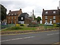
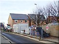
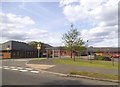
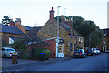
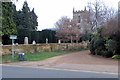
Photos of NN4 6BZ
Area Information
Living in NN4 6BZ offers a compact, residential experience within a small cluster of homes. The area covers just 2.8 hectares, yet it supports a population of 2,298 people, resulting in a high population density of 82,304 per square kilometre. This suggests a tightly knit community, where proximity to neighbours and local amenities is a defining feature. The area is predominantly occupied by adults aged 30–64, with 77% of residents owning their homes. Most properties are houses, reflecting a traditional, family-oriented living environment. Nearby, residents have access to schools such as Hardingstone Primary and Hardingstone Academy, alongside retail options like Waitrose Wootton and Tesco East. Public transport links, including Northampton Railway Station and University Bus Interchange, connect the area to broader networks. While the postcode is small, its density and accessibility make it a practical choice for those prioritising convenience and community over expansive space.
- Area Type
- Postcode
- Area Size
- 2.8 hectares
- Population
- 2298
- Population Density
- 2930 people/km²
The property market in NN4 6BZ is dominated by owner-occupied homes, with 77% of residents living in properties they own. This high rate of home ownership indicates a community that values long-term investment and stability. The accommodation type is predominantly houses, which contrasts with areas where flats or apartments are more common. Given the area’s small size—just 2.8 hectares—the housing stock is limited, making it a niche market. Buyers should consider the compact nature of the postcode, as the immediate surroundings may offer more options. The focus on owner-occupation suggests lower rental availability, which could be a consideration for those seeking short-term or flexible housing. For those prioritising family-friendly living, the prevalence of houses aligns with the area’s demographic profile, offering space and privacy within a densely populated setting.
House Prices in NN4 6BZ
Showing 28 properties
| Address | Type | Beds | Baths | Last Sale Price | Last Sale Date | |
|---|---|---|---|---|---|---|
| 31 High Street, Hardingstone, Northampton, NN4 6BZ | Cottage | 2 | 1 | £270,000 | Aug 2025 | |
| 33 High Street, Hardingstone, Northampton, NN4 6BZ | Semi-detached | 2 | 1 | £270,000 | Jul 2025 | |
| Reglado, 53 High Street, Hardingstone, Northampton, NN4 6BZ | Bungalow | 3 | 2 | £470,000 | Mar 2025 | |
| 45 High Street, Hardingstone, Northampton, NN4 6BZ | Semi-detached | 3 | 2 | £360,000 | Feb 2024 | |
| 21 High Street, Hardingstone, Northampton, NN4 6BZ | house | 3 | 1 | £290,000 | Mar 2022 | |
| 39 High Street, Hardingstone, Northampton, NN4 6BZ | Terraced | 2 | - | £247,000 | Oct 2020 | |
| The Old Vicarage, High Street, Hardingstone, Northampton, NN4 6BZ | house | 5 | - | £835,000 | Apr 2017 | |
| 35 High Street, Hardingstone, Northampton, NN4 6BZ | Terraced | 2 | - | £206,000 | Mar 2016 | |
| Church House, High Street, Hardingstone, Northampton, NN4 6BZ | Detached | - | - | £425,000 | Jan 2016 | |
| 41 High Street, Hardingstone, Northampton, NN4 6BZ | Semi-detached | 3 | - | £277,995 | Oct 2015 |
Energy Efficiency in NN4 6BZ
The lifestyle in NN4 6BZ is shaped by its proximity to essential amenities. Retail options include five shops, such as Waitrose Wootton and Co-op Wootten, providing access to groceries, household items, and other necessities. The area’s transport links, including Northampton Railway Station and two bus interchanges, facilitate easy travel to nearby towns and universities. While the data does not specify parks or leisure facilities, the compact nature of the postcode suggests that residents may rely on nearby public spaces or community hubs. The presence of multiple retail outlets and transport options enhances daily convenience, allowing residents to manage errands and travel efficiently. This accessibility supports a practical, community-focused lifestyle, where proximity to services and connectivity are prioritised.
Amenities
Schools
Residents of NN4 6BZ have access to a range of school options, including Hardingstone Primary School, which caters to younger children, and Hardingstone Academy, a good-rated academy offering secondary education. For those seeking independent education, Northampton High School provides an alternative. The mix of state and independent schools offers families flexibility, whether they prioritise public education or seek the resources of a private institution. Hardingstone Academy’s Ofsted rating of ‘good’ reflects a standard of teaching and facilities that meets regulatory benchmarks. The proximity of these schools to the area ensures ease of access for families, reducing commuting times and supporting a balanced lifestyle. With three distinct educational institutions nearby, the area accommodates diverse preferences, from early years education to secondary schooling.
| Rank | School | Type | Entry gender | Ages |
|---|
Explore more schools in this area
Go to Schools tabDemographics
The demographic profile of NN4 6BZ is shaped by a median age of 47, with the majority of residents falling within the 30–64 age range. This suggests a mature, stable population, likely with established careers and family commitments. Home ownership is high at 77%, indicating a strong preference for long-term residency over rental properties. The predominant accommodation type is houses, aligning with the area’s character as a residential cluster. The predominant ethnic group is White, reflecting a homogenous community. The high population density, while not explicitly tied to deprivation data, implies a compact, possibly urbanised setting. This density may influence the availability of private spaces but also fosters a sense of neighbourly interaction. For those considering relocation, the area’s demographics suggest a focus on stability, with residents likely prioritising proximity to essential services and a low-risk environment.
Household Size
Accommodation Type
Tenure
Ethnic Group
Religion
Household Composition
Age
Household Deprivation
NS-SEC
Explore more demographic insights in this area
Go to Demographics tabPlanning
Planning Constraints
- Flood RiskPremium
- Ramsar Wetland SitesPremium
- Area of Outstanding Natural BeautyPremium
- Protected Nature ReservePremium
- Protected WoodlandPremium