Area Overview for NN4 5FB
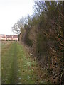
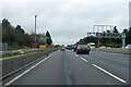
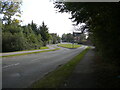
Photos of NN4 5FB


Area Information
NN4 5FB is a small, densely populated residential cluster in England, covering just 10.8 hectares. With 1,681 residents packed into this compact area, it is one of the most densely populated postcode zones in the country, at 15,595 people per square kilometre. This tight-knit community thrives on its proximity to Northampton’s transport hubs, including the city’s main railway station and bus interchange, which provide easy access to surrounding towns and cities. Daily life here is defined by convenience: residents can walk to nearby retail outlets like Co-op Grange, Co-op Wootten, and Tesco East, while the area’s low crime risk and minimal environmental constraints make it a stable place to live. The compact size means most amenities are within practical reach, though the area’s small footprint also means it is not suited to large families or those needing extensive outdoor space. For buyers seeking a tightly connected, low-risk neighbourhood with direct links to Northampton’s infrastructure, NN4 5FB offers a distinct blend of practicality and accessibility.
- Area Type
- Postcode
- Area Size
- 10.8 hectares
- Population
- 1681
- Population Density
- 1934 people/km²
NN4 5FB is predominantly a home-ownership area, with 76% of properties owned by residents rather than rented. The accommodation type is primarily houses, which is unusual for a densely populated postcode area. This suggests a mix of semi-detached or terraced housing, typical of older residential clusters. The high home ownership rate indicates a stable market with long-term residents, though the small size of the area means property availability is limited. Buyers should expect competition for available homes, as the area’s proximity to Northampton’s transport links makes it attractive. The dominance of owner-occupied properties also implies that rental options are scarce, making it a less viable choice for those seeking short-term housing. For those prioritising security and a settled community, NN4 5FB’s property market offers a reliable, though tightly controlled, opportunity.
House Prices in NN4 5FB
Showing 2 properties
| Address | Type | Beds | Baths | Last Sale Price | Last Sale Date | |
|---|---|---|---|---|---|---|
| Yusen Logistics (uk), Unit 2, Cheaney Drive, Grange Park, NN4 5FB | storage_distribution | - | - | - | - | |
| Yusen Logistics (uk), Unit 3, Cheaney Drive, Grange Park, NN4 5FB | Industrial | - | - | - | - |
Energy Efficiency in NN4 5FB
Living in NN4 5FB offers a mix of convenience and practicality. The area’s retail options include Co-op Grange, Co-op Wootten, and Tesco East, providing essential shopping within walking distance. While there are no named parks or leisure facilities in the data, the proximity to Northampton’s transport links opens access to the city’s cultural and recreational offerings. The single bus route to Northampton Bus Interchange and the railway station ensure residents can reach larger retail centres, theatres, and green spaces. The low crime risk and lack of environmental constraints — such as protected woodlands or wetlands — suggest a straightforward, uncluttered lifestyle. However, the area’s small size means it is not ideal for those seeking extensive outdoor space or a rural feel. For buyers prioritising accessibility and convenience over expansive amenities, NN4 5FB provides a functional, well-connected base.
Amenities
Schools
| Rank | School | Type | Entry gender | Ages |
|---|
Explore more schools in this area
Go to Schools tabDemographics
The population of NN4 5FB skews towards adults aged 30–64, with a median age of 47. This suggests a community of established professionals and families, rather than students or retirees. Home ownership is high, at 76%, indicating a stable, long-term resident base. The predominant ethnic group is White, which aligns with broader regional demographics. The area’s density and compact size mean most households are likely to be family-oriented, though the data does not specify the proportion of single-person or multi-generational homes. The absence of significant deprivation data implies that residents generally have access to essential services, though the high population density may strain local infrastructure. This demographic profile suggests a mature, settled community with strong ties to the area, prioritising security and convenience over expansion.
Household Size
Accommodation Type
Tenure
Ethnic Group
Religion
Household Composition
Age
Household Deprivation
NS-SEC
Explore more demographic insights in this area
Go to Demographics tabPlanning
Planning Constraints
- Flood RiskPremium
- Ramsar Wetland SitesPremium
- Area of Outstanding Natural BeautyPremium
- Protected Nature ReservePremium
- Protected WoodlandPremium