Area Overview for NN4 5EF
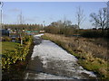
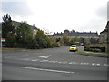
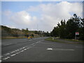
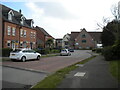
Photos of NN4 5EF
Area Information
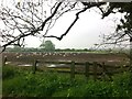
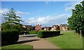
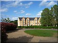
NN4 5EF is a small, densely populated residential area in England, covering 4,620 square metres and home to 1,431 residents. Its compact size means daily life is tightly woven around local amenities and community hubs. The area’s population density of 1,428 people per square kilometre reflects a mix of established families and long-term residents, with the median age of 47 indicating a mature demographic. This is a place where proximity to essentials matters: schools, shops, and transport links are within practical reach. The area’s character is defined by its housing stock, with a strong emphasis on owner-occupied homes. While the small footprint limits expansion, it creates a tightly knit community. However, residents should be mindful of the high flood risk, a critical factor for property buyers. Despite this, the area’s low crime rate and proximity to retail and transport networks make it appealing for those prioritising convenience and safety.
- Area Type
- Postcode
- Area Size
- 4620 m²
- Population
- 1431
- Population Density
- 1428 people/km²
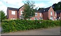
The property market in NN4 5EF is dominated by owner-occupied homes, with 62% of properties owned by residents. This contrasts with rental markets typically found in urban centres, indicating a community of settled households. The area’s housing stock consists primarily of houses, which are well-suited to families and those seeking private, spacious living. Given the small size of the postcode area, the number of available properties is limited, making the local market competitive for buyers. The focus on owner-occupation suggests stable demand, though the high population density may constrain future development. For buyers, this means prioritising properties in the immediate vicinity, as the area’s boundaries are narrowly defined.
House Prices in NN4 5EF
Showing 8 properties
| Address | Type | Beds | Baths | Last Sale Price | Last Sale Date | |
|---|---|---|---|---|---|---|
| 32, Cookham Richmond, Bridge Meadow Way, Grange Park, NN4 5EF | Flat | - | - | £257,500 | May 2025 | |
| 27, Cookham Richmond, Bridge Meadow Way, Grange Park, NN4 5EF | Flat | - | - | £245,000 | Jun 2024 | |
| 31, Cookham Richmond, Bridge Meadow Way, Grange Park, NN4 5EF | Flat | - | - | £272,500 | Jan 2023 | |
| 29, Cookham Richmond, Bridge Meadow Way, Grange Park, NN4 5EF | Flat | - | - | £400,000 | Mar 2022 | |
| 30, Cookham Richmond, Bridge Meadow Way, Grange Park, NN4 5EF | Flat | - | - | £260,000 | May 2018 | |
| 28, Cookham Richmond, Bridge Meadow Way, Grange Park, NN4 5EF | Flat | - | - | £282,000 | Mar 2018 | |
| 33, Cookham Richmond, Bridge Meadow Way, Grange Park, NN4 5EF | Flat | 1 | 1 | £200,000 | May 2009 | |
| Cookham Richmond, Bridge Meadow Way, Grange Park, NN4 5EF | Retirement | - | - | - | - |
Energy Efficiency in NN4 5EF
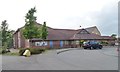
Daily life in NN4 5EF is shaped by its proximity to essential amenities. Retail options include Co-op Grange, Co-op Wootten, and Tesco East, offering grocery and household needs within walking distance. The area’s transport links, including bus and rail services, provide access to broader regional networks. While the small postcode area limits the variety of leisure facilities, the nearby Northampton Bus Interchange and railway station connect residents to cultural and recreational hubs. The presence of Woodland View Primary School adds to the community’s family-friendly appeal. The compact nature of the area means residents can access shops, transport, and education without long commutes, fostering a convenient, self-contained lifestyle.
Amenities
Schools
The nearest school to NN4 5EF is Woodland View Primary School, which holds an outstanding Ofsted rating. This institution serves the area’s primary education needs, offering a high standard of teaching and facilities. The presence of a single primary school suggests that families may need to travel slightly beyond the postcode area for secondary education. However, the school’s rating ensures that children receive quality early education, which is a significant draw for families. The absence of secondary schools within the immediate vicinity means buyers should consider proximity to larger towns or cities for comprehensive schooling.
| Rank | School | Type | Entry gender | Ages |
|---|
Explore more schools in this area
Go to Schools tabDemographics
The community in NN4 5EF is predominantly composed of adults aged 30–64, with a median age of 47. This suggests a stable population of working-age individuals and families, likely with children in primary education. Home ownership stands at 62%, indicating a mix of long-term residents and investors. The area is characterised by houses rather than flats, reflecting a preference for family homes. The predominant ethnic group is White, though no specific data on diversity or deprivation is provided. With a population density of 1,428 people per square kilometre, the area is compact, which may influence social dynamics and access to shared resources. The high proportion of owner-occupied properties suggests a focus on long-term residency rather than transient tenancies.
Household Size
Accommodation Type
Tenure
Ethnic Group
Religion
Household Composition
Age
Household Deprivation
NS-SEC
Explore more demographic insights in this area
Go to Demographics tabPlanning
Planning Constraints
- Flood RiskPremium
- Ramsar Wetland SitesPremium
- Area of Outstanding Natural BeautyPremium
- Protected Nature ReservePremium
- Protected WoodlandPremium