Area Overview for NN4 5DR
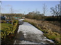
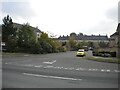
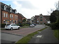
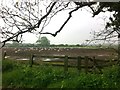
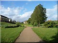
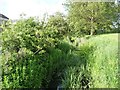
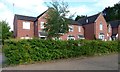
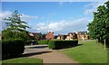
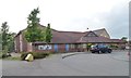
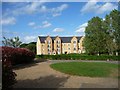
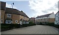
Photos of NN4 5DR

Area Information
Living in NN4 5DR means inhabiting a compact, residential cluster in England, where 1,431 people reside across 1.4 hectares. This small area is characterised by a high population density of 1,428 people per square kilometre, creating a tightly woven community. The area is primarily composed of houses, with 62% of residents owning their homes. The median age of 47 suggests a mature population, with the majority aged between 30 and 64. Daily life here is shaped by proximity to essential services, including retail outlets like Co-op Grange and Tesco East, and transport hubs such as Northampton Railway Station. While the area lacks large-scale amenities, its compact size ensures that essentials are within practical reach. The presence of Woodland View Primary School, rated outstanding by Ofsted, adds to its appeal for families. However, the small footprint means the community is both intimate and limited in scope, requiring residents to balance local convenience with the need for broader regional access.
- Area Type
- Postcode
- Area Size
- 1.4 hectares
- Population
- 1431
- Population Density
- 1428 people/km²
The property market in NN4 5DR is dominated by owner-occupied homes, with 62% of residents owning their properties. This contrasts with areas where rental markets predominate, indicating a community of long-term residents rather than transient tenants. The accommodation type is primarily houses, which are typically larger and more spacious than flats or apartments. Given the area’s small size of 1.4 hectares, the housing stock is limited, and the proximity to amenities like Northampton Railway Station and retail outlets may influence property values. For buyers, this means a focus on existing, established homes rather than new developments. The compact nature of the area also means that properties are likely to be in close proximity to each other, with limited scope for expansion or new construction.
House Prices in NN4 5DR
Showing 43 properties
| Address | Type | Beds | Baths | Last Sale Price | Last Sale Date | |
|---|---|---|---|---|---|---|
| 7 Brook View, Grange Park, NN4 5DR | house | - | - | £267,000 | Dec 2024 | |
| 14 Brook View, Grange Park, NN4 5DR | Flat | 1 | 1 | £166,000 | Sep 2024 | |
| 32 Brook View, Grange Park, NN4 5DR | Flat | 2 | - | £168,000 | Jun 2024 | |
| 31 Brook View, Grange Park, NN4 5DR | Flat | - | - | £159,995 | May 2024 | |
| 22 Brook View, Grange Park, NN4 5DR | Flat | 2 | 1 | £169,000 | Oct 2023 | |
| 1 Brook View, Grange Park, NN4 5DR | Terraced | 3 | - | £250,000 | Jul 2023 | |
| 38 Brook View, Grange Park, NN4 5DR | Flat | 2 | - | £162,000 | Apr 2023 | |
| 3 Brook View, Grange Park, NN4 5DR | house | 3 | 2 | £273,000 | Oct 2022 | |
| 15 Brook View, Grange Park, NN4 5DR | Flat | - | - | £167,500 | Mar 2022 | |
| 12 Brook View, Grange Park, NN4 5DR | Flat | - | - | £170,000 | Mar 2022 |
Energy Efficiency in NN4 5DR
The lifestyle in NN4 5DR is shaped by its proximity to essential amenities within practical reach. Retail options include Co-op Grange, Co-op Wootten, and Tesco East, ensuring that daily shopping needs are met locally. The area’s transport links, such as Northampton Bus Interchange and University Bus Interchange, provide access to broader regional networks. While there are no named parks or leisure facilities in the data, the presence of a railway station and bus routes suggests opportunities for recreation beyond the immediate area. The compact nature of the neighbourhood means that residents can access shops, transport, and services without long commutes, though the lack of detailed leisure options may require travel for more specialised amenities.
Amenities
Schools
The nearest school to NN4 5DR is Woodland View Primary School, which serves the area’s primary education needs. This school is explicitly listed twice in the data, both times as a primary institution with an outstanding Ofsted rating. The absence of secondary schools in the data suggests that families may need to look beyond NN4 5DR for secondary education options. The presence of a high-rated primary school is a significant draw for families, offering quality early education within walking distance. However, the lack of secondary schools nearby means that parents should consider commuting arrangements for older children. The school’s rating indicates a strong educational foundation, which is a key factor for many homebuyers prioritising family-friendly environments.
| Rank | School | Type | Entry gender | Ages |
|---|
Explore more schools in this area
Go to Schools tabDemographics
NN4 5DR’s population is predominantly adults aged 30 to 64, with a median age of 47. This suggests a community of established professionals and families, rather than a mix of younger or older demographics. Home ownership is strong, with 62% of residents owning their homes, indicating stability and long-term residency. The area is composed mostly of houses, reflecting a preference for traditional, single-family dwellings. The predominant ethnic group is White, which aligns with broader regional trends. The high population density of 1,428 people per square kilometre implies a closely knit neighbourhood, though it may also contribute to a sense of overcrowding in a small area. While no specific data on deprivation is provided, the high home ownership and mature age profile suggest a relatively stable, middle-income community.
Household Size
Accommodation Type
Tenure
Ethnic Group
Religion
Household Composition
Age
Household Deprivation
NS-SEC
Explore more demographic insights in this area
Go to Demographics tabPlanning
Planning Constraints
- Flood RiskPremium
- Ramsar Wetland SitesPremium
- Area of Outstanding Natural BeautyPremium
- Protected Nature ReservePremium
- Protected WoodlandPremium