Area Overview for NN4 0PS
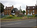
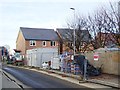
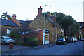
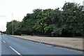
Photos of NN4 0PS


Area Information
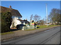
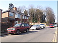
Living in NN4 0PS offers a compact, residential experience with a population of 2,298, centered around a small cluster of homes. The area’s character is defined by its proximity to essential services and a mix of local amenities. With a median age of 47 and a majority of residents aged 30–64, it is a community skewed toward established families and professionals. The high home ownership rate of 77% suggests a stable, long-term presence, with most properties being houses rather than flats. Daily life here is shaped by practicality: nearby schools, retail outlets, and transport links make it convenient for families and commuters. The area’s low crime risk and absence of environmental constraints like protected woodlands or wetlands contribute to a sense of security. While small, NN4 0PS is well-connected to Northampton’s infrastructure, including railway stations and bus interchanges, ensuring accessibility to the city’s broader offerings. For those seeking a quiet, family-friendly environment with easy access to services, this postcode provides a balanced blend of residential comfort and functional connectivity.
- Area Type
- Postcode
- Area Size
- Not available
- Population
- 2298
- Population Density
- 2930 people/km²
The property market in NN4 0PS is largely owner-occupied, with 77% of homes owned by residents rather than rented. This suggests a community of long-term residents rather than a transient rental market. The accommodation type is predominantly houses, which is typical of smaller, suburban or rural postcode areas. Given the postcode’s small size and limited housing stock, the market is likely to be niche, with limited scope for new developments. Buyers should consider the area’s proximity to amenities such as schools and transport links, which may enhance its appeal. The absence of planning constraints like protected woodlands or Areas of Outstanding Natural Beauty means there are no restrictions on property modifications or extensions. However, the small size of the area means that property availability is limited, and buyers may need to look beyond NN4 0PS for more options. For those prioritising home ownership in a low-risk, family-friendly environment, this area could be a viable choice.
House Prices in NN4 0PS
No properties found in this postcode.
Energy Efficiency in NN4 0PS
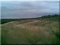
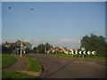
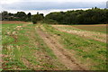
The lifestyle in NN4 0PS is shaped by its proximity to essential amenities and services. Within practical reach are five retail outlets, including Waitrose Wootton, Tesco East, and Co-op Wootten, offering a range of shopping options. The area’s transport links, such as Northampton Railway Station and nearby bus interchanges, provide easy access to the city’s broader amenities, including dining, leisure, and cultural venues. While the postcode itself is small, its integration with Northampton’s infrastructure ensures residents can enjoy the city’s offerings without long commutes. The absence of major parks or green spaces within the area means outdoor recreation may require travel to nearby locations, but the convenience of local shops and transport mitigates this. The mix of retail and transport options supports a practical, everyday lifestyle, with a focus on accessibility and functionality. For those valuing convenience over expansive leisure facilities, NN4 0PS delivers a straightforward, service-oriented environment.
Amenities
Schools
Residents of NN4 0PS have access to a range of educational institutions, including Hardingstone Primary School, a state-funded primary school, and Hardingstone Academy, a good-rated academy offering secondary education. Northampton High School, an independent school, provides an alternative for families seeking private education. The mix of school types ensures flexibility for parents, whether they prefer state, academy, or independent schooling. Hardingstone Academy’s Ofsted rating of ‘good’ indicates a reliable standard of education, which is a key consideration for families prioritising academic outcomes. The proximity of these schools to the area makes NN4 0PS an attractive option for households with children. However, the limited number of schools means that parents may need to consider commuting to other parts of Northampton for additional options. The presence of both state and independent schools reflects the area’s appeal to a diverse range of educational preferences.
| Rank | School | Type | Entry gender | Ages |
|---|
Explore more schools in this area
Go to Schools tabDemographics
The community in NN4 0PS is predominantly composed of adults aged 30–64, with a median age of 47. This suggests a population of established professionals and families, rather than a younger or elderly demographic. Home ownership is high, at 77%, indicating a strong presence of long-term residents. The accommodation type is primarily houses, reflecting a more traditional housing stock compared to areas with higher flat or apartment density. The predominant ethnic group is White, though no specific diversity statistics are provided. The absence of data on deprivation or socioeconomic breakdown means the area’s quality of life can only be inferred from its safety and infrastructure. With no significant environmental constraints or protected sites, the area is likely to have lower housing restrictions, supporting its residential character. The demographic profile points to a stable, low-mobility community, which may appeal to those seeking a settled environment.
Household Size
Accommodation Type
Tenure
Ethnic Group
Religion
Household Composition
Age
Household Deprivation
NS-SEC
Explore more demographic insights in this area
Go to Demographics tabPlanning
Planning Constraints
- Flood RiskPremium
- Ramsar Wetland SitesPremium
- Area of Outstanding Natural BeautyPremium
- Protected Nature ReservePremium
- Protected WoodlandPremium