Area Overview for NN4 0LY
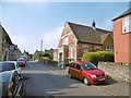
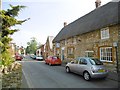
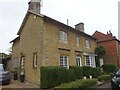
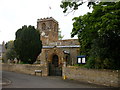
Photos of NN4 0LY


Area Information
NN4 0LY is a compact residential area in England, covering 8.8 hectares with a population of 1431 people. Its high population density of 1428 people per square kilometre suggests a tightly knit community, likely centred around a mix of single-family homes and small clusters of housing. The area’s character is defined by its proximity to essential services, including a primary school with an outstanding Ofsted rating and nearby retail hubs. Daily life here is shaped by the balance between local amenities and connections to broader transport networks. With Northampton Railway Station and multiple bus routes within reach, residents have access to regional travel options. The area’s small size means it is likely a quiet, family-oriented neighbourhood, where proximity to schools and shops plays a key role in its appeal. For those seeking a community with a strong sense of local identity and practical infrastructure, NN4 0LY offers a blend of residential comfort and accessibility.
- Area Type
- Postcode
- Area Size
- 8.8 hectares
- Population
- 1431
- Population Density
- 1428 people/km²
The property market in NN4 0LY is characterised by a high rate of home ownership (62%) and a predominance of houses. This suggests a community where long-term residency is common, with properties likely designed for family living. The small area size means the housing stock is limited, which could make the market competitive for buyers. Given the high proportion of owner-occupied homes, rental options may be scarce, potentially limiting choices for those seeking to rent. Buyers should consider the surrounding areas for additional housing options, as the immediate vicinity may have limited availability. The focus on houses rather than flats or apartments indicates a preference for private, spacious living, which aligns with the area’s demographic profile of older, established residents.
House Prices in NN4 0LY
Showing 3 properties
| Address | Type | Beds | Baths | Last Sale Price | Last Sale Date | |
|---|---|---|---|---|---|---|
| Viridor Waste Management, Wootton Landfill Site, London Road Part A 45, Northampton, NN4 0LY | commercial | - | - | - | - | |
| Buddies Burger Company, London Road Part A 45, Northampton, NN4 0LY | Retail | - | - | - | - | |
| The Flat, Buddies Burger Company, London Road Part A 45, Northampton, NN4 0LY | Flat | - | - | - | - |
Energy Efficiency in NN4 0LY
Living in NN4 0LY provides access to a range of amenities within practical reach. The area is served by five retail outlets, including Co-op Grange, Tesco East, and Co-op Wootten, offering everyday shopping needs. Public transport options include Northampton Bus Interchange and University Bus Interchange, facilitating travel to nearby towns and educational institutions. While the data does not specify parks or leisure facilities, the absence of planning constraints such as protected woodlands or AONB designations suggests open spaces may be available locally. The combination of retail, transport, and proximity to a high-performing primary school creates a convenient lifestyle, ideal for those prioritising accessibility and community amenities.
Amenities
Schools
The nearest school to NN4 0LY is Woodland View Primary School, which serves the local community with an outstanding Ofsted rating. This indicates a high standard of education for young children, which is a significant draw for families. The presence of a primary school with such a rating suggests that the area is well-served for early education, though no secondary schools are listed in the data. For families requiring secondary education, proximity to Northampton’s broader school network would be key. The school’s performance may contribute to the area’s appeal, reinforcing its reputation as a family-friendly neighbourhood. However, buyers should verify the availability of secondary schooling options in the wider region to ensure long-term educational needs are met.
| Rank | School | Type | Entry gender | Ages |
|---|
Explore more schools in this area
Go to Schools tabDemographics
The population of NN4 0LY has a median age of 47, with the majority of residents falling within the 30-64 age range. This suggests a community dominated by adults, likely including families and older homeowners. Home ownership is high at 62%, with houses being the predominant type of accommodation. The area’s demographic profile indicates a stable, established population with limited representation of younger age groups or rental households. The predominant ethnic group is White, reflecting a homogenous community. While no specific data on deprivation is provided, the high home ownership rate and age distribution imply a relatively low dependency on social services. This demographic structure may influence local amenities, with services tailored to the needs of adults and families rather than younger residents or transient populations.
Household Size
Accommodation Type
Tenure
Ethnic Group
Religion
Household Composition
Age
Household Deprivation
NS-SEC
Explore more demographic insights in this area
Go to Demographics tabPlanning
Planning Constraints
- Flood RiskPremium
- Ramsar Wetland SitesPremium
- Area of Outstanding Natural BeautyPremium
- Protected Nature ReservePremium
- Protected WoodlandPremium