Area Overview for NN3 9HW
Photos of NN3 9HW


Area Information
NN3 9HW is a compact residential postcode area in England, covering 17.5 hectares and home to 1,769 residents. Its small size means it is a tightly knit community, with a population density of 534 people per square kilometre. The area is characterised by a mature demographic, with a median age of 47 and the majority of residents falling within the 30-64 age range. This suggests a stable, established community with a focus on long-term living. The area is primarily composed of owner-occupied homes, with 54% of properties in private ownership. While it is a residential cluster, its proximity to Northampton offers access to larger urban amenities. However, the area’s small footprint means that daily life revolves around local services and nearby transport links. Residents are likely to be commuters, given the presence of Northampton Railway Station and multiple bus routes. The area’s distinctiveness lies in its balance of residential tranquillity and connectivity to nearby cities, though its limited size means it is not suited to those seeking expansive living spaces.
- Area Type
- Postcode
- Area Size
- 17.5 hectares
- Population
- 1769
- Population Density
- 534 people/km²
The property market in NN3 9HW is dominated by owner-occupied homes, with 54% of properties in private hands. This suggests a community focused on long-term residency rather than rental turnover. The accommodation type is primarily houses, which is unusual for smaller postcode areas and may indicate a mix of semi-detached or terraced housing. Given the area’s compact size, the housing stock is likely limited, making it a niche market for buyers seeking specific properties. The predominance of houses over flats or apartments may appeal to those prioritising space and privacy. However, the small area size means that property choices are constrained, and buyers may need to look beyond NN3 9HW for larger options. The high home ownership rate also implies that the market is less influenced by rental demand, which could affect property values and availability. Prospective buyers should consider the area’s limited footprint when evaluating long-term suitability.
House Prices in NN3 9HW
No properties found in this postcode.
Energy Efficiency in NN3 9HW
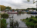
Residents of NN3 9HW have access to nearby retail options, including Aldi Headlands, Lidl Lings, and Tesco Northampton, which provide essential shopping and grocery needs. The area’s proximity to Northampton Bus Interchange and University Bus Interchange enhances mobility, allowing easy access to the city’s cultural, commercial, and educational hubs. While the data does not mention parks or leisure facilities, the presence of multiple retail and transport points suggests a practical, service-oriented lifestyle. The limited local amenities mean that residents may need to travel to Northampton for more extensive leisure or recreational opportunities. Nonetheless, the combination of retail outlets and transport links offers convenience for daily living, particularly for those prioritising accessibility over on-site facilities.
Amenities
Schools
The nearest school to NN3 9HW is Bellinge Primary School, which serves the local community with primary education. The data does not provide an Ofsted rating, so its quality remains unspecified. Families with young children may find this school convenient, though the absence of secondary schools within the area suggests that parents would need to seek options in nearby Northampton. The single primary school indicates a limited range of educational choices, which could be a consideration for families requiring a broader selection of schools. The school’s presence contributes to the area’s appeal for households with children, but its standalone nature means that educational planning must extend beyond NN3 9HW.
| Rank | School | Type | Entry gender | Ages |
|---|
Explore more schools in this area
Go to Schools tabDemographics
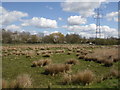
The community in NN3 9HW is predominantly composed of adults aged 30-64, reflecting a mature population with a median age of 47. This age group suggests a stable demographic with likely strong family ties and long-term residency. Home ownership is significant, with 54% of properties owned by residents, indicating a preference for settled living over rental tenancies. The accommodation type is primarily houses, which aligns with the area’s residential character and the typical preferences of its older demographic. The predominant ethnic group is White, which is consistent with broader regional trends. The population density of 534 people per square kilometre suggests a moderately populated area, neither overly crowded nor sparsely inhabited. While the data does not specify deprivation levels, the combination of high home ownership and a mature age profile implies a community with relatively stable economic conditions. However, the absence of protected natural areas or green spaces may impact quality of life for those prioritising environmental amenities.
Household Size
Accommodation Type
Tenure
Ethnic Group
Religion
Household Composition
Age
Household Deprivation
NS-SEC
Explore more demographic insights in this area
Go to Demographics tabPlanning
Planning Constraints
- Flood RiskPremium
- Area of Outstanding Natural BeautyPremium
- Protected Nature ReservePremium
- Protected WoodlandPremium