Area Overview for NN3 9HS
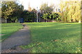
Photos of NN3 9HS


Area Information
NN3 9HS is a small, densely populated residential postcode in England, covering just 3,847 square metres and home to 1,643 residents. This compact area is defined by its high population density of 427,123 people per square kilometre, reflecting a tightly knit community. The area’s character is shaped by its modest size and the mix of housing types, though the data suggests a predominance of single-family homes. Residents here are largely adults aged 30–64, with a median age of 47, indicating a mature, settled population. Daily life in NN3 9HS is influenced by its proximity to essential services, including retail outlets like Co-op Bellinge and Tesco Northampton, and transport hubs such as Northampton Railway Station. While the area lacks natural landscapes or protected sites, its practical connectivity and low flood risk make it a viable option for those prioritising accessibility over rural tranquillity. The high broadband score of 100 ensures seamless digital connectivity, supporting remote work and online activities. For buyers, NN3 9HS offers a snapshot of suburban living with a focus on convenience and proximity to urban amenities.
- Area Type
- Postcode
- Area Size
- 3847 m²
- Population
- 1643
- Population Density
- 7717 people/km²
The property market in NN3 9HS is characterised by a 44% home ownership rate, meaning just under half of residents own their homes. This suggests a significant rental market, with the remaining 56% likely to be private tenants. The accommodation type is predominantly houses, which is unusual for a small postcode area and may indicate a mix of semi-detached or terraced properties. Given the area’s compact size and high population density, the housing stock is likely to be limited in volume, with properties concentrated in a small geographical footprint. For buyers, this presents a niche market with potentially limited availability but also fewer competing properties. The focus on houses rather than apartments or flats may appeal to those seeking traditional family homes. However, the small area size means that buyers should consider proximity to amenities and transport links, as the immediate surroundings may not offer extensive housing options.
House Prices in NN3 9HS
Showing 15 properties
| Address | Type | Beds | Baths | Last Sale Price | Last Sale Date | |
|---|---|---|---|---|---|---|
| 15 Bromford Close, Northampton, NN3 9HS | Detached | 3 | 1 | £269,000 | May 2023 | |
| 14 Bromford Close, Northampton, NN3 9HS | Detached | 3 | - | £227,000 | Mar 2019 | |
| 1 Bromford Close, Northampton, NN3 9HS | house | - | - | £170,000 | Aug 2018 | |
| 9 Bromford Close, Northampton, NN3 9HS | Semi-detached | 2 | - | £170,000 | Mar 2018 | |
| 8 Bromford Close, Northampton, NN3 9HS | house | - | - | £138,500 | Jun 2015 | |
| 11 Bromford Close, Northampton, NN3 9HS | house | - | - | £124,995 | Jun 2012 | |
| 3 Bromford Close, Northampton, NN3 9HS | house | - | - | £95,000 | Jul 2011 | |
| 12 Bromford Close, Northampton, NN3 9HS | Detached | - | - | £181,000 | Jun 2008 | |
| 6 Bromford Close, Northampton, NN3 9HS | Detached | - | - | £119,500 | Jul 2003 | |
| 5 Bromford Close, Northampton, NN3 9HS | Detached | - | - | £122,750 | Sep 2002 |
Energy Efficiency in NN3 9HS
Living in NN3 9HS offers access to essential retail and transport hubs within practical reach. The area is served by five retail outlets, including Co-op Bellinge, Lidl Lings, and Tesco Northampton, providing everyday shopping needs. These stores cater to a range of preferences, from local grocers to larger supermarkets. Transport connectivity is robust, with the University Bus Interchange and Northampton Bus Interchange offering frequent services to nearby towns and cities. Northampton Railway Station is also nearby, facilitating longer-distance travel. While the area lacks detailed information on parks or leisure facilities, the proximity to urban centres suggests that residents can access broader recreational options. The combination of retail convenience and transport links makes daily life in NN3 9HS efficient, with minimal need for a car. The small size of the postcode means that amenities are closely clustered, enhancing accessibility for residents.
Amenities
Schools
| Rank | School | Type | Entry gender | Ages |
|---|
Explore more schools in this area
Go to Schools tabDemographics
The population of NN3 9HS is predominantly adults aged 30–64, with a median age of 47. This suggests a community of middle-aged residents, many of whom may be in their peak earning years or retired. Home ownership stands at 44%, indicating that nearly half of residents rent their homes, while the remaining 56% are likely to be private tenants. The accommodation type is primarily houses, which is notable in a small postcode area, suggesting a mix of semi-detached or terraced properties. The predominant ethnic group is White, with no specific data on other demographics provided. The population density of 427,123 people per square kilometre is exceptionally high, which may influence the character of the area, creating a closely packed residential environment. This density, combined with the age profile, implies a community with established social networks but potentially limited space for expansion or new developments.
Household Size
Accommodation Type
Tenure
Ethnic Group
Religion
Household Composition
Age
Household Deprivation
NS-SEC
Explore more demographic insights in this area
Go to Demographics tabPlanning
Planning Constraints
- Flood RiskPremium
- Ramsar Wetland SitesPremium
- Area of Outstanding Natural BeautyPremium
- Protected Nature ReservePremium
- Protected WoodlandPremium