Area Overview for NN3 9DX
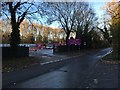
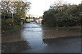
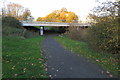
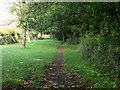
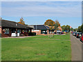
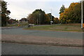
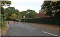
Photos of NN3 9DX


Area Information
NN3 9DX is a compact residential postcode in England, covering 8,160 square metres and home to 1,611 residents. Its high population density—197,428 people per square kilometre—reflects a tightly knit community, though the area remains small enough to feel intimate. Daily life here is shaped by proximity to essential services, with Northampton Railway Station offering direct links to regional hubs and two major bus interchanges within reach. The area’s broadband score of 98 ensures seamless connectivity, supporting both remote work and digital lifestyles. While the crime risk is rated medium, with a score of 55, most residents report average safety levels. The postcode is dominated by owner-occupied homes, with 64% of properties in private hands, suggesting a stable, long-term community. Nearby, Co-op and Asda stores provide convenience, while The Spires Academy serves as the primary educational institution. This blend of practicality and accessibility makes NN3 9DX appealing to those seeking a balance between urban reach and residential tranquillity.
- Area Type
- Postcode
- Area Size
- 8160 m²
- Population
- 1611
- Population Density
- 4062 people/km²
NN3 9DX is predominantly an owner-occupied area, with 64% of properties in private hands. The housing stock consists mainly of houses, which is unusual for a small postcode but may reflect a focus on family homes or larger residences. Given the area’s limited size—just 8,160 square metres—property availability is constrained, potentially increasing competition among buyers. The high home ownership rate suggests a stable market with fewer rental properties, which could benefit long-term investors seeking secure assets. However, the small footprint of the postcode means buyers must consider nearby areas for broader options. The presence of established homes may appeal to those prioritising permanence over rental flexibility, though the market’s dynamics remain shaped by local demand and the area’s proximity to transport links.
House Prices in NN3 9DX
Showing 17 properties
| Address | Type | Beds | Baths | Last Sale Price | Last Sale Date | |
|---|---|---|---|---|---|---|
| 18 Pound Lane, Northampton, NN3 9DX | Cottage | 3 | 2 | £405,000 | Feb 2024 | |
| 8 Pound Lane, Northampton, NN3 9DX | house | - | - | £230,000 | Dec 2022 | |
| 22 Pound Lane, Northampton, NN3 9DX | Semi-detached | 3 | 2 | £399,949 | May 2016 | |
| 11 Pound Lane, Northampton, NN3 9DX | Bungalow | 4 | - | £467,000 | Apr 2016 | |
| 10 Pound Lane, Northampton, NN3 9DX | Terraced | 2 | 1 | £166,000 | Sep 2015 | |
| 14 Pound Lane, Northampton, NN3 9DX | Terraced | 1 | 1 | £100,000 | Jul 2008 | |
| 26 Pound Lane, Northampton, NN3 9DX | Semi-detached | 2 | 1 | £190,000 | Nov 2006 | |
| 6 Pound Lane, Northampton, NN3 9DX | house | - | - | £110,000 | Aug 2004 | |
| 12 Pound Lane, Northampton, NN3 9DX | Semi-detached | - | - | £130,000 | Aug 2003 | |
| 1-3 Pound Lane, Northampton, NN3 9DX | Detached | 5 | - | £290,000 | May 2002 |
Energy Efficiency in NN3 9DX
Daily life in NN3 9DX is enhanced by nearby amenities, including five retail outlets such as Co-op Bellinge, Co-op Northampton, and Asda Nene Valley, offering convenience for shopping and daily essentials. The area’s proximity to Northampton Railway Station and two bus interchanges ensures easy access to urban centres and educational institutions. While no parks or leisure facilities are explicitly listed, the presence of multiple retail and transport hubs suggests a practical, service-oriented lifestyle. Residents can enjoy a mix of local shopping and efficient travel options, though the area’s small size means larger recreational spaces may require a short journey. The blend of retail, transport, and connectivity fosters a functional environment tailored to everyday needs.
Amenities
Schools
The primary educational institution near NN3 9DX is The Spires Academy, categorised as an ‘other’ school type. No Ofsted rating is provided, so its academic performance remains unspecified. As the sole listed school in the area, it serves as the main option for local families. The absence of additional schools, such as primary or specialist institutions, may require residents to travel beyond NN3 9DX for a broader range of educational choices. For families prioritising school proximity, The Spires Academy’s role as the central educational hub is critical. However, the lack of diversity in school types could be a consideration for those seeking specific curricula or facilities.
| Rank | School | Type | Entry gender | Ages |
|---|
Explore more schools in this area
Go to Schools tabDemographics
The population of NN3 9DX skews towards adults aged 30–64, with a median age of 47. This suggests a mature, established community, likely with strong family ties and a focus on stability. Home ownership is high at 64%, with houses being the predominant accommodation type. The White ethnic group forms the majority, though no specific diversity statistics are provided. The age profile indicates a workforce-centric demographic, potentially influencing local employment patterns and service demand. With no data on deprivation levels, it is reasonable to infer that the area’s infrastructure and amenities cater to the needs of its middle-aged population. The absence of younger households or students may reflect a focus on long-term residency rather than transient populations. This demographic profile aligns with a community prioritising security, familiar routines, and proximity to essential services.
Household Size
Accommodation Type
Tenure
Ethnic Group
Religion
Household Composition
Age
Household Deprivation
NS-SEC
Explore more demographic insights in this area
Go to Demographics tabPlanning
Planning Constraints
- Flood RiskPremium
- Ramsar Wetland SitesPremium
- Area of Outstanding Natural BeautyPremium
- Protected Nature ReservePremium
- Protected WoodlandPremium