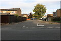
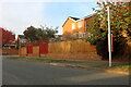
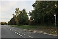
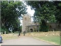
Area Overview for NN3 9BP
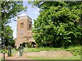
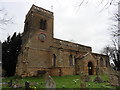
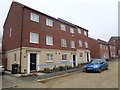
Photos of NN3 9BP


Area Information
NN3 9BP is a compact residential postcode area in England, covering just 2.2 hectares and home to 2,102 residents. Its high population density of 97,426 people per square kilometre reflects a tightly knit community, where proximity to amenities and services is a defining feature. The area’s small size means it is likely to be a focused cluster of homes, possibly within a larger town or city. Daily life here is shaped by its immediate surroundings, with residents relying on nearby infrastructure for shopping, transport, and leisure. The demographic profile suggests a mature population, with a median age of 47 and a strong presence of adults aged 30–64. This hints at a stable, long-term community with a mix of families and established households. While the area’s size limits expansion, its strategic location near retail hubs and transport links makes it a practical choice for those prioritising convenience. For buyers, NN3 9BP offers a blend of compact living and accessibility, though its small footprint means the housing stock is likely limited to a few hundred properties.
- Area Type
- Postcode
- Area Size
- 2.2 hectares
- Population
- 2102
- Population Density
- 3325 people/km²
NN3 9BP is a predominantly owner-occupied area, with 84% of homes owned by residents rather than rented. The accommodation type is primarily houses, which suggests a focus on family homes and private living spaces. Given the small area size of 2.2 hectares, the housing stock is likely limited to a few hundred properties, making the market relatively tight. This could mean limited availability for buyers, though the high home ownership rate indicates a stable demand for existing properties. The presence of nearby amenities, including retail stores and transport links, may enhance the area’s appeal for those seeking a balance between privacy and accessibility. However, the compact nature of the postcode means buyers should consider the immediate surroundings for additional housing options. For those prioritising long-term investment, the high ownership rate and stable community profile could be advantageous, though the small footprint may restrict future development potential.
House Prices in NN3 9BP
Showing 51 properties
| Address | Type | Beds | Baths | Last Sale Price | Last Sale Date | |
|---|---|---|---|---|---|---|
| 43 Leatherworks Way, Northampton, NN3 9BP | Semi-detached | 5 | 3 | £365,000 | Sep 2024 | |
| 53 Leatherworks Way, Northampton, NN3 9BP | Semi-detached | 4 | 3 | £355,000 | Feb 2024 | |
| 49 Leatherworks Way, Northampton, NN3 9BP | Detached | 3 | 2 | £331,500 | Sep 2022 | |
| 25 Leatherworks Way, Northampton, NN3 9BP | Semi-detached | 3 | - | £275,000 | Sep 2021 | |
| 3 Leatherworks Way, Northampton, NN3 9BP | house | - | - | £385,000 | Jun 2021 | |
| 28 Leatherworks Way, Northampton, NN3 9BP | Detached | 4 | 3 | £370,000 | Oct 2020 | |
| 12 Leatherworks Way, Northampton, NN3 9BP | Terraced | - | - | £263,500 | Jun 2020 | |
| 33 Leatherworks Way, Northampton, NN3 9BP | house | - | - | £250,000 | Nov 2019 | |
| 57 Leatherworks Way, Northampton, NN3 9BP | Terraced | 5 | 4 | £315,000 | Sep 2019 | |
| 21 Leatherworks Way, Northampton, NN3 9BP | Semi-detached | 4 | - | £247,500 | Apr 2019 |
Energy Efficiency in NN3 9BP
Living in NN3 9BP offers access to a range of nearby amenities that cater to daily needs and leisure. The retail options include major chains such as Tesco Northampton, Lidl Lings, and Co-op Bellinge, ensuring residents have easy access to groceries, household goods, and other essentials. For transport, the University Bus Interchange and Northampton Bus Interchange provide frequent services, while Northampton Railway Station offers rail connections to surrounding areas. Though the area itself is small, its proximity to these hubs suggests a well-integrated location within a larger town. The presence of multiple retail points and transport options enhances convenience, reducing the need for long commutes. The compact nature of the postcode means the character of the area is likely shaped by its immediate surroundings, with a focus on practical living. Whether shopping, commuting, or accessing services, residents of NN3 9BP are well-connected to the broader network of amenities.
Amenities
Schools
| Rank | School | Type | Entry gender | Ages |
|---|
Explore more schools in this area
Go to Schools tabDemographics
The population of NN3 9BP is predominantly adults aged 30–64, with a median age of 47. This suggests a mature community with a strong presence of middle-aged and older residents, likely reflecting a mix of long-term homeowners and families. Home ownership is high, at 84%, indicating a stable, settled population with a focus on property as a long-term investment. The accommodation type is primarily houses, which aligns with the higher ownership rates and suggests a preference for private, family-oriented living. The predominant ethnic group is White, though no data is provided on the presence of other groups. The age profile and ownership figures imply a community with low turnover, where residents are likely to have established careers and local ties. The absence of specific data on deprivation or income levels means the quality of life here can only be inferred from the available metrics, but the low crime risk and flood safety scores suggest a generally secure and stable environment.
Household Size
Accommodation Type
Tenure
Ethnic Group
Religion
Household Composition
Age
Household Deprivation
NS-SEC
Explore more demographic insights in this area
Go to Demographics tabPlanning
Planning Constraints
- Flood RiskPremium
- Ramsar Wetland SitesPremium
- Area of Outstanding Natural BeautyPremium
- Protected Nature ReservePremium
- Protected WoodlandPremium