Area Overview for NN3 9AN
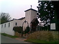
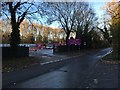
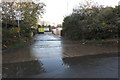
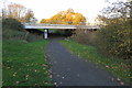
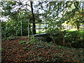
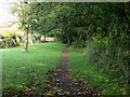
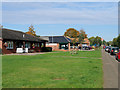
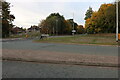
Photos of NN3 9AN


Area Information
NN3 9AN is a compact residential postcode area in England, spanning 1.1 hectares and home to 1,769 residents. Its small size means it’s a tight-knit community with a population density of 534 people per square kilometre. The area is defined by its modest scale, offering a quiet, localised living experience rather than sprawling urban sprawl. Most residents are adults aged 30–64, with a median age of 47, suggesting a stable, middle-aged demographic. The area’s proximity to Northampton’s transport hubs and retail centres, such as Asda Nene Valley and Co-op Bellinge, ensures daily needs are met without the need for long commutes. While it lacks large-scale amenities, its practical reach to nearby schools, bus routes, and the Northampton railway station makes it appealing for families and commuters. The area’s low flood risk and absence of environmental constraints like AONB or protected woodlands indicate a straightforward planning landscape, though its higher-than-average crime risk is a notable consideration for prospective buyers.
- Area Type
- Postcode
- Area Size
- 1.1 hectares
- Population
- 1769
- Population Density
- 534 people/km²
NN3 9AN is primarily an owner-occupied area, with 54% of homes owned by residents rather than rented. The accommodation type is predominantly houses, which suggests a focus on larger, family-friendly properties. This contrasts with areas where flats or apartments dominate, making NN3 9AN more suited to those seeking private, spacious living. As a small postcode covering just 1.1 hectares, the housing stock is limited, meaning buyers should consider nearby areas for additional options. The high home ownership rate indicates a stable market, though the small size of the area may mean limited inventory. For those prioritising ownership over rental flexibility, this area offers a straightforward, low-constraint environment, though its compact nature means proximity to larger urban centres is key for broader property choices.
House Prices in NN3 9AN
No properties found in this postcode.
Energy Efficiency in NN3 9AN
Residents of NN3 9AN have access to a range of nearby amenities, including five retail outlets such as Co-op Bellinge and Asda Nene Valley, ensuring daily shopping needs are met. The area’s proximity to Northampton’s transport hubs, including the University Bus Interchange and Northampton Bus Interchange, provides easy access to the city’s cultural and commercial centres. While the data does not specify parks or leisure facilities, the practical reach of retail and transport options suggests a lifestyle focused on convenience and connectivity. The presence of a primary school and railway station further supports a balanced mix of domestic and urban living, catering to both local and regional needs.
Amenities
Schools
The nearest school to NN3 9AN is Bellinge Primary School, which serves the local community with primary education. No secondary schools are listed in the data, so families with older children may need to look further afield. The presence of a primary school within practical reach is a significant advantage for households with young children, reducing the need for long commutes. However, the absence of secondary schooling in the immediate area could be a consideration for families planning long-term in the postcode. The single school type suggests a focus on early education, which may align with the area’s demographic of middle-aged residents, many of whom may have children in primary years.
| Rank | School | Type | Entry gender | Ages |
|---|---|---|---|---|
| 1 | Bellinge Primary School | primary | N/A | N/A |
Explore more schools in this area
Go to Schools tabDemographics
The population of NN3 9AN is predominantly adults aged 30–64, with a median age of 47. This suggests a community rooted in middle-aged households, likely with established careers and families. Home ownership is strong, with 54% of residents owning their homes, compared to 46% renting. The area is characterised by houses rather than flats, indicating a preference for single-family dwellings. The predominant ethnic group is White, though no specific data on diversity or deprivation levels is provided. The age profile implies a balance between older residents and those in their prime working years, potentially shaping local services and amenities. With a population density of 534 per square kilometre, the area is neither overcrowded nor sparse, offering a moderate sense of community without urban congestion.
Household Size
Accommodation Type
Tenure
Ethnic Group
Religion
Household Composition
Age
Household Deprivation
NS-SEC
Explore more demographic insights in this area
Go to Demographics tabPlanning
Planning Constraints
- Flood RiskPremium
- Ramsar Wetland SitesPremium
- Area of Outstanding Natural BeautyPremium
- Protected Nature ReservePremium
- Protected WoodlandPremium
- Crime RiskPremium