Area Overview for NN3 8NN
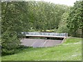
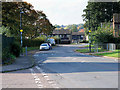
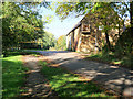
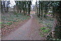
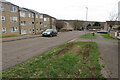
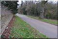
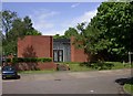
Photos of NN3 8NN


Area Information
Living in NN3 8NN means being part of a tightly knit residential cluster in England, where 1,644 people inhabit just 4,398 square metres. The area’s high population density—373,847 people per square kilometre—creates a compact, community-focused environment. This postcode is characterised by a mix of practical living and proximity to essential services. With a median age of 47 and a strong presence of adults aged 30–64, the area is home to a stable, established population. Daily life here is shaped by the surrounding infrastructure: nearby retail hubs, public transport links, and a primary school with a good Ofsted rating. While the area is small, it offers a blend of convenience and quiet living, with homes predominantly in private ownership. For buyers, NN3 8NN represents a chance to invest in a well-connected, low-risk location with a clear sense of community.
- Area Type
- Postcode
- Area Size
- 4398 m²
- Population
- 1644
- Population Density
- 4262 people/km²
The property market in NN3 8NN is dominated by owner-occupied homes, with 61% of properties in private hands. This suggests a community of long-term residents rather than a transient rental market. The area’s housing stock is primarily composed of houses, which may appeal to families or those seeking more space. Given the postcode’s small size—just 4,398 square metres—the housing options are limited, and buyers may need to look beyond the immediate area for more choices. The high population density indicates that properties here are likely to be in close proximity to each other, with little scope for expansion. For those considering a purchase, the area offers a stable, low-risk investment with a focus on private ownership and family-friendly living.
House Prices in NN3 8NN
Showing 4 properties
| Address | Type | Beds | Baths | Last Sale Price | Last Sale Date | |
|---|---|---|---|---|---|---|
| 7 Hayeswood Road, Northampton, NN3 8NN | house | - | - | - | - | |
| 3 Hayeswood Road, Northampton, NN3 8NN | house | - | - | - | - | |
| 5 Hayeswood Road, Northampton, NN3 8NN | house | - | - | - | - | |
| 1 Hayeswood Road, Northampton, NN3 8NN | house | - | - | - | - |
Energy Efficiency in NN3 8NN
Residents of NN3 8NN have access to a range of nearby amenities, including five retail outlets such as Tesco Northampton, Lidl Lings, and Co-op Northampton. These shops provide everyday essentials, supporting a practical lifestyle. The area’s proximity to the University Bus Interchange and Northampton Bus Interchange enhances mobility, while the Northampton Railway Station offers regional travel options. Though the data does not mention parks or leisure facilities, the presence of retail and transport hubs suggests a convenient, service-oriented environment. The compact nature of the area means amenities are within practical reach, fostering a lifestyle that balances accessibility with the quietude of a small residential cluster.
Amenities
Schools
The nearest school to NN3 8NN is Lings Primary School, which serves the local community with a primary education offering. The school holds an Ofsted rating of ‘good’, indicating a solid standard of teaching and facilities. While no secondary schools are listed in the data, the presence of a primary school with a positive rating is a strong point for families. The school’s proximity to the area means parents can easily access education for their children, reducing the need for long commutes. The absence of additional schools in the data suggests that families may need to look further afield for secondary education, but the existing primary school provides a reliable foundation for early learning.
| Rank | School | Type | Entry gender | Ages |
|---|
Explore more schools in this area
Go to Schools tabDemographics
The community in NN3 8NN is predominantly composed of adults aged 30–64, with a median age of 47. This suggests a mature population, likely with established careers and families. Home ownership rates stand at 61%, indicating a mix of long-term residents and those seeking stability. The area is largely composed of houses, which aligns with the demographic profile of older, family-oriented households. The predominant ethnic group is White, though no specific data on diversity or deprivation is provided. The high population density—373,847 people per square kilometre—suggests a compact, possibly urbanised setting, where proximity to amenities is key. This density may influence the character of daily life, with shared spaces and community interaction playing a central role.
Household Size
Accommodation Type
Tenure
Ethnic Group
Religion
Household Composition
Age
Household Deprivation
NS-SEC
Explore more demographic insights in this area
Go to Demographics tabPlanning
Planning Constraints
- Flood RiskPremium
- Ramsar Wetland SitesPremium
- Area of Outstanding Natural BeautyPremium
- Protected Nature ReservePremium
- Protected WoodlandPremium