Area Overview for NN3 8JY
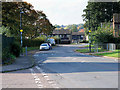
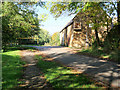
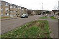
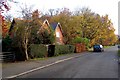
Photos of NN3 8JY


Area Information
NN3 8JY is a compact residential postcode area in England, covering 8,202 square metres and home to 1,801 residents. Its high population density of 219,593 people per square kilometre reflects a tightly knit community. The area’s small size means it is likely a focused cluster of homes, possibly centred around local amenities or transport hubs. Daily life here is shaped by proximity to retail and transport infrastructure, with shops like Co-op Bushland and Tesco Northampton within reach. The median age of 47 suggests a mature population, with adults aged 30–64 forming the largest demographic group. This hints at a community of established residents, possibly with families, though the 34% home ownership rate indicates a significant proportion of renters. The area’s practical size and density make it a convenient choice for those prioritising accessibility to services over expansive living space.
- Area Type
- Postcode
- Area Size
- 8202 m²
- Population
- 1801
- Population Density
- 4161 people/km²
NN3 8JY’s property market is characterised by a 34% home ownership rate, indicating that most residents are renters rather than homeowners. The accommodation type is predominantly houses, which may suggest a focus on family homes or standalone properties. Given the area’s small size and high population density, the housing stock is likely limited, with properties concentrated in a compact cluster. This could mean competition for available homes, particularly for buyers seeking owner-occupied properties. The low home ownership rate also points to a rental market that may offer opportunities for investors, though the small area size means the surrounding options for property are likely constrained. Buyers should consider the practicality of the area’s size and the dominance of rental properties when evaluating long-term value.
House Prices in NN3 8JY
Showing 11 properties
| Address | Type | Beds | Baths | Last Sale Price | Last Sale Date | |
|---|---|---|---|---|---|---|
| 12 Sage Close, Northampton, NN3 8JY | Detached | 3 | 1 | £250,000 | Aug 2019 | |
| 9 Sage Close, Northampton, NN3 8JY | Detached | 4 | - | £203,000 | Apr 2016 | |
| 8 Sage Close, Northampton, NN3 8JY | Detached | 4 | - | £225,000 | Jun 2015 | |
| 11 Sage Close, Northampton, NN3 8JY | Detached | 3 | - | £171,000 | Feb 2014 | |
| 2 Sage Close, Northampton, NN3 8JY | house | - | - | £185,000 | Dec 2010 | |
| 5 Sage Close, Northampton, NN3 8JY | Detached | 4 | 2 | £157,000 | Apr 2009 | |
| 1 Sage Close, Northampton, NN3 8JY | Detached | 4 | - | £208,500 | Jun 2008 | |
| 10 Sage Close, Northampton, NN3 8JY | Detached | - | - | £173,000 | May 2008 | |
| 3 Sage Close, Northampton, NN3 8JY | Detached | - | - | £169,995 | Aug 2007 | |
| 4 Sage Close, Northampton, NN3 8JY | Detached | - | - | £152,500 | Nov 2005 |
Energy Efficiency in NN3 8JY
Living in NN3 8JY offers access to essential retail and transport services within practical reach. Nearby shops include Co-op Bushland, Tesco Northampton, and Lidl Lings, providing grocery and daily needs. The area’s transport links are robust, with Northampton Railway Station and two bus interchanges offering connections to surrounding areas. While the data does not mention parks or leisure facilities, the presence of multiple retail options and transport hubs suggests a convenient, service-oriented lifestyle. The compact nature of the area may encourage walking or cycling to nearby amenities, fostering a sense of community. Residents can expect a straightforward, functional daily routine centred around local shopping and efficient travel options.
Amenities
Schools
| Rank | School | Type | Entry gender | Ages |
|---|
Explore more schools in this area
Go to Schools tabDemographics
The population of NN3 8JY is predominantly adults aged 30–64, with a median age of 47. This suggests a community of middle-aged individuals, many of whom may be in their peak working years or raising families. The 34% home ownership rate is notably low, implying that a majority of residents are likely to be renting, which could reflect a mix of private rentals and social housing. The area’s accommodation is primarily houses, which may cater to families or those preferring standalone properties. The predominant ethnic group is White, though no specific data on diversity or deprivation is provided. The age profile and housing type suggest a stable, possibly family-oriented environment, though the low home ownership rate could indicate limited long-term investment in property.
Household Size
Accommodation Type
Tenure
Ethnic Group
Religion
Household Composition
Age
Household Deprivation
NS-SEC
Explore more demographic insights in this area
Go to Demographics tabPlanning
Planning Constraints
- Flood RiskPremium
- Ramsar Wetland SitesPremium
- Area of Outstanding Natural BeautyPremium
- Protected Nature ReservePremium
- Protected WoodlandPremium