Area Overview for NN3 7WU
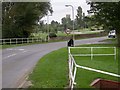
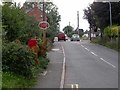
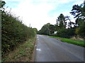
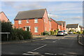
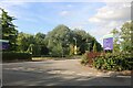
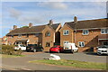
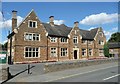
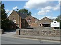
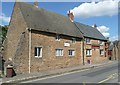
Photos of NN3 7WU

Area Information
NN3 7WU is a small, tightly knit residential area in England, spanning 13.4 hectares and home to 2,141 residents. Its compact size and low population density of 306 people per square kilometre suggest a quiet, low-rise environment, likely characterised by family homes and a mature community. The area’s median age of 47 and predominance of adults aged 30–64 indicate a stable, established population, possibly with long-standing local ties. Daily life here is likely shaped by proximity to essential services, with nearby schools, shops, and transport links offering practical convenience. The absence of major planning constraints or environmental designations means the area is free from restrictions that might complicate development or living. For those seeking a calm, residential setting with a balance of accessibility and seclusion, NN3 7WU offers a snapshot of traditional English suburbia, where community roots run deep and the pace of life remains unhurried.
- Area Type
- Postcode
- Area Size
- 13.4 hectares
- Population
- 2141
- Population Density
- 306 people/km²
The property market in NN3 7WU is dominated by owner-occupied homes, with 65% of residents living in their own properties. The area’s accommodation type is primarily houses, which aligns with the low population density and suggests a focus on larger, family-friendly properties rather than apartments or terraced housing. This composition indicates a market more suited to buyers seeking long-term stability rather than short-term rental opportunities. The limited area size means the housing stock is finite, which could make the local market competitive for those looking to purchase. For buyers, this implies a need to act decisively, as properties may not be available for long. The prevalence of owner-occupation also suggests a community with strong local ties, where homes are likely to be passed down through generations.
House Prices in NN3 7WU
Showing 19 properties
| Address | Type | Beds | Baths | Last Sale Price | Last Sale Date | |
|---|---|---|---|---|---|---|
| 14 Stewart Close, Moulton, NN3 7WU | Detached | 4 | 2 | £590,000 | May 2024 | |
| 8 Stewart Close, Moulton, NN3 7WU | Detached | 4 | 3 | £627,500 | May 2022 | |
| 1 Stewart Close, Moulton, NN3 7WU | Retail | 4 | 3 | £650,000 | Feb 2022 | |
| Vanmarkis, 15 Stewart Close, Moulton, NN3 7WU | house | - | - | £497,000 | Dec 2020 | |
| 9 Stewart Close, Moulton, NN3 7WU | house | - | - | £500,000 | Oct 2020 | |
| Gwythian, 7 Stewart Close, Moulton, NN3 7WU | Detached | 4 | - | £575,000 | Jul 2018 | |
| 3 Stewart Close, Moulton, NN3 7WU | Detached | 5 | - | £680,000 | Oct 2017 | |
| 10 Stewart Close, Moulton, NN3 7WU | house | - | - | £410,000 | Jan 2014 | |
| 18 Stewart Close, Moulton, NN3 7WU | house | - | - | £342,500 | Dec 2012 | |
| Aldercote, 17 Stewart Close, Moulton, NN3 7WU | Detached | - | - | £370,000 | Jun 2008 |
Energy Efficiency in NN3 7WU
The lifestyle in NN3 7WU is shaped by its proximity to essential amenities. Retail options include Co-op Moulton, Aldi Overstone, and Tesco Spinny, offering everyday shopping needs within reach. The area’s transport links, such as the University Bus Interchange and Northampton Railway Station, provide access to broader networks, enhancing connectivity for both leisure and work. While the data does not specify parks or leisure facilities, the absence of planning constraints suggests open spaces may be available nearby. The combination of retail, transport, and educational institutions creates a self-contained environment, where residents can access services without needing to travel far. This balance of convenience and accessibility contributes to a practical, low-stress lifestyle.
Amenities
Schools
Residents of NN3 7WU have access to a range of educational institutions, including Moulton Primary School, which holds a ‘good’ Ofsted rating, and Moulton School and Science College, an academy with the same rating. Moulton College, a sixth-form provider, further extends the educational options available. This mix of primary, secondary, and post-16 education ensures families can access schooling from early years through to advanced studies without needing to travel far. The presence of two primary schools with strong ratings suggests a focus on quality education, which is a key consideration for families. The proximity of these institutions to residential areas likely enhances the area’s appeal, offering convenience for parents and students alike.
| Rank | School | Type | Entry gender | Ages |
|---|
Explore more schools in this area
Go to Schools tabDemographics
The population of NN3 7WU is predominantly adults aged 30–64, with a median age of 47. This suggests a community of working-age individuals and families, many of whom may have raised children in the area. Home ownership is high, at 65%, with houses being the primary type of accommodation. The predominant ethnic group is White, reflecting a homogenous demographic profile. The low population density of 306 people per square kilometre indicates a spread-out, perhaps semi-rural character, where housing is likely to be detached or semi-detached. This demographic structure implies a stable, low-turnover community, with a focus on long-term residency rather than transient populations. For prospective buyers, this suggests a neighbourhood with established social networks and a predictable, family-oriented environment.
Household Size
Accommodation Type
Tenure
Ethnic Group
Religion
Household Composition
Age
Household Deprivation
NS-SEC
Explore more demographic insights in this area
Go to Demographics tabPlanning
Planning Constraints
- Flood RiskPremium
- Ramsar Wetland SitesPremium
- Area of Outstanding Natural BeautyPremium
- Protected Nature ReservePremium
- Protected WoodlandPremium