Area Overview for NN3 7UW
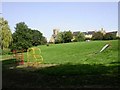
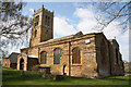
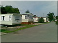
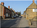
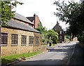
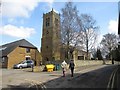
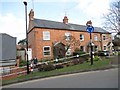
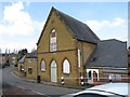
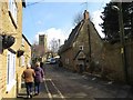
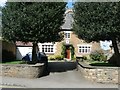
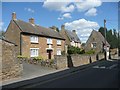
Photos of NN3 7UW
Area Information
Living in NN3 7UW means inhabiting a compact, densely populated residential cluster in England. The area covers 8,744 square metres and is home to 1,812 residents, translating to a population density of 1,581 people per square kilometre. This small postcode area is ideal for those seeking a tight-knit community with easy access to nearby towns and services. Proximity to Northampton’s infrastructure, including retail hubs and transport links, makes it practical for commuters or those preferring a suburban lifestyle. The area’s low flood risk and absence of environmental constraints like protected woodlands or AONB designations mean development is straightforward. Daily life here is characterised by a balance between residential tranquillity and connectivity, with nearby amenities and schools within practical reach. For buyers, NN3 7UW offers a snapshot of a mature, stable neighbourhood where most residents own their homes, reflecting a long-term presence in the area.
- Area Type
- Postcode
- Area Size
- 8744 m²
- Population
- 1812
- Population Density
- 1581 people/km²
NN3 7UW is a predominantly owner-occupied area, with 83% of residents owning their homes. The housing stock is almost entirely composed of houses, which is typical for smaller, established residential clusters. This suggests a market skewed towards long-term buyers rather than renters, with limited turnover in property transactions. The compact size of the area means the housing stock is finite, and buyers should consider the proximity to nearby towns for additional options. The prevalence of houses may appeal to families or those seeking more space, though the small footprint of the postcode implies a focus on quality over quantity. For those considering purchase, the area’s stability and low environmental constraints make it a practical choice, though the limited housing supply could affect availability.
House Prices in NN3 7UW
Showing 16 properties
| Address | Type | Beds | Baths | Last Sale Price | Last Sale Date | |
|---|---|---|---|---|---|---|
| 2 The Crescent, Moulton, NN3 7UW | house | - | - | £186,500 | Sep 2010 | |
| 6 The Crescent, Moulton, NN3 7UW | Semi-detached | - | - | £188,000 | Jul 2006 | |
| 4 The Crescent, Moulton, NN3 7UW | Semi-detached | - | - | £131,000 | Jan 2004 | |
| 7 The Crescent, Moulton, NN3 7UW | Semi-detached | - | - | £77,500 | Feb 2002 | |
| 10 The Crescent, Moulton, NN3 7UW | Semi-detached | 4 | - | £65,500 | Dec 1998 | |
| 3 The Crescent, Moulton, NN3 7UW | Detached | 2 | 1 | - | - | |
| 1B The Crescent, Moulton, NN3 7UW | Bungalow | - | - | - | - | |
| 5 The Crescent, Moulton, NN3 7UW | house | - | - | - | - | |
| 14 The Crescent, Moulton, NN3 7UW | Bungalow | - | - | - | - | |
| 8 The Crescent, Moulton, NN3 7UW | house | - | - | - | - |
Energy Efficiency in NN3 7UW
Residents of NN3 7UW have access to a range of nearby amenities, including five retail outlets such as Co-op Moulton, Aldi Overstone, and Tesco Spinny. These shops provide essential services and grocery options within walking or short driving distance. The area’s transport links, including Northampton Bus Interchange and Northampton Railway Station, connect residents to broader networks for leisure, shopping, and employment. While the data does not list parks or leisure facilities, the proximity to retail and transport hubs suggests a practical, convenience-driven lifestyle. The mix of retail and transport infrastructure ensures daily needs are met without the need for long commutes, enhancing the area’s appeal for families and professionals.
Amenities
Schools
The nearest school to NN3 7UW is Northampton School, an academy. While no Ofsted rating is provided, the presence of a single academy suggests a focused educational offering for the area. Families may benefit from the school’s proximity, though the lack of additional schools in the immediate vicinity could necessitate travel for alternative options. The absence of primary schools or specialist institutions within the postcode means parents may need to look beyond NN3 7UW for a broader range of educational choices. However, the academy’s status may indicate a standardised approach to education, aligning with regional benchmarks.
| Rank | School | Type | Entry gender | Ages |
|---|
Explore more schools in this area
Go to Schools tabDemographics
The community in NN3 7UW is predominantly composed of adults aged 30–64, with a median age of 47. This suggests a mature, established population, likely with long-term ties to the area. Home ownership is high, at 83%, indicating a strong preference for property investment over renting. The accommodation type is primarily houses, which aligns with the area’s residential character and higher property values. The predominant ethnic group is White, reflecting a homogenous demographic profile. With no data on deprivation or diversity beyond this, the area appears to cater to a stable, middle-aged demographic. The high home ownership rate and age profile suggest a community focused on long-term residency rather than transient populations.
Household Size
Accommodation Type
Tenure
Ethnic Group
Religion
Household Composition
Age
Household Deprivation
NS-SEC
Explore more demographic insights in this area
Go to Demographics tabPlanning
Planning Constraints
- Flood RiskPremium
- Ramsar Wetland SitesPremium
- Area of Outstanding Natural BeautyPremium
- Protected Nature ReservePremium
- Protected WoodlandPremium