Area Overview for NN3 7UF
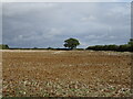
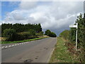
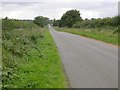
Photos of NN3 7UF

Area Information
NN3 7UF is a compact residential cluster in England, covering 41.8 hectares and home to 2,505 residents. Its small size fosters a tight-knit community, where daily life is shaped by proximity to essential services and a mature demographic. With a median age of 47 and the majority of residents aged 30–64, the area is characterised by stability and long-term occupancy. Most properties are owner-occupied, reflecting a preference for settled living. The postcode lies near Northampton, offering access to urban amenities without the congestion of larger cities. Residents benefit from practical connectivity, including nearby railway stations and bus routes, while the area’s low flood risk and absence of protected natural sites make it a straightforward place to live. For those seeking a quiet, family-friendly environment with a balance of convenience and tranquillity, NN3 7UF provides a snapshot of suburban England.
- Area Type
- Postcode
- Area Size
- 41.8 hectares
- Population
- 2505
- Population Density
- 292 people/km²
NN3 7UF is predominantly an owner-occupied area, with 87% of properties in private hands. The accommodation type is exclusively houses, which suggests a focus on family homes and larger properties. This contrasts with areas where flats or apartments dominate, and it aligns with the area’s mature demographic. The small size of the postcode means the housing stock is limited, and buyers may need to consider nearby areas for more options. The high home ownership rate indicates a stable market, with properties likely retaining value due to their rarity in the region. For those seeking a home in NN3 7UF, the emphasis on houses means buyers should prioritise properties that meet their long-term needs, given the limited turnover in the area.
House Prices in NN3 7UF
Showing 26 properties
| Address | Type | Beds | Baths | Last Sale Price | Last Sale Date | |
|---|---|---|---|---|---|---|
| 40 The Grove, Moulton, NN3 7UF | Semi-detached | 4 | 2 | £385,000 | Sep 2025 | |
| 36 The Grove, Moulton, NN3 7UF | Semi-detached | 3 | 1 | £315,000 | Jun 2025 | |
| 54 The Grove, Moulton, NN3 7UF | Semi-detached | 4 | 1 | £375,000 | May 2024 | |
| 44 The Grove, Moulton, NN3 7UF | Semi-detached | 3 | 2 | £385,000 | Apr 2024 | |
| Dene Cottage, 2 The Grove, Moulton, NN3 7UF | Cottage | 3 | 2 | £575,000 | Aug 2023 | |
| 46 The Grove, Moulton, NN3 7UF | Semi-detached | 3 | 1 | £315,000 | Jul 2023 | |
| 48 The Grove, Moulton, NN3 7UF | house | - | - | £265,000 | Sep 2021 | |
| 34 The Grove, Moulton, NN3 7UF | house | - | - | £230,000 | Jul 2021 | |
| 4 The Grove, Moulton, NN3 7UF | Cottage | 3 | - | £264,000 | Jun 2021 | |
| 38 The Grove, Moulton, NN3 7UF | house | - | - | £289,995 | May 2021 |
Energy Efficiency in NN3 7UF
The lifestyle in NN3 7UF is shaped by its proximity to practical amenities. Within reach are five retail outlets, including Co-op Moulton, Aldi Overstone, and Tesco Spinny, offering everyday shopping needs. The area’s bus routes connect to the University and Northampton Bus Interchanges, while the Northampton Railway Station provides access to regional travel. Though the postcode is small, these amenities contribute to a convenient, self-contained lifestyle. The absence of large-scale leisure facilities means residents may need to travel for entertainment, but the compact size ensures services are not distant. This balance of accessibility and quiet living defines the area’s character.
Amenities
Schools
The nearest schools to NN3 7UF include Overstone Primary School, a primary institution with a ‘good’ Ofsted rating, and Overstone Park School, a special needs school rated ‘inadequate’. The presence of a well-rated primary school is a positive for families with young children, though the special school’s lower rating may raise concerns for parents seeking broader educational options. The mix of school types reflects the area’s diverse needs, but the lack of secondary schools nearby means families may need to look beyond NN3 7UF for comprehensive education. This dynamic could influence decisions about proximity to other schools or the need for additional transport arrangements.
| Rank | School | Type | Entry gender | Ages |
|---|
Explore more schools in this area
Go to Schools tabDemographics
The population of NN3 7UF is 2,505, with a median age of 47, indicating a mature community. The majority of residents are adults aged 30–64, suggesting a mix of established families and older professionals. Home ownership is high at 87%, with the predominant accommodation type being houses rather than flats. The ethnic composition is largely White, reflecting a homogenous demographic. This profile implies a stable, long-term resident base with fewer transient populations. The absence of specific deprivation data means quality of life is inferred from infrastructure and services, such as the nearby schools and transport links. The area’s compact size means it is not densely populated, with 292 people per square kilometre, allowing for a less crowded, community-oriented lifestyle.
Household Size
Accommodation Type
Tenure
Ethnic Group
Religion
Household Composition
Age
Household Deprivation
NS-SEC
Explore more demographic insights in this area
Go to Demographics tabPlanning
Planning Constraints
- Flood RiskPremium
- Ramsar Wetland SitesPremium
- Area of Outstanding Natural BeautyPremium
- Protected Nature ReservePremium
- Protected WoodlandPremium