Area Overview for NN3 7SY
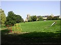
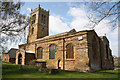
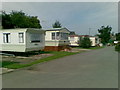
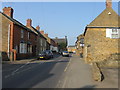
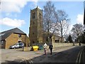
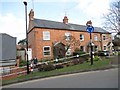
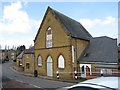
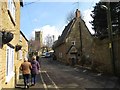
Photos of NN3 7SY

Area Information
Living in NN3 7SY offers a compact, residential experience within a small cluster of homes. Covering just 4.4 hectares, this postcode area is home to 2,141 people, with a population density of 306 people per square kilometre. The community is predominantly composed of adults aged 30–64, with a median age of 47, suggesting a stable, mature demographic. Daily life here is shaped by the local amenities and proximity to nearby towns. The area’s small size means residents are likely to know their neighbours, fostering a close-knit environment. While it is not a sprawling suburb, the density supports a balance between private space and community interaction. The presence of schools, retail outlets, and transport links within reach ensures practicality for families and commuters. For those seeking a quiet, established residential area with access to essential services, NN3 7SY provides a focused, manageable living space. Its characteristics make it appealing to those prioritising convenience over expansive surroundings.
- Area Type
- Postcode
- Area Size
- 4.4 hectares
- Population
- 2141
- Population Density
- 306 people/km²
The property market in NN3 7SY is characterised by a strong emphasis on owner-occupation, with 65% of homes owned by their residents. This suggests a community of long-term residents rather than a transient rental market. The accommodation type is predominantly houses, which is unusual for areas with higher population densities but aligns with the small, clustered nature of the postcode. Given the area’s size of just 4.4 hectares, the housing stock is limited, meaning properties are likely to be in close proximity to one another. For buyers, this presents both opportunities and constraints: the demand for owner-occupied homes may support property values, but the limited space could mean fewer options for expansion or development. The focus on houses may appeal to families seeking private, single-family living, though the small area means buyers must consider the immediate surroundings for additional space or amenities.
House Prices in NN3 7SY
Showing 6 properties
| Address | Type | Beds | Baths | Last Sale Price | Last Sale Date | |
|---|---|---|---|---|---|---|
| The Bungalow, Pitsford Road, Moulton, NN3 7SY | Bungalow | 4 | - | £390,000 | Mar 2019 | |
| 4, College Grounds, Pitsford Road, Moulton, NN3 7SY | Detached | - | - | - | - | |
| 2, College Grounds, Pitsford Road, Moulton, NN3 7SY | Detached | - | - | - | - | |
| 3, College Grounds, Pitsford Road, Moulton, NN3 7SY | Detached | - | - | - | - | |
| 5, College Grounds, Pitsford Road, Moulton, NN3 7SY | Bungalow | - | - | - | - | |
| 6, College Grounds, Pitsford Road, Moulton, NN3 7SY | Bungalow | - | - | - | - |
Energy Efficiency in NN3 7SY
The lifestyle in NN3 7SY is shaped by its proximity to essential amenities and services. Residents have access to five retail outlets, including Co-op Moulton, Aldi Overstone, and Tesco Spinny, ensuring everyday shopping needs are met locally. The area’s transport links are robust, with two bus interchanges and a railway station providing connections to Northampton and beyond. While parks and leisure facilities are not explicitly listed in the data, the presence of retail and transport hubs suggests a practical, community-focused lifestyle. The compact size of the area means amenities are within walking or short driving distance, reducing reliance on cars. This accessibility supports a balanced daily life, where residents can manage errands, work, and socialising without extensive travel. The combination of retail, transport, and proximity to schools creates a convenient, functional environment for families and commuters alike.
Amenities
Schools
Residents of NN3 7SY have access to a range of educational institutions, including primary and sixth-form colleges. Moulton Primary School, rated ‘good’ by Ofsted, provides early education for local children. Moulton School and Science College, listed as both a primary and academy school, also holds a ‘good’ rating, offering a broader curriculum. For older students, Moulton College offers sixth-form education, ensuring continuity in learning. The combination of primary and post-16 provision means families can access schooling from early years through to higher education within the area. This diversity supports households with children at different stages of their education, reducing the need for long commutes. The presence of multiple schools with positive ratings indicates a commitment to education quality, which is a key factor for many homebuyers.
| Rank | School | Type | Entry gender | Ages |
|---|
Explore more schools in this area
Go to Schools tabDemographics
The community in NN3 7SY is defined by its age profile and home ownership patterns. With a median age of 47 and 65% of residents owning their homes, the area is primarily occupied by middle-aged adults, many of whom are likely to be settled in long-term residences. The majority of households are in the 30–64 age range, indicating a population that is largely in their prime working and family-raising years. Accommodation here is predominantly houses, reflecting a preference for single-family living. The predominant ethnic group is White, aligning with broader trends in the region. The population density of 306 people per square kilometre suggests a moderate level of proximity without overcrowding. This demographic profile supports a stable, low-maintenance lifestyle, with fewer transient populations. For homebuyers, the data highlights a community that values continuity and established living, with a clear majority of homeowners rather than renters.
Household Size
Accommodation Type
Tenure
Ethnic Group
Religion
Household Composition
Age
Household Deprivation
NS-SEC
Explore more demographic insights in this area
Go to Demographics tabPlanning
Planning Constraints
- Flood RiskPremium
- Ramsar Wetland SitesPremium
- Area of Outstanding Natural BeautyPremium
- Protected Nature ReservePremium
- Protected WoodlandPremium