Area Overview for NN3 6AJ
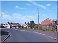
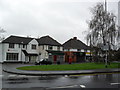
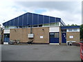
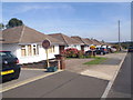
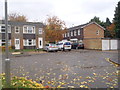
Photos of NN3 6AJ


Area Information
NN3 6AJ is a compact residential postcode area in England, spanning just 2.1 hectares and home to 1666 residents. Its high population density—81,161 people per square kilometre—reflects a tightly knit community, with homes predominantly owned by residents rather than rented. The area’s small size means it is a focused cluster of housing, likely centred around local amenities and transport links. Daily life here is shaped by proximity to essential services, with a mix of retail and transport options within reach. The median age of 47 suggests a mature demographic, with adults aged 30–64 forming the largest group. This makes NN3 6AJ a place where stability and established living patterns dominate, offering a quiet, settled environment for those seeking a community with low crime risk and minimal environmental constraints.
- Area Type
- Postcode
- Area Size
- 2.1 hectares
- Population
- 1666
- Population Density
- 2976 people/km²
NN3 6AJ is predominantly an owner-occupied area, with 85% of homes owned by residents rather than rented. The accommodation type is largely houses, which is unusual for a small postcode area but suggests a mix of semi-detached or detached properties. Given the area’s compact size—just 2.1 hectares—housing stock is limited, meaning buyers may need to consider nearby areas for more options. The high home ownership rate indicates a stable market, but the small size of NN3 6AJ itself may restrict availability. For those seeking a house in this area, the focus is on private ownership rather than rental, reflecting a community prioritising long-term residency over investment or transient living.
House Prices in NN3 6AJ
Showing 31 properties
| Address | Type | Beds | Baths | Last Sale Price | Last Sale Date | |
|---|---|---|---|---|---|---|
| 16 Lumbertubs Rise, Northampton, NN3 6AJ | Bungalow | 3 | 1 | £322,000 | May 2025 | |
| 18 Lumbertubs Rise, Northampton, NN3 6AJ | Bungalow | 2 | 1 | £300,000 | Jun 2023 | |
| 9 Lumbertubs Rise, Northampton, NN3 6AJ | Semi-detached | 3 | - | £325,000 | Dec 2022 | |
| 12 Lumbertubs Rise, Northampton, NN3 6AJ | house | - | - | £370,000 | Dec 2021 | |
| 29 Lumbertubs Rise, Northampton, NN3 6AJ | Bungalow | 4 | 2 | £335,000 | Oct 2019 | |
| 7 Lumbertubs Rise, Northampton, NN3 6AJ | Bungalow | 2 | - | £265,000 | Aug 2019 | |
| 3 Lumbertubs Rise, Northampton, NN3 6AJ | Bungalow | 2 | 1 | £249,995 | Nov 2018 | |
| 4 Lumbertubs Rise, Northampton, NN3 6AJ | Bungalow | - | - | £220,000 | Sep 2018 | |
| 17 Lumbertubs Rise, Northampton, NN3 6AJ | Bungalow | 3 | 1 | £270,000 | Jan 2018 | |
| 2 Lumbertubs Rise, Northampton, NN3 6AJ | Bungalow | 3 | - | £240,000 | May 2016 |
Energy Efficiency in NN3 6AJ
Living in NN3 6AJ offers access to a range of nearby amenities, including five retail outlets such as Tesco Spinny, Co-op Bushland, and Tesco Northampton. These shops provide essential services, from grocery shopping to general retail, supporting daily life. The area is also served by two bus interchanges and a railway station, facilitating travel to nearby towns and cities. While the data does not mention parks or leisure facilities, the proximity to retail and transport hubs suggests a practical, convenience-focused lifestyle. The compact nature of the area means residents can reach key services quickly, though those seeking extensive recreational spaces may need to venture further afield.
Amenities
Schools
The nearest school to NN3 6AJ is Boothville Middle School, a primary school. No secondary schools are listed in the data, which means families with older children may need to look beyond the immediate area for secondary education. The presence of a primary school suggests the area is suitable for young families, though the absence of a comprehensive school nearby could influence decisions about proximity to education. Parents should consider the need for additional transport or commuting for secondary schooling, as the data does not indicate any other schools within practical reach.
| Rank | School | Type | Entry gender | Ages |
|---|
Explore more schools in this area
Go to Schools tabDemographics
The population of NN3 6AJ is 1666, with a median age of 47, indicating a mature community. The largest age group is adults aged 30–64, reflecting a demographic skewed towards middle-aged individuals. Home ownership is exceptionally high at 85%, with the majority of accommodation being houses rather than flats. The predominant ethnic group is White, though specific data on diversity or deprivation is not provided. The high home ownership rate suggests a stable, long-term resident base, while the absence of rental properties points to a community focused on private ownership. This profile aligns with a neighbourhood where families and individuals prioritise settled living over transient tenancies.
Household Size
Accommodation Type
Tenure
Ethnic Group
Religion
Household Composition
Age
Household Deprivation
NS-SEC
Explore more demographic insights in this area
Go to Demographics tabPlanning
Planning Constraints
- Flood RiskPremium
- Ramsar Wetland SitesPremium
- Area of Outstanding Natural BeautyPremium
- Protected Nature ReservePremium
- Protected WoodlandPremium