Area Overview for NN3 5LF
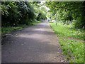
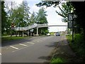
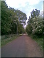
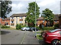
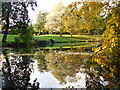
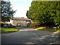
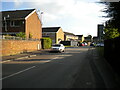
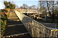
Photos of NN3 5LF

Area Information
NN3 5LF is a compact residential postcode in England, covering just 2.0 hectares and home to 1,448 residents. Its high population density—72,852 people per square kilometre—reflects a tightly knit community where proximity to amenities is a defining feature. The area is characterised by a mature demographic, with a median age of 47 and a majority of residents aged 30–64. This suggests a stable, established population, likely drawn to the area’s practicality and accessibility. The postcode is dominated by owner-occupied homes, with 70% of properties in private hands, and housing stock primarily comprising detached or semi-detached houses. Living here means being within reach of essential services, including retail hubs, public transport nodes, and a well-regarded primary school. The area’s small size ensures a quiet, localised feel, though its density may mean limited green space. For those seeking a balance between urban convenience and residential calm, NN3 5LF offers a focused, community-driven environment.
- Area Type
- Postcode
- Area Size
- 2.0 hectares
- Population
- 1448
- Population Density
- 4528 people/km²
The property market in NN3 5LF is dominated by owner-occupied homes, with 70% of properties in private hands. This suggests a stable market where long-term residency is common. The accommodation type is predominantly houses, which may appeal to those seeking larger living spaces or families requiring more room. Given the area’s small size—just 2.0 hectares—the housing stock is likely limited, with few new developments. Buyers should consider the proximity to key amenities such as schools, transport, and retail, which are all within practical reach. The high population density may mean competition for available properties, particularly for those prioritising specific features like garden space or proximity to transport links. For those seeking a rental market, the data does not indicate a significant presence of lettings, implying a focus on owner-occupation.
House Prices in NN3 5LF
Showing 33 properties
| Address | Type | Beds | Baths | Last Sale Price | Last Sale Date | |
|---|---|---|---|---|---|---|
| 67 Ecton Park Road, Northampton, NN3 5LF | Detached | 3 | 1 | £248,000 | Sep 2025 | |
| 71 Ecton Park Road, Northampton, NN3 5LF | Semi-detached | 3 | 1 | £260,000 | Jan 2025 | |
| 75 Ecton Park Road, Northampton, NN3 5LF | Semi-detached | 3 | - | £270,000 | Sep 2024 | |
| 85 Ecton Park Road, Northampton, NN3 5LF | Semi-detached | 3 | 1 | £255,000 | Jul 2023 | |
| 66 Ecton Park Road, Northampton, NN3 5LF | Semi-detached | 3 | 1 | £255,000 | Jan 2023 | |
| 73 Ecton Park Road, Northampton, NN3 5LF | Bungalow | 2 | 1 | £220,000 | Dec 2022 | |
| 82 Ecton Park Road, Northampton, NN3 5LF | house | - | - | £315,000 | Apr 2022 | |
| 62 Ecton Park Road, Northampton, NN3 5LF | Semi-detached | 3 | 1 | £218,000 | Oct 2021 | |
| 69 Ecton Park Road, Northampton, NN3 5LF | Semi-detached | 2 | 1 | £187,500 | Aug 2021 | |
| 78 Ecton Park Road, Northampton, NN3 5LF | Semi-detached | 3 | - | £197,000 | Aug 2020 |
Energy Efficiency in NN3 5LF
Residents of NN3 5LF have access to a range of nearby amenities, including five retail outlets such as Co-op Northampton, Co-op Bellinge, and Asda Nene Valley, ensuring everyday shopping needs are met. The area’s proximity to University Bus Interchange and Northampton Bus Interchange provides convenient transport links, while Northampton Railway Station offers connections to other parts of the region. Though the area is small, these amenities contribute to a practical, self-contained lifestyle. The presence of a well-rated primary school adds to the appeal for families, while the compact nature of the postcode means residents are likely within walking distance of local services. The mix of retail, transport, and education facilities supports a balanced daily life, though the lack of expansive leisure or green spaces may be a consideration for those prioritising recreational amenities.
Amenities
Schools
The nearest school to NN3 5LF is St Andrew’s Ceva Primary School, which holds an Ofsted rating of ‘good’. This institution serves the local community, offering primary education to children in the area. The absence of secondary schools nearby means families with older children may need to consider commuting to other areas for secondary education. However, the presence of a well-rated primary school is a strong point for those prioritising quality early education. The school’s rating suggests a commitment to standards, which may be a deciding factor for homebuyers with children. For families, the availability of a primary school within walking distance adds convenience, though the lack of secondary options could influence long-term housing decisions.
| Rank | School | Type | Entry gender | Ages |
|---|
Explore more schools in this area
Go to Schools tabDemographics
The population of NN3 5LF is predominantly adults aged 30–64, with a median age of 47, indicating a mature, settled community. Seventy per cent of residents own their homes, a figure that aligns with the area’s focus on private housing. The accommodation type is largely houses, suggesting a preference for standalone or semi-detached properties. The predominant ethnic group is White, reflecting a homogenous demographic profile. With a population density of 72,852 people per square kilometre, the area is among the most densely populated in the UK, which may influence the character of daily life. This density, while enabling efficient access to services, could also contribute to a more compact, communal lifestyle. The data does not indicate significant deprivation, though the high population density may place pressure on local infrastructure and amenities.
Household Size
Accommodation Type
Tenure
Ethnic Group
Religion
Household Composition
Age
Household Deprivation
NS-SEC
Explore more demographic insights in this area
Go to Demographics tabPlanning
Planning Constraints
- Flood RiskPremium
- Ramsar Wetland SitesPremium
- Area of Outstanding Natural BeautyPremium
- Protected Nature ReservePremium
- Protected WoodlandPremium