Area Overview for NN3 5HG
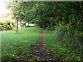
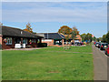
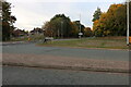
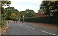
Photos of NN3 5HG


Area Information
Living in NN3 5HG means being part of a tightly knit residential cluster in England, where 1,817 people reside across just 1.1 hectares. The area’s compact size fosters a sense of community, though its high population density of 164,146 people per square kilometre reflects the concentration of homes in a small space. The median age of 47 suggests a mature population, with adults aged 30–64 forming the largest demographic group. This is a place where families and long-term residents coexist, with 40% of homes owned outright and the majority being houses. Daily life here is shaped by proximity to essential services, though the area’s small footprint means every journey, whether to shops or transport hubs, is measured in short distances. The lack of significant natural constraints, such as protected woodlands or areas of outstanding natural beauty, makes NN3 5HG a practical choice for those prioritising convenience over rural landscapes.
- Area Type
- Postcode
- Area Size
- 1.1 hectares
- Population
- 1817
- Population Density
- 5991 people/km²
The property market in NN3 5HG is characterised by a 40% home ownership rate, indicating a balance between owner-occupied and rental properties. The accommodation type is predominantly houses, which is unusual for areas with high population density. This suggests a mix of larger homes and smaller dwellings, possibly including semi-detached or terraced housing. Given the area’s small size, the housing stock is limited, which may affect availability for buyers. The focus on houses rather than flats or apartments could appeal to those seeking more space, though the high density means proximity to neighbours is inevitable. For buyers, this area’s compactness means competition for properties is likely, with limited scope for expansion or development. The market may cater more to existing residents than to new arrivals seeking investment opportunities.
House Prices in NN3 5HG
Showing 30 properties
| Address | Type | Beds | Baths | Last Sale Price | Last Sale Date | |
|---|---|---|---|---|---|---|
| 3 Blueberry Rise, Northampton, NN3 5HG | house | 3 | 1 | £215,000 | Dec 2022 | |
| 5 Blueberry Rise, Northampton, NN3 5HG | Terraced | 3 | 1 | £191,000 | Jul 2022 | |
| 25 Blueberry Rise, Northampton, NN3 5HG | Terraced | 3 | 2 | £164,000 | Jun 2019 | |
| 10 Blueberry Rise, Northampton, NN3 5HG | Terraced | 3 | 1 | £145,000 | May 2019 | |
| 13 Blueberry Rise, Northampton, NN3 5HG | Terraced | 3 | - | £162,000 | Nov 2018 | |
| 12 Blueberry Rise, Northampton, NN3 5HG | Terraced | 5 | 1 | £183,000 | Sep 2018 | |
| 11 Blueberry Rise, Northampton, NN3 5HG | house | 3 | - | £125,000 | Aug 2016 | |
| 23 Blueberry Rise, Northampton, NN3 5HG | Terraced | 3 | - | £115,000 | Oct 2015 | |
| 20 Blueberry Rise, Northampton, NN3 5HG | Bungalow | 4 | 2 | £75,000 | Feb 2011 | |
| 28 Blueberry Rise, Northampton, NN3 5HG | Terraced | - | - | £119,995 | May 2008 |
Energy Efficiency in NN3 5HG
The lifestyle in NN3 5HG is shaped by its proximity to essential amenities. Retail options include Co-op Bellinge, Asda Nene Valley, and Co-op Northampton, offering everyday shopping needs within reach. The area’s transport links, such as the University Bus Interchange and Northampton Railway Station, provide convenience for commuting and travel. While the data does not specify leisure or park facilities, the presence of retail and transport hubs suggests a focus on practicality over leisure. The compact nature of the area means residents can access shops, transport, and services without long journeys, though the absence of detailed information on parks or recreational spaces leaves some aspects of daily life unexplored.
Amenities
Schools
The schools nearest to NN3 5HG include Ecton Brook Primary School and Ecton Brook Middle School, both of which are primary institutions. One of the primary schools has an Ofsted rating of ‘good’, reflecting satisfactory standards of education. The presence of two primary schools within reach provides families with options for their children’s early education, though secondary schooling is not explicitly listed in the data. The concentration of primary schools may be beneficial for younger families, but those requiring secondary education would need to look beyond the immediate area. The availability of schools with a ‘good’ rating suggests a baseline level of quality, though further details on curriculum or performance are not provided.
| Rank | School | Type | Entry gender | Ages |
|---|
Explore more schools in this area
Go to Schools tabDemographics
NN3 5HG’s population is predominantly White, with 40% of residents owning their homes. The median age of 47 indicates a community skewed towards middle-aged adults, with the 30–64 age group making up the largest share. This suggests a stable, established population with fewer young families or retirees compared to other areas. The high home ownership rate of 40% implies a mix of long-term residents and renters, though the exact proportion of rental properties is not specified. The absence of detailed diversity data means the area’s ethnic composition remains largely unquantified beyond the dominant White group. The population density, at 164,146 people per square kilometre, reflects the area’s compact nature, which may influence social dynamics and the availability of shared spaces.
Household Size
Accommodation Type
Tenure
Ethnic Group
Religion
Household Composition
Age
Household Deprivation
NS-SEC
Explore more demographic insights in this area
Go to Demographics tabPlanning
Planning Constraints
- Flood RiskPremium
- Ramsar Wetland SitesPremium
- Area of Outstanding Natural BeautyPremium
- Protected Nature ReservePremium
- Protected WoodlandPremium