Area Overview for NN3 5BB
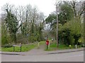
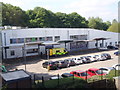
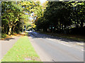
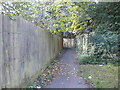
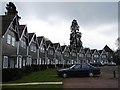
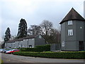
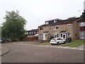
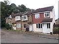
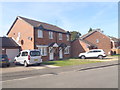
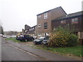
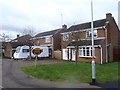
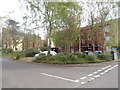
Photos of NN3 5BB
Area Information
Living in NN3 5BB offers a compact, densely populated residential experience within a small cluster of 6,843 square metres, home to 1,981 residents. The area’s high population density—289,475 people per square kilometre—suggests a tightly knit community, though the small footprint means limited space for expansion. It is a neighbourhood primarily inhabited by adults aged 30–64, with a median age of 47, reflecting a mature demographic. Proximity to schools, retail, and transport hubs like Northampton Railway Station and Northampton Bus Interchange adds practicality to daily life. The area’s broadband score of 100 ensures seamless internet connectivity, while a mobile coverage score of 84 supports reliable communication. While crime rates are average, with a safety score of 52, residents are advised to take standard precautions. The absence of environmental constraints like protected woodlands or wetlands means development is unrestricted, though the compact nature of the area may limit private outdoor space.
- Area Type
- Postcode
- Area Size
- 6843 m²
- Population
- 1981
- Population Density
- 4951 people/km²
The property market in NN3 5BB is characterised by a 47% home ownership rate, indicating that over half of properties are rented. The area is predominantly composed of houses, not flats, suggesting a preference for traditional, family-oriented housing. This mix of owner-occupied and rental properties may appeal to both long-term residents and investors. Given the area’s small size and high density, property options are limited, and buyers may need to consider nearby areas for more choice. The presence of houses rather than flats could also influence demand from families seeking larger living spaces. However, the compact nature of the area may mean properties are closely spaced, requiring buyers to weigh proximity to amenities against potential overcrowding.
House Prices in NN3 5BB
Showing 23 properties
| Address | Type | Beds | Baths | Last Sale Price | Last Sale Date | |
|---|---|---|---|---|---|---|
| 21 Barnhill Square, Northampton, NN3 5BB | house | 3 | 1 | £205,000 | Nov 2023 | |
| 1 Barnhill Square, Northampton, NN3 5BB | house | - | - | £200,000 | Mar 2023 | |
| 9 Barnhill Square, Northampton, NN3 5BB | house | - | - | £167,000 | Mar 2022 | |
| 18 Barnhill Square, Northampton, NN3 5BB | house | 5 | - | £250,000 | Dec 2021 | |
| 10 Barnhill Square, Northampton, NN3 5BB | Terraced | 3 | 1 | £153,000 | Aug 2017 | |
| 22 Barnhill Square, Northampton, NN3 5BB | Terraced | 3 | 2 | £73,000 | Mar 2010 | |
| 12 Barnhill Square, Northampton, NN3 5BB | Terraced | 5 | 3 | £135,000 | Jun 2008 | |
| 11 Barnhill Square, Northampton, NN3 5BB | Terraced | - | - | £117,000 | Nov 2007 | |
| 7 Barnhill Square, Northampton, NN3 5BB | Terraced | - | - | £110,000 | May 2006 | |
| 2 Barnhill Square, Northampton, NN3 5BB | Terraced | 3 | - | £89,000 | Aug 2005 |
Energy Efficiency in NN3 5BB
Daily life in NN3 5BB is shaped by its proximity to retail, transport, and community hubs. The area’s retail offerings include Co-op Northampton, Aldi Overstone, and Tesco Northampton, ensuring access to groceries and everyday essentials. Public transport is well-served by Northampton Bus Interchange, the University Bus Interchange, and Northampton Railway Station, facilitating travel to nearby towns and cities. While the data does not mention parks or leisure facilities, the presence of schools and transport links suggests a focus on practicality over recreational space. The compact layout means amenities are closely clustered, offering convenience but potentially limiting private outdoor areas. For residents prioritising accessibility over expansive green spaces, this balance of retail and transport options may be a key draw.
Amenities
Schools
Residents of NN3 5BB have access to two special schools: Greenfields School and Sports College, and Greenfields Specialist School for Communication. Both institutions cater to students with specific educational needs, though no Ofsted ratings are provided. The presence of these schools may be particularly valuable for families with children requiring tailored support. However, the absence of mainstream schools in the data suggests that families may need to look beyond the immediate area for primary or secondary education. The concentration of special schools indicates a focus on niche educational provision, which could be a key consideration for prospective buyers prioritising specific schooling options.
| Rank | School | Type | Entry gender | Ages |
|---|
Explore more schools in this area
Go to Schools tabDemographics
NN3 5BB’s population skews towards adults aged 30–64, with a median age of 47. This suggests a community of established professionals and families, though the 47% home ownership rate indicates that over half of residents rent their homes. The area is predominantly composed of houses, not flats, which may appeal to those seeking traditional housing. The predominant ethnic group is White, though no specific data on diversity or deprivation is provided. The high population density—289,475 people per square kilometre—reflects a compact, possibly urbanised setting. For buyers, this demographic profile implies a stable, long-term resident base, though the high density may influence property availability and community dynamics.
Household Size
Accommodation Type
Tenure
Ethnic Group
Religion
Household Composition
Age
Household Deprivation
NS-SEC
Explore more demographic insights in this area
Go to Demographics tabPlanning
Planning Constraints
- Flood RiskPremium
- Ramsar Wetland SitesPremium
- Area of Outstanding Natural BeautyPremium
- Protected Nature ReservePremium
- Protected WoodlandPremium