Area Overview for NN3 3JH
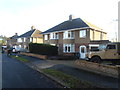
Photos of NN3 3JH


Area Information
Living in NN3 3JH means being part of a tightly knit, small-scale residential community in England. This postcode area covers just 1.2 hectares, yet it supports a population of 1804 people, resulting in a remarkably high population density of 149,126 people per square kilometre. Despite its compact size, the area is well-served by essential amenities, including multiple retail outlets, public transport hubs, and a range of schools. The demographic profile suggests a mature community, with a median age of 47 and a majority of residents aged between 30 and 64. This suggests a stable, established population, many of whom are likely homeowners, given that 80% of properties are owner-occupied. Daily life here is shaped by proximity to local shops, schools, and transport links, making it practical for those who value convenience. The area’s small footprint means it is likely surrounded by larger residential or commercial zones, though the data does not specify these. For buyers, the challenge lies in the limited space, but the density ensures that essential services are within easy reach.
- Area Type
- Postcode
- Area Size
- 1.2 hectares
- Population
- 1804
- Population Density
- 3574 people/km²
The property market in NN3 3JH is characterised by a strong presence of owner-occupied homes, with 80% of properties owned by residents rather than rented. The accommodation type is predominantly houses, which is unusual for a densely populated area but may reflect the compact nature of the postcode. This suggests a mix of smaller, family-friendly homes that fit within the 1.2-hectare footprint. The high home ownership rate implies a stable market, with fewer rental properties available, which could be a consideration for buyers seeking investment opportunities. The small size of the area means the housing stock is likely limited, and properties may be in high demand due to proximity to schools and transport links. Buyers should focus on the immediate surroundings, as the area itself is too small to offer significant variety. The lack of specific data on property prices or types means the market’s dynamics are inferred from the broader demographic and ownership patterns.
House Prices in NN3 3JH
Showing 1 properties
| Address | Type | Beds | Baths | Last Sale Price | Last Sale Date | |
|---|---|---|---|---|---|---|
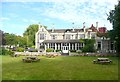
| Westone Lodge, Westone Avenue, Northampton, NN3 3JH | Detached | 4 | 2 | £580,000 | Jun 2025 |
Energy Efficiency in NN3 3JH
The lifestyle in NN3 3JH is shaped by its proximity to essential amenities. Within practical reach are retail outlets such as Lidl Lings, Tesco Northampton, and Aldi Headlands, providing access to groceries and everyday necessities. The area’s transport links, including University and Northampton Bus Interchanges, and the Northampton Railway Station, enhance mobility for shopping, work, or leisure. While the data does not specify parks or leisure facilities, the high population density suggests a focus on compact, efficient living rather than expansive recreational spaces. The presence of multiple schools and retail options indicates a community-oriented environment where daily life is centred around local services. The convenience of nearby amenities reduces the need for long commutes, making it practical for those who prioritise accessibility over large-scale leisure options. The character of the area is defined by its practicality and the ease of accessing essential services.
Amenities
Schools
Residents of NN3 3JH have access to a range of primary schools, including Weston Favell CofE VA Primary School, Weston Favell School, and Weston Favell CofE Primary School, which holds an outstanding Ofsted rating. A nearby academy, Weston Favell Academy, provides additional educational options. The presence of multiple primary schools suggests a focus on early education, which is crucial for families with young children. The outstanding rating at one school indicates a high standard of teaching and facilities, which could be a draw for homebuyers prioritising education quality. The variety of school types—both church-affiliated and academies—offers flexibility for parents seeking different approaches to schooling. However, the absence of secondary schools in the data means families may need to look beyond the immediate area for secondary education. The proximity of these schools to residential properties underscores the area’s appeal to families.
| Rank | School | Type | Entry gender | Ages |
|---|
Explore more schools in this area
Go to Schools tabDemographics
The community in NN3 3JH is predominantly composed of adults aged 30 to 64, with a median age of 47. This indicates a mature, stable population, likely with long-term ties to the area. Home ownership is high, with 80% of residents living in properties they own, suggesting a sense of permanence. The accommodation types are primarily houses, which aligns with the higher population density, as single-family homes can be more space-efficient in compact areas. The predominant ethnic group is White, though no data is provided on the proportion of other ethnicities. The high population density—149,126 people per square kilometre—suggests a mix of family homes and possibly smaller dwellings, though the exact distribution of household types is not specified. This density may contribute to a close-knit community but could also mean limited green space or privacy. The absence of specific deprivation data means the quality of life is inferred from the availability of amenities and low safety risks.
Household Size
Accommodation Type
Tenure
Ethnic Group
Religion
Household Composition
Age
Household Deprivation
NS-SEC
Explore more demographic insights in this area
Go to Demographics tabPlanning
Planning Constraints
- Flood RiskPremium
- Ramsar Wetland SitesPremium
- Area of Outstanding Natural BeautyPremium
- Protected Nature ReservePremium
- Protected WoodlandPremium