Area Overview for NN3 3HH
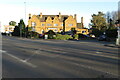
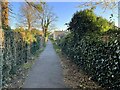
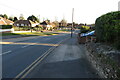
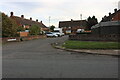
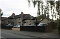
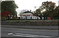
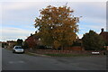
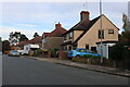
Photos of NN3 3HH
Area Information
NN3 3HH is a compact residential postcode area in England, covering just 1.1 hectares and home to 1,804 residents. Its high population density of 157,093 people per square kilometre reflects a tightly knit community. The area is defined by its small-scale living, with most properties being houses rather than flats. Located near Northampton, it benefits from proximity to the city’s transport hubs, including Northampton Railway Station and major bus interchanges. Daily life here is shaped by its proximity to local amenities, schools, and retail outlets. The demographic profile suggests a mature population, with a median age of 47 and a strong presence of adults aged 30–64. This makes NN3 3HH a stable, family-oriented area where many residents are likely to be long-term homeowners. The area’s low flood risk and crime score of 74/100 add to its appeal, offering a balance of safety and practicality. For buyers seeking a small, well-serviced neighbourhood with good connectivity, NN3 3HH presents a focused, community-driven option.
- Area Type
- Postcode
- Area Size
- 1.1 hectares
- Population
- 1804
- Population Density
- 3574 people/km²
The property market in NN3 3HH is dominated by owner-occupied homes, with 80% of properties owned by residents rather than rented. This contrasts with areas where rental markets dominate, and it suggests a community of long-term residents invested in their homes. The accommodation type is primarily houses, which is unusual for a small postcode area but may reflect a mix of older, larger properties. Given the area’s compact size and high population density, the housing stock is likely to be limited, with little scope for new developments. Buyers should consider that the small footprint of NN3 3HH means property availability is constrained, and prices may be influenced by proximity to nearby amenities. The focus on owner-occupation also indicates that the area is less likely to attract short-term renters, which could stabilise the market but limit options for those seeking flexibility.
House Prices in NN3 3HH
Showing 10 properties
| Address | Type | Beds | Baths | Last Sale Price | Last Sale Date | |
|---|---|---|---|---|---|---|
| 10 Westwood Way, Northampton, NN3 3HH | house | - | - | £312,000 | Dec 2024 | |
| 1 Westwood Way, Northampton, NN3 3HH | Semi-detached | 3 | - | £265,000 | Jul 2022 | |
| 5 Westwood Way, Northampton, NN3 3HH | Retail | 3 | 2 | £285,000 | Apr 2022 | |
| 2 Westwood Way, Northampton, NN3 3HH | Detached | 3 | - | £273,000 | Mar 2021 | |
| 9 Westwood Way, Northampton, NN3 3HH | Semi-detached | 3 | - | £269,995 | Dec 2020 | |
| 4 Westwood Way, Northampton, NN3 3HH | house | - | - | £234,995 | Oct 2014 | |
| 7 Westwood Way, Northampton, NN3 3HH | house | 4 | 1 | £205,795 | May 2013 | |
| 6 Westwood Way, Northampton, NN3 3HH | house | - | - | £204,995 | May 2013 | |
| 8 Westwood Way, Northampton, NN3 3HH | house | - | - | £200,000 | May 2013 | |
| 3 Westwood Way, Northampton, NN3 3HH | Detached | 2 | 1 | £133,000 | May 2013 |
Energy Efficiency in NN3 3HH
Daily life in NN3 3HH is shaped by its proximity to essential amenities. Local retail options include Aldi Headlands, Co-op Bushland, and Co-op Birchfield, providing grocery and household needs within walking or short driving distance. The area’s transport links, such as the University Bus Interchange and Northampton Bus Interchange, connect residents to wider networks, facilitating access to shopping, healthcare, and cultural attractions in Northampton. While parks and leisure facilities are not explicitly listed, the high population density suggests a compact, community-focused environment where social interactions are frequent. The presence of multiple schools and transport hubs adds to the area’s convenience, making it practical for families and commuters. The mix of retail, transport, and educational facilities ensures a balanced lifestyle, where residents can meet daily needs without venturing far from home.
Amenities
Schools
Residents of NN3 3HH have access to a range of schools, including primary and academy institutions. Weston Favell CofE VA Primary School and Weston Favell School are both primary schools, offering early education options. Weston Favell Academy, an academy with an Ofsted rating of ‘good’, provides secondary education, while Weston Favell CofE Primary School holds an ‘outstanding’ rating. This mix of school types ensures families can choose between faith-based and state-run institutions. The presence of an ‘outstanding’ school in the area is a significant draw for families prioritising high-quality education. The proximity of multiple schools within practical reach reduces the need for long commutes, supporting a family-friendly lifestyle. The combination of primary and secondary options also means parents can plan for their children’s education from early years through to adolescence, ensuring continuity of care and academic support.
| Rank | School | Type | Entry gender | Ages |
|---|
Explore more schools in this area
Go to Schools tabDemographics
The community in NN3 3HH is predominantly composed of adults aged 30–64, with a median age of 47. This suggests a mature population, likely with established careers and family ties. Home ownership is high at 80%, indicating a stable residential base with long-term residents. The accommodation type is primarily houses, reflecting a preference for private, standalone properties over flats or apartments. The predominant ethnic group is White, though no specific diversity statistics are provided. The area’s population density of 157,093 people per square kilometre is exceptionally high, which may influence the character of daily interactions and local services. This density, combined with the age profile, points to a community that prioritises stability and proximity to amenities. While no data on deprivation is available, the high home ownership and low crime risk suggest a relatively affluent and secure environment.
Household Size
Accommodation Type
Tenure
Ethnic Group
Religion
Household Composition
Age
Household Deprivation
NS-SEC
Explore more demographic insights in this area
Go to Demographics tabPlanning
Planning Constraints
- Flood RiskPremium
- Ramsar Wetland SitesPremium
- Area of Outstanding Natural BeautyPremium
- Protected Nature ReservePremium
- Protected WoodlandPremium