Area Overview for NN3 3AP
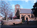
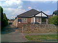
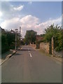
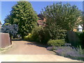
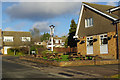
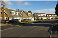
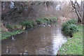
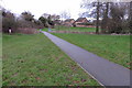
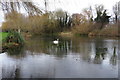
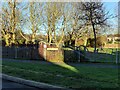
Photos of NN3 3AP


Area Information
Living in NN3 3AP means inhabiting a tightly knit residential cluster in England, where 1.9 hectares of space accommodate 1,535 residents. The area’s high population density of 81,207 people per square kilometre reflects its compact nature, ideal for those seeking proximity to amenities without sacrificing comfort. This postcode is characterised by a mature demographic, with a median age of 47 and a majority of residents aged between 30 and 64. The housing stock here is predominantly owner-occupied, with 89% of homes owned by their occupants, suggesting a stable, long-term community. Daily life in NN3 3AP balances quiet residential living with accessible transport links, including Northampton Railway Station and nearby bus interchanges. The area’s small footprint means it is well-suited to those prioritising convenience, though its limited size may constrain expansion. For buyers, NN3 3AP offers a snapshot of suburban England, where traditional housing meets practical connectivity.
- Area Type
- Postcode
- Area Size
- 1.9 hectares
- Population
- 1535
- Population Density
- 1690 people/km²
The property market in NN3 3AP is dominated by owner-occupied homes, with 89% of properties owned by their occupants. This high rate of home ownership points to a community of long-term residents rather than a transient rental market. The area’s housing stock consists primarily of houses, which is unusual for a small postcode area but may reflect its suburban character. Given the limited size of 1.9 hectares, the housing stock is constrained, meaning buyers should consider the proximity of properties to nearby amenities and transport links. The predominance of houses over flats or apartments suggests a preference for private, family-oriented living. For buyers, this small area offers a niche market with limited scope for new developments, making it essential to evaluate the immediate surroundings for additional housing options. The high home ownership rate also indicates a potential for stable property values, though the small size of the area may limit investment opportunities.
House Prices in NN3 3AP
Showing 32 properties
| Address | Type | Beds | Baths | Last Sale Price | Last Sale Date | |
|---|---|---|---|---|---|---|
| 27 Ridgeway, Northampton, NN3 3AP | Semi-detached | 4 | 3 | £457,500 | Mar 2025 | |
| 45 Ridgeway, Northampton, NN3 3AP | Semi-detached | 3 | 1 | £395,000 | Dec 2022 | |
| 67 Ridgeway, Northampton, NN3 3AP | Bungalow | - | - | £370,000 | Nov 2020 | |
| 41 Ridgeway, Northampton, NN3 3AP | house | 4 | - | £520,000 | Sep 2019 | |
| 7 Ridgeway, Northampton, NN3 3AP | Bungalow | - | - | £375,000 | Sep 2016 | |
| 17 Ridgeway, Northampton, NN3 3AP | Detached | 4 | 1 | £449,500 | Mar 2016 | |
| 51 Ridgeway, Northampton, NN3 3AP | Detached | 4 | - | £430,000 | Feb 2016 | |
| 29 Ridgeway, Northampton, NN3 3AP | Semi-detached | 4 | - | £343,000 | Jan 2016 | |
| 35 Ridgeway, Northampton, NN3 3AP | house | - | - | £220,000 | Aug 2015 | |
| 69 Ridgeway, Northampton, NN3 3AP | Bungalow | 2 | - | £250,000 | Jul 2014 |
Energy Efficiency in NN3 3AP
Residents of NN3 3AP have access to a range of nearby amenities within practical reach, including retail options such as Aldi Headlands, Co-op Birchfield, and Co-op Bushland. These stores provide essential shopping and grocery needs, supporting daily life in the area. The presence of Northampton Bus Interchange and University Bus Interchange ensures frequent transport links to Northampton and educational institutions, while Northampton Railway Station offers direct rail connections to larger cities. Although the area is small, the combination of retail, transport, and connectivity creates a functional environment for residents. The lack of extensive leisure or recreational facilities means those seeking parks or cultural venues may need to travel further, but the proximity to transport hubs mitigates this limitation. For those prioritising convenience over expansive amenities, NN3 3AP offers a compact, serviceable lifestyle with minimal reliance on cars.
Amenities
Schools
| Rank | School | Type | Entry gender | Ages |
|---|
Explore more schools in this area
Go to Schools tabDemographics
The community in NN3 3AP is defined by its mature age profile, with a median age of 47 and the majority of residents falling within the 30-64 age range. This suggests a population largely composed of working-age adults and older professionals, contributing to a stable, established neighbourhood. Home ownership is exceptionally high at 89%, indicating a preference for long-term residency over rental living. The area is predominantly occupied by White residents, with no specific data on other ethnic groups provided. The high population density of 81,207 people per square kilometre, combined with the compact 1.9-hectare footprint, implies a tightly packed residential environment. This density, while efficient, may influence the availability of private outdoor space. The absence of specific data on deprivation or income levels means the area’s socioeconomic challenges remain unquantified, though the high home ownership rate suggests relative financial stability among residents.
Household Size
Accommodation Type
Tenure
Ethnic Group
Religion
Household Composition
Age
Household Deprivation
NS-SEC
Explore more demographic insights in this area
Go to Demographics tabPlanning
Planning Constraints
- Flood RiskPremium
- Ramsar Wetland SitesPremium
- Area of Outstanding Natural BeautyPremium
- Protected Nature ReservePremium
- Protected WoodlandPremium