Area Overview for NN3 2TD
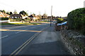
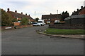
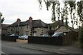
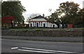
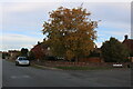
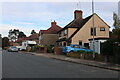
Photos of NN3 2TD


Area Information
Living in NN3 2TD offers a compact, tightly knit residential experience within a small cluster of homes. The area covers 5,555 square metres and is home to 1,992 residents, creating a high population density of 358,596 people per square kilometre. This suggests a closely connected community where daily life revolves around local amenities and familiar faces. The area is predominantly composed of houses, with 64% of residents owning their homes. The median age of 47 and a strong presence of adults aged 30–64 indicate a mature, stable population, likely with established careers and families. While the postcode is small, it provides access to essential services, including nearby schools, transport links, and retail options. For those seeking a quiet, residential environment with practical connectivity, NN3 2TD balances proximity to urban conveniences with a sense of local identity. Its compact size means residents are likely within walking or short driving distance of most amenities, though the area’s character is defined by its density and the mix of home ownership and rental properties.
- Area Type
- Postcode
- Area Size
- 5555 m²
- Population
- 1992
- Population Density
- 5273 people/km²
The property market in NN3 2TD is characterised by a strong presence of owner-occupied homes, with 64% of residents owning their properties. This suggests a stable, long-term market where homeownership is the norm rather than the exception. The accommodation type is predominantly houses, which is unusual for areas with high population density but aligns with the compact, residential nature of the postcode. This mix of home ownership and housing stock implies a community where properties are likely to be family homes rather than rental units. For buyers, this means a limited number of available properties, as the area is small, and the housing stock is largely fixed. The focus on houses may appeal to those seeking more space or a traditional home, though the density of the area suggests proximity to urban centres. Buyers should consider the local market’s insularity, which may limit options for those seeking larger or more varied property types.
House Prices in NN3 2TD
Showing 10 properties
| Address | Type | Beds | Baths | Last Sale Price | Last Sale Date | |
|---|---|---|---|---|---|---|
| 8 Hervey Close, Northampton, NN3 2TD | Terraced | 3 | 1 | £170,000 | Aug 2016 | |
| 1 Hervey Close, Northampton, NN3 2TD | house | 3 | 1 | £150,000 | Aug 2007 | |
| 6 Hervey Close, Northampton, NN3 2TD | Semi-detached | 3 | - | - | - | |
| 2 Hervey Close, Northampton, NN3 2TD | Terraced | - | - | - | - | |
| 5 Hervey Close, Northampton, NN3 2TD | house | - | - | - | - | |
| 10 Hervey Close, Northampton, NN3 2TD | house | - | - | - | - | |
| 7 Hervey Close, Northampton, NN3 2TD | house | - | - | - | - | |
| 4 Hervey Close, Northampton, NN3 2TD | house | - | - | - | - | |
| 9 Hervey Close, Northampton, NN3 2TD | Terraced | - | - | - | - | |
| 3 Hervey Close, Northampton, NN3 2TD | house | - | - | - | - |
Energy Efficiency in NN3 2TD
Daily life in NN3 2TD is supported by a range of nearby amenities, including retail stores such as Aldi Headlands, Co-op Bushland, and Lidl Lings. These shops provide essential groceries and household items, reducing the need for long trips to larger centres. The area’s transport links, including University Bus Interchange and Northampton Bus Interchange, offer regular services to nearby destinations, while Northampton Railway Station provides access to regional routes. Though the data does not list parks or leisure facilities, the presence of retail and transport hubs suggests a practical, convenience-focused lifestyle. Residents can access basic shopping and travel needs without leaving the immediate vicinity, though more extensive leisure options may require visiting adjacent areas. The compact nature of the postcode means amenities are closely clustered, fostering a sense of accessibility.
Amenities
Schools
The nearest school to NN3 2TD is Cherry Orchard Middle School, a primary school. No secondary schools are listed in the data, meaning families with older children may need to look further afield for secondary education. The presence of a primary school suggests that the area is well-served for younger children, though the lack of secondary options could be a consideration for those planning for long-term schooling. The school’s type and the absence of other educational institutions indicate that the area is likely part of a larger local authority with broader school networks. For families, this means relying on nearby towns or districts for secondary education, which may involve commuting. The data does not include Ofsted ratings, so additional research would be needed to assess the quality of the school.
| Rank | School | Type | Entry gender | Ages |
|---|
Explore more schools in this area
Go to Schools tabDemographics
The community in NN3 2TD is predominantly composed of adults aged 30–64, with a median age of 47. This suggests a population that is largely in their prime working years, with many likely to be raising families or nearing retirement. Home ownership is strong, with 64% of residents owning their homes, indicating a stable housing market and long-term investment in the area. The accommodation type is primarily houses, which aligns with the higher proportion of owner-occupied properties compared to flats or apartments. The predominant ethnic group is White, reflecting a homogenous demographic profile. While specific data on deprivation is not provided, the high home ownership rate and mature age profile suggest a community with relatively stable economic conditions. However, the absence of detailed diversity metrics means the full picture of social composition remains incomplete.
Household Size
Accommodation Type
Tenure
Ethnic Group
Religion
Household Composition
Age
Household Deprivation
NS-SEC
Explore more demographic insights in this area
Go to Demographics tabPlanning
Planning Constraints
- Flood RiskPremium
- Ramsar Wetland SitesPremium
- Area of Outstanding Natural BeautyPremium
- Protected Nature ReservePremium
- Protected WoodlandPremium