Area Overview for NN3 2SB
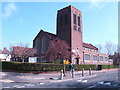
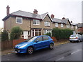
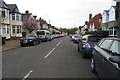
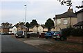
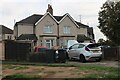
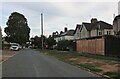
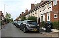
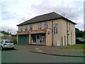
Photos of NN3 2SB


Area Information
Living in NN3 2SB offers a quiet, residential experience in a small cluster of homes. With a population of 1675, this area is compact yet well-served by essential services. The community is predominantly composed of adults aged 30–64, reflecting a mature demographic that values stability. Home ownership is high, at 82%, with most properties being houses rather than flats. The area’s low flood risk and below-average crime rates contribute to a sense of security. Residents benefit from proximity to Northampton’s transport hubs, including the railway station and bus interchanges, while nearby shops like Co-op Bushland and Morrisons Kingsley ensure daily needs are met. NN3 2SB is ideal for those seeking a settled, low-maintenance lifestyle with minimal environmental constraints. Its small size means amenities are within practical reach, though it remains distinct from larger urban centres. The area’s character is defined by its residential focus, with no major industrial or commercial developments nearby. For buyers prioritising safety, convenience, and a close-knit community, NN3 2SB presents a straightforward option.
- Area Type
- Postcode
- Area Size
- Not available
- Population
- 1675
- Population Density
- 4796 people/km²
The property market in NN3 2SB is characterised by a high rate of home ownership, with 82% of residents living in owner-occupied homes. This indicates a market skewed towards long-term residents rather than a rental-heavy area. The accommodation type is predominantly houses, which aligns with the area’s residential nature and lack of high-density development. As a small postcode cluster, the housing stock is limited in scale, meaning buyers should consider the immediate surrounding areas for more options. The high home ownership rate suggests a stable market with relatively low turnover, which can be advantageous for buyers seeking a secure investment. However, the limited number of properties may also mean competition for available homes. The absence of flats or commercial properties further reinforces the area’s focus on private, family-oriented living. For those prioritising a quiet, low-maintenance environment, NN3 2SB’s property market offers a straightforward, if modest, selection.
House Prices in NN3 2SB
No properties found in this postcode.
Energy Efficiency in NN3 2SB
Residents of NN3 2SB have access to a range of nearby amenities that support daily life. The area is within walking distance of Co-op Bushland, Morrisons Kingsley, and Tesco Spinny, providing essential shopping and grocery options. These retail outlets cater to both routine needs and occasional purchases, ensuring convenience for households. The proximity to Northampton Bus Interchange and the University Bus Interchange facilitates easy travel to the city centre or educational institutions. Northampton Railway Station further enhances connectivity, allowing residents to reach other parts of the country efficiently. While the data does not mention parks or leisure facilities, the presence of multiple retail and transport hubs suggests a practical, service-oriented lifestyle. The combination of local shops and transport links means that most errands and travel can be managed without a car. This makes NN3 2SB appealing to those who value accessibility and the ability to live independently within a compact area.
Amenities
Schools
| Rank | School | Type | Entry gender | Ages |
|---|
Explore more schools in this area
Go to Schools tabDemographics
The demographic profile of NN3 2SB is shaped by a median age of 47, with the majority of residents falling within the 30–64 age range. This suggests a community of established professionals and families, rather than a younger or elderly population. Home ownership is high, at 82%, indicating a strong preference for long-term residency over rental properties. The area is predominantly occupied by households living in houses, with no data on flats or other accommodation types. The predominant ethnic group is White, though no further breakdown of diversity is provided. The absence of specific data on deprivation means it is not possible to assess economic inequality or access to services beyond what is stated. The age profile and ownership figures suggest a stable, low-turnover community where residents are likely to have built long-term ties. This demographic structure may influence local services and amenities, which are tailored to the needs of middle-aged and older adults.
Household Size
Accommodation Type
Tenure
Ethnic Group
Religion
Household Composition
Age
Household Deprivation
NS-SEC
Explore more demographic insights in this area
Go to Demographics tabPlanning
Planning Constraints
- Flood RiskPremium
- Ramsar Wetland SitesPremium
- Area of Outstanding Natural BeautyPremium
- Protected Nature ReservePremium
- Protected WoodlandPremium