Area Overview for NN3 2LD
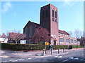
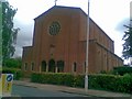
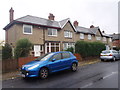
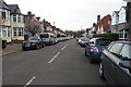
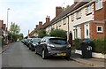
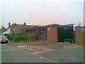
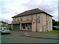
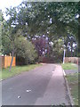
Photos of NN3 2LD
Area Information
NN3 2LD is a compact residential postcode area in England, covering just 1.6 hectares and home to 1,675 people. Its high population density of 103,738 people per square kilometre reflects a tightly knit community, typical of small urban clusters. The area’s character is defined by its proximity to Northampton’s transport hubs, including the Northampton Railway Station and nearby bus interchanges. Daily life here is shaped by a balance of local amenities and connectivity to larger urban centres. With a median age of 47 and a population skewed towards adults aged 30–64, the area feels stable and mature. Most residents own their homes, with 82% of properties in private ownership, suggesting a long-term commitment to the neighbourhood. The dominance of houses over flats indicates a preference for family-friendly living, while the predominantly White population underscores a homogenous demographic. Living in NN3 2LD means navigating a small, densely populated space with easy access to retail, transport, and nearby green spaces. It is a practical choice for those prioritising convenience and connectivity over sprawling suburban landscapes.
- Area Type
- Postcode
- Area Size
- 1.6 hectares
- Population
- 1675
- Population Density
- 4796 people/km²
The property market in NN3 2LD is overwhelmingly owner-occupied, with 82% of residents in private homes. This contrasts with areas where rental markets dominate, indicating a community of long-term residents rather than transient tenants. The accommodation type is primarily houses, which are more common than flats or apartments in this postcode. This suggests a housing stock tailored to families or individuals seeking space and privacy. Given the area’s small size—just 1.6 hectares—the housing stock is limited, meaning buyers may need to consider nearby areas for more options. The high home ownership rate also implies stable property values, potentially offering security for long-term investors. However, the compact nature of NN3 2LD means competition for properties could be fierce, especially for those prioritising proximity to Northampton’s transport links and amenities.
House Prices in NN3 2LD
Showing 47 properties
| Address | Type | Beds | Baths | Last Sale Price | Last Sale Date | |
|---|---|---|---|---|---|---|
| 3 Elmhurst Avenue, Northampton, NN3 2LD | Semi-detached | 4 | - | £313,000 | Jun 2025 | |
| 11 Elmhurst Avenue, Northampton, NN3 2LD | Terraced | 3 | 2 | £260,000 | May 2025 | |
| 1 Elmhurst Avenue, Northampton, NN3 2LD | Semi-detached | 3 | 2 | £305,000 | Jun 2024 | |
| 30 Elmhurst Avenue, Northampton, NN3 2LD | Semi-detached | 3 | 1 | £334,000 | May 2024 | |
| 2 Elmhurst Avenue, Northampton, NN3 2LD | Terraced | 3 | 1 | £330,000 | Jun 2023 | |
| 18 Elmhurst Avenue, Northampton, NN3 2LD | Semi-detached | 3 | 2 | £365,000 | Sep 2022 | |
| 13 Elmhurst Avenue, Northampton, NN3 2LD | Terraced | 3 | 2 | £292,000 | Jul 2022 | |
| 47 Elmhurst Avenue, Northampton, NN3 2LD | house | - | - | £365,000 | Mar 2022 | |
| 6 Elmhurst Avenue, Northampton, NN3 2LD | Semi-detached | 3 | - | £275,000 | Sep 2021 | |
| 27 Elmhurst Avenue, Northampton, NN3 2LD | Semi-detached | 3 | 1 | £235,000 | Mar 2021 |
Energy Efficiency in NN3 2LD
Living in NN3 2LD offers easy access to essential amenities within walking or short driving distance. The retail landscape includes major supermarkets such as Morrisons Kingsley, Co-op Birchfield, and Tesco Kingsley, providing a range of grocery and everyday shopping options. For transport, the University Bus Interchange and Northampton Bus Interchange are nearby, offering regular services to Northampton and beyond. The Northampton Railway Station is also within reach, connecting residents to London and other key cities. While the area lacks named parks or leisure facilities in the provided data, the proximity to Northampton suggests access to larger recreational spaces. The presence of multiple retail outlets and transport hubs contributes to a convenient, practical lifestyle, ideal for those prioritising accessibility over expansive green spaces.
Amenities
Schools
| Rank | School | Type | Entry gender | Ages |
|---|
Explore more schools in this area
Go to Schools tabDemographics
The community in NN3 2LD is predominantly composed of adults aged 30–64, with a median age of 47. This suggests a population that is largely in their prime working years, likely contributing to a stable local economy. With 82% of residents owning their homes, the area is characterised by long-term occupancy rather than transient renters. The accommodation type is primarily houses, indicating a preference for private, family-oriented living. The predominant ethnic group is White, reflecting a relatively homogenous demographic profile. The high population density of 103,738 people per square kilometre means the area is densely populated despite its small size, which could influence the pace of life and availability of shared spaces. While the data does not specify deprivation levels, the combination of high home ownership and a mature age profile suggests a community with established roots and potentially lower socioeconomic volatility.
Household Size
Accommodation Type
Tenure
Ethnic Group
Religion
Household Composition
Age
Household Deprivation
NS-SEC
Explore more demographic insights in this area
Go to Demographics tabPlanning
Planning Constraints
- Flood RiskPremium
- Ramsar Wetland SitesPremium
- Area of Outstanding Natural BeautyPremium
- Protected Nature ReservePremium
- Protected WoodlandPremium