Area Overview for NN3 2HU
Photos of NN3 2HU
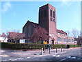
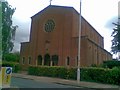
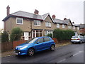
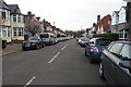
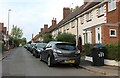
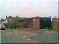
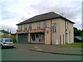
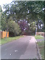
75 photos from this area
Area Information
Key information about the NN3 2HU including its size, population, and administrative classification.
- Area Type
- Postcode
- Area Size
- 5590 m²
- Population
- 1786
- Population Density
- 8257 people/km²
House Prices in NN3 2HU
13
Properties
£384,731
Average Sold Price
£94,000
Lowest Price
£650,000
Highest Price
Showing 13 properties
| Address | Type | Beds | Baths | Last Sale Price | Last Sale Date | |
|---|---|---|---|---|---|---|
| 55 Park Avenue North, Northampton, NN3 2HU | Terraced | 5 | 4 | £550,000 | Mar 2025 | |
| 69 Park Avenue North, Northampton, NN3 2HU | Detached | 6 | 3 | £560,000 | Aug 2024 | |
| 47 Park Avenue North, Northampton, NN3 2HU | Semi-detached | 4 | 2 | £650,000 | Nov 2023 | |
| 65 Park Avenue North, Northampton, NN3 2HU | Semi-detached | 4 | - | £460,000 | Jan 2018 | |
| 67 Park Avenue North, Northampton, NN3 2HU | Semi-detached | 4 | 1 | £334,376 | Mar 2016 | |
| 61 Park Avenue North, Northampton, NN3 2HU | house | 4 | - | £278,936 | Aug 2013 | |
| 63 Park Avenue North, Northampton, NN3 2HU | house | - | - | £310,000 | Dec 2010 | |
| 57 Park Avenue North, Northampton, NN3 2HU | Semi-detached | - | - | £320,000 | Jun 2006 | |
| 51 Park Avenue North, Northampton, NN3 2HU | house | - | - | £290,000 | Aug 2005 | |
| 59 Park Avenue North, Northampton, NN3 2HU | Semi-detached | - | - | £94,000 | Nov 1995 |
Page 1 of 2
Energy Efficiency in NN3 2HU
Amenities
Schools
| Rank | School | Type | Entry gender | Ages |
|---|
Explore more schools in this area
Go to Schools tabDemographics
Household Size
Family (3-5 people)
most common
Accommodation Type
Houses
most common
Tenure
78
majority
Ethnic Group
White
most common
Religion
N/A
most common
Household Composition
N/A
most common
Age
47
median
Adults (30-64 years)
most common
Household Deprivation
N/A
with no deprivation
NS-SEC
37
in Lower managerial occupations
Explore more demographic insights in this area
Go to Demographics tabPlanning
Planning Constraints
- Flood RiskPremium
- Ramsar Wetland SitesPremium
- Area of Outstanding Natural BeautyPremium
- Protected Nature ReservePremium
- Protected WoodlandPremium