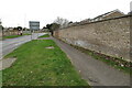
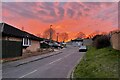
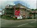
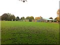
Area Overview for NN3 2AY
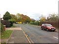
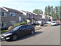
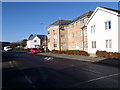
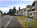
Photos of NN3 2AY


Area Information
Living in NN3 2AY means inhabiting a compact, densely populated residential cluster in England. The area covers 5,802 square metres and is home to 1,907 residents, making it one of the most densely populated places in the country. Daily life here is shaped by its small-scale nature, where proximity to amenities and services is key. The area’s demographics suggest a mature population, with a median age of 47 and a majority of residents aged 30–64. This reflects a community rooted in stability, with a focus on established housing rather than transient populations. While the area lacks large-scale infrastructure, its practical size ensures that essential services are within walking or short-driving distance. Residents benefit from nearby schools, retail options, and transport links, creating a self-contained environment. However, the high population density and limited land area mean that NN3 2AY is not suited to those seeking expansive living spaces or rural tranquillity. Instead, it caters to those prioritising convenience and accessibility over space.
- Area Type
- Postcode
- Area Size
- 5802 m²
- Population
- 1907
- Population Density
- 5219 people/km²
The property market in NN3 2AY is characterised by a low rate of home ownership, with only 32% of residents owning their homes. This suggests a rental market that dominates, likely catering to those who prefer not to commit to long-term property ownership. The accommodation type is predominantly houses, which is notable given the area’s small size. This mix of housing stock may indicate a blend of older, family-oriented properties and newer developments. However, the limited land area and high population density mean that the housing supply is constrained, potentially leading to competition among buyers and renters. For those considering purchasing property in NN3 2AY, the focus should be on practicality rather than luxury, with homes likely prioritising functionality over spaciousness. The small area also means that property values may be influenced more by proximity to amenities than by size or condition.
House Prices in NN3 2AY
Showing 21 properties
| Address | Type | Beds | Baths | Last Sale Price | Last Sale Date | |
|---|---|---|---|---|---|---|
| 39 Grange Road, Northampton, NN3 2AY | house | - | - | £167,500 | Apr 2022 | |
| 21 Grange Road, Northampton, NN3 2AY | Flat | 1 | 1 | £105,000 | Apr 2022 | |
| 25 Grange Road, Northampton, NN3 2AY | Terraced | 2 | 1 | £119,995 | Jan 2016 | |
| 35 Grange Road, Northampton, NN3 2AY | Terraced | 2 | 1 | £84,000 | Jul 2009 | |
| 33 Grange Road, Northampton, NN3 2AY | Terraced | 2 | 1 | £100,995 | Jun 2007 | |
| 37 Grange Road, Northampton, NN3 2AY | house | - | - | £95,000 | Oct 2006 | |
| 31 Grange Road, Northampton, NN3 2AY | house | - | - | £94,000 | Mar 2006 | |
| 1 Grange Road, Northampton, NN3 2AY | Flat | - | - | £62,950 | Mar 2003 | |
| 41 Grange Road, Northampton, NN3 2AY | Terraced | 2 | - | £69,000 | Apr 2002 | |
| 27 Grange Road, Northampton, NN3 2AY | Terraced | - | - | £46,000 | Feb 2000 |
Energy Efficiency in NN3 2AY
The lifestyle in NN3 2AY is defined by its proximity to essential amenities. Residents have access to five retail stores, including Co-op Bushland, Tesco Spinny, and Aldi Headlands, which provide everyday shopping needs. The University Bus Interchange and Northampton Bus Interchange offer convenient transport links, while Northampton Railway Station connects to broader regional networks. These facilities support a practical, community-oriented lifestyle, though the area lacks mention of parks or leisure spaces. The density of retail and transport options suggests a focus on convenience over expansive recreational areas. For those prioritising accessibility, NN3 2AY offers a compact environment where daily essentials are within reach, though larger leisure opportunities may require travel to nearby towns.
Amenities
Schools
Residents of NN3 2AY have access to a range of schools, including primary and academy institutions. Eastfield Primary School and St Gregory’s Catholic Primary School serve younger children, with the latter holding a good Ofsted rating. St Mary’s Catholic Middle School, Northampton, is listed as a primary school but may offer middle-year education, though its specific age range is unclear. Eastfield Academy, an academy school, also has a good Ofsted rating, indicating quality education for older students. The presence of both state and Catholic schools provides families with options, though the data does not specify the availability of secondary education. The mix of school types suggests a balance between local and possibly larger educational institutions, but the absence of detailed information on school capacity or performance beyond Ofsted ratings means prospective families should investigate further.
| Rank | School | Type | Entry gender | Ages |
|---|
Explore more schools in this area
Go to Schools tabDemographics
The community in NN3 2AY is predominantly composed of adults aged 30–64, with a median age of 47. This suggests a population focused on middle-aged and older residents, likely with established careers and families. Home ownership is relatively low at 32%, indicating that a majority of residents rent their homes. The accommodation type is primarily houses, which is unusual for an area of this size, suggesting a mix of older properties and perhaps some newer developments. The predominant ethnic group is White, with no data provided on other ethnicities. The high population density of 328,659 people per square kilometre reflects the area’s compact nature and may influence the social dynamics and pressure on local resources. While the data does not specify deprivation levels, the combination of high density and limited land area could impact quality of life, particularly in terms of space and privacy.
Household Size
Accommodation Type
Tenure
Ethnic Group
Religion
Household Composition
Age
Household Deprivation
NS-SEC
Explore more demographic insights in this area
Go to Demographics tabPlanning
Planning Constraints
- Flood RiskPremium
- Ramsar Wetland SitesPremium
- Area of Outstanding Natural BeautyPremium
- Protected Nature ReservePremium
- Protected WoodlandPremium