Area Overview for NN3 2AJ
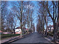
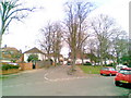
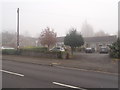
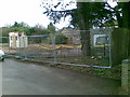
Photos of NN3 2AJ
Area Information
NN3 2AJ is a compact residential postcode in England, spanning just 2.8 hectares and home to 1,907 people. Its high population density of 69,064 people per square kilometre reflects a tightly packed community, typical of small urban clusters. The area’s character is defined by its proximity to essential services and transport links, making it a practical choice for those prioritising convenience. With a median age of 47, the population skews towards adults aged 30–64, suggesting a mix of established families and professionals. Daily life here is shaped by the surrounding infrastructure, including nearby schools, retail outlets, and public transport hubs. The area’s small size means residents are close to amenities, though the limited space also means the community is densely populated. For buyers, this postcode offers a snapshot of urban living with a focus on accessibility, though the compact nature may appeal more to those seeking proximity to services than expansive living space.
- Area Type
- Postcode
- Area Size
- 2.8 hectares
- Population
- 1907
- Population Density
- 5219 people/km²
The property market in NN3 2AJ is characterised by a low home ownership rate of 32%, suggesting that the area is more rental-oriented than owner-occupied. The accommodation type is predominantly houses, which is unusual for a small, densely populated postcode. This mix implies a limited number of properties, potentially increasing competition among buyers. The compact size of the area means that the housing stock is concentrated, with fewer options for those seeking larger properties or new builds. For buyers, this could mean navigating a competitive market with limited inventory. The presence of houses may appeal to families, but the low ownership rate suggests that many residents are renters, possibly drawn by the area’s proximity to amenities. Prospective buyers should consider the small footprint of the area and its impact on availability.
House Prices in NN3 2AJ
Showing 26 properties
| Address | Type | Beds | Baths | Last Sale Price | Last Sale Date | |
|---|---|---|---|---|---|---|
| 38 Greenside, Northampton, NN3 2AJ | house | 3 | 1 | £130,000 | Oct 2024 | |
| 14 Greenside, Northampton, NN3 2AJ | Terraced | 3 | 1 | £215,000 | Jun 2022 | |
| 2 Greenside, Northampton, NN3 2AJ | house | - | - | £186,995 | Oct 2021 | |
| 36 Greenside, Northampton, NN3 2AJ | Terraced | 3 | - | £202,428 | Dec 2020 | |
| 24 Greenside, Northampton, NN3 2AJ | house | - | - | £122,500 | Oct 2016 | |
| 46 Greenside, Northampton, NN3 2AJ | house | - | - | £117,000 | Oct 2016 | |
| 20 Greenside, Northampton, NN3 2AJ | Terraced | 3 | - | £107,000 | Aug 2015 | |
| 40 Greenside, Northampton, NN3 2AJ | Terraced | 3 | - | £114,995 | Jun 2014 | |
| 42 Greenside, Northampton, NN3 2AJ | house | 3 | 1 | £85,000 | Aug 2011 | |
| 28 Greenside, Northampton, NN3 2AJ | Terraced | - | - | £24,310 | Jan 2002 |
Energy Efficiency in NN3 2AJ
The lifestyle in NN3 2AJ is shaped by its proximity to essential amenities, including five retail outlets such as Tesco Spinny, Co-op Bushland, and Morrisons Kingsley. These shops provide access to groceries, household goods, and other necessities within practical reach. The area’s transport links, including bus interchanges and a railway station, enhance mobility, though the small footprint means that residents may need to travel to nearby locations for more specialised services. Parks and leisure facilities are not explicitly mentioned in the data, but the presence of schools and retail suggests a focus on practicality over expansive recreational spaces. The compact nature of the area fosters a sense of convenience, with daily needs met nearby. However, the limited number of amenities within the postcode itself means that the community relies on surrounding areas for broader lifestyle options.
Amenities
Schools
Residents of NN3 2AJ have access to a range of schools, including Eastfield Primary School, St Gregory’s Catholic Primary School, and St Mary’s Catholic Middle School in Northampton. Eastfield Academy, an academy with a ‘good’ Ofsted rating, provides secondary education, while St Gregory’s Catholic Primary School also holds a ‘good’ rating. The mix of primary and secondary schools offers families a choice of educational institutions, though the area’s small size may limit the diversity of options. The presence of multiple schools, including one with a strong rating, suggests that education is a key consideration for families in the area. However, the concentration of schools in nearby Northampton may mean that some students travel outside the postcode for secondary education. This proximity to schools is a practical advantage, though the limited number of institutions reflects the area’s compact nature.
| Rank | School | Type | Entry gender | Ages |
|---|
Explore more schools in this area
Go to Schools tabDemographics
The population of NN3 2AJ is predominantly adults aged 30–64, with a median age of 47. This suggests a community of working-age individuals, many of whom may be raising families or in established careers. Home ownership is relatively low at 32%, indicating that a significant portion of the housing stock is rented out, which could influence the local rental market. The area’s accommodation is primarily houses, a rarity in densely populated urban zones, which may reflect a mix of older properties and family homes. The predominant ethnic group is White, though no data on other demographics is provided. The high population density, combined with a low home ownership rate, may indicate a transient or rental-focused population. For quality of life, this profile suggests a mature, stable community but one that may lack the diversity or younger population seen in other areas.
Household Size
Accommodation Type
Tenure
Ethnic Group
Religion
Household Composition
Age
Household Deprivation
NS-SEC
Explore more demographic insights in this area
Go to Demographics tabPlanning
Planning Constraints
- Flood RiskPremium
- Ramsar Wetland SitesPremium
- Area of Outstanding Natural BeautyPremium
- Protected Nature ReservePremium
- Protected WoodlandPremium