Area Overview for NN3 1WS
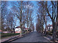
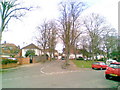
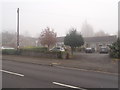
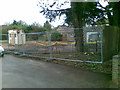
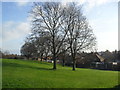
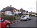
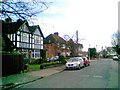
Photos of NN3 1WS


Area Information
NN3 1WS is a small, tightly knit residential cluster in England, home to 1625 residents. Its compact size means daily life is shaped by close proximity to local amenities and transport links. The area sits within reach of Northampton’s broader infrastructure, offering a balance between suburban tranquillity and urban accessibility. With a median age of 47, the community is predominantly composed of adults aged 30–64, suggesting a stable demographic with established households. The area’s housing stock is largely composed of individual homes, reflecting a strong tradition of home ownership. Residents benefit from a mix of retail options, public transport hubs, and a primary school with a good Ofsted rating. While the postcode itself is small, its strategic location ensures residents can access regional services without long commutes. This makes NN3 1WS appealing to those seeking a self-contained yet connected living environment, where community ties and practicality coexist.
- Area Type
- Postcode
- Area Size
- Not available
- Population
- 1625
- Population Density
- 4158 people/km²
The property market in NN3 1WS is characterised by a high rate of home ownership (58%) and a predominance of houses over flats. This suggests a community prioritising stability and space, with properties likely to be family homes rather than investment properties. The small size of the area means the housing stock is limited, and buyers should consider the proximity to Northampton for additional options. With no mention of rental properties in the data, it appears this is not a hotspot for landlords or short-term lets. For buyers, this means competition may be fierce for available homes, and the market is likely to cater to those seeking long-term residency. The lack of flats also indicates a focus on traditional, owner-occupied housing, which may appeal to those valuing privacy and garden space.
House Prices in NN3 1WS
No properties found in this postcode.
Energy Efficiency in NN3 1WS
The lifestyle in NN3 1WS is shaped by its proximity to retail, transport, and community hubs. Within practical reach are five retail outlets, including Tesco Spinny, Co-op Bushland, and Morrisons Kingsley, offering a range of shopping options. These stores cater to daily needs, from groceries to household goods, reducing the need for long trips. The area’s transport links, including two bus interchanges and a railway station, provide easy access to Northampton and beyond, supporting both commuting and leisure travel. While there is no mention of parks or leisure facilities in the data, the presence of multiple retail and transport options suggests a focus on practicality and convenience. This makes NN3 1WS suitable for those prioritising accessibility over expansive green spaces.
Amenities
Schools
The nearest school to NN3 1WS is Boothville Primary School, which serves the local community with a good Ofsted rating. As a primary school, it caters to children aged 4–11, providing a foundation for education before secondary schooling. The absence of secondary schools in the data suggests families may need to look further afield, potentially to Northampton. However, the quality rating of the primary school offers reassurance for parents prioritising early education. The single school listed indicates a limited but functional educational infrastructure, with no mention of additional schools or specialist provisions. For families, this means a reliance on local provision for younger children, with broader options available for older students.
| Rank | School | Type | Entry gender | Ages |
|---|---|---|---|---|
| 1 | Boothville Primary School | primary | N/A | N/A |
Explore more schools in this area
Go to Schools tabDemographics
The population of NN3 1WS is 1625, with a median age of 47, indicating a mature demographic skewed towards adults aged 30–64. This age range suggests a community of established professionals and families, with fewer young dependents or retirees. Home ownership is high at 58%, reflecting a preference for long-term residency over rental properties. The area is predominantly composed of houses rather than flats, aligning with the demographic’s stability and space requirements. The predominant ethnic group is White, though no specific data on diversity or deprivation is provided. This profile implies a low turnover of residents and a focus on settled, family-oriented living. The absence of younger age groups may mean fewer schools or youth facilities, but the presence of Boothville Primary School suggests local needs are partially met.
Household Size
Accommodation Type
Tenure
Ethnic Group
Religion
Household Composition
Age
Household Deprivation
NS-SEC
Explore more demographic insights in this area
Go to Demographics tabPlanning
Planning Constraints
- Flood RiskPremium
- Ramsar Wetland SitesPremium
- Area of Outstanding Natural BeautyPremium
- Protected Nature ReservePremium
- Protected WoodlandPremium
- Crime RiskPremium