Area Overview for NN29 7RP
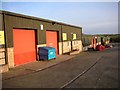
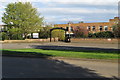
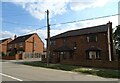
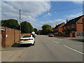
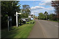
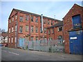
Photos of NN29 7RP

Area Information
Living in NN29 7RP offers a compact, residential experience in a small cluster of homes spread across 6,627 square metres. With a population of 1,641 people, the area is densely populated at 609 residents per square kilometre, yet retains a quiet, community-focused character. The postcode is primarily home to owner-occupied properties, with 86% of households owning their homes. This suggests a stable, long-term resident base, predominantly adults aged 30–64, with a median age of 47. Daily life here is shaped by proximity to Wellingborough Railway Station and nearby retail options, including Co-op Wollaston and Tesco Wellingborough. The area’s low crime risk score of 77 and absence of environmental constraints like flood zones or protected landscapes make it appealing for families and professionals seeking a balanced lifestyle. While small, NN29 7RP is well-connected to essential services, blending practicality with a sense of local identity.
- Area Type
- Postcode
- Area Size
- 6627 m²
- Population
- 1641
- Population Density
- 609 people/km²
NN29 7RP is a small, owner-occupied area where 86% of homes are owned by their residents. The housing stock is predominantly houses, which is unusual for a postcode of this size but suggests a mix of semi-detached and detached properties. This makes the area more suited to families or individuals seeking private, spacious living rather than high-density housing. The limited size of the area means the property market is niche, with few options available. Buyers should consider the proximity to Wellingborough’s amenities, including retail and transport links, which may influence property values. The high home ownership rate also implies a stable market with low turnover, which can be advantageous for long-term investors. However, the small size of the area means competition for properties could be keen, especially for those prioritising location over scale.
House Prices in NN29 7RP
Showing 9 properties
| Address | Type | Beds | Baths | Last Sale Price | Last Sale Date | |
|---|---|---|---|---|---|---|
| 76 Irchester Road, Wollaston, NN29 7RP | Detached | 5 | - | £605,000 | Jun 2021 | |
| 78 Irchester Road, Wollaston, NN29 7RP | Detached | 5 | - | £420,000 | Mar 2012 | |
| 86 Irchester Road, Wollaston, NN29 7RP | Bungalow | - | - | £285,000 | Oct 2010 | |
| 82 Irchester Road, Wollaston, NN29 7RP | Semi-detached | - | - | £360,000 | Nov 2007 | |
| 84 Irchester Road, Wollaston, NN29 7RP | Semi-detached | - | - | £238,000 | Oct 2001 | |
| 80 Irchester Road, Wollaston, NN29 7RP | Detached | - | - | - | - | |
| 98 Irchester Road, Wollaston, NN29 7RP | Detached | - | - | - | - | |
| Garage/car Repairs, Works Adjacent Number 2, Hookhams Path, Wollaston, NN29 7RP | Industrial | - | - | - | - | |
| Annexe, 82 Irchester Road, Wollaston, NN29 7RP | Flat | - | - | - | - |
Energy Efficiency in NN29 7RP
Residents of NN29 7RP have access to nearby retail options, including Co-op Wollaston, Co-op Irchester, and Tesco Wellingborough, which cater to everyday shopping needs. These stores provide convenience for groceries, household items, and other essentials. The Wellingborough Railway Station adds to the area’s accessibility, linking residents to broader networks for commuting or leisure. While the area lacks large parks or leisure facilities, the proximity to Wellingborough suggests nearby recreational opportunities. The retail and transport infrastructure support a practical lifestyle, with minimal need to travel far for basic amenities. The compact nature of the postcode means daily life revolves around local services, fostering a self-contained, community-oriented environment.
Amenities
Schools
Residents of NN29 7RP have access to Wollaston School, which operates as both a primary school and an academy with a good Ofsted rating. This dual role provides families with a seamless educational pathway from early years through to secondary education. The academy’s good rating indicates a school that meets national standards in teaching, pupil outcomes, and leadership. For primary education, the same institution offers a local option, reducing the need for long commutes. The presence of a single school with multiple functions is practical for families, though it may limit choice compared to areas with multiple schools. The quality of education here is a key selling point, particularly for those prioritising academic outcomes and community-based learning environments.
| Rank | School | Type | Entry gender | Ages |
|---|
Explore more schools in this area
Go to Schools tabDemographics
The community in NN29 7RP is predominantly composed of adults aged 30–64, with a median age of 47. This suggests a mature, established population, likely with strong ties to the area. Home ownership is high at 86%, indicating a stable housing market with few rental properties. The accommodation type is primarily houses, reflecting a more traditional residential profile. The predominant ethnic group is White, though specific data on diversity is not provided. The population density of 609 people per square kilometre means the area is neither sprawling nor overly congested. For quality of life, the high home ownership rate and age profile suggest a community focused on long-term stability, with fewer transient residents. The absence of detailed deprivation data means further analysis of socioeconomic factors is not possible, but the figures imply a reasonably well-off, settled population.
Household Size
Accommodation Type
Tenure
Ethnic Group
Religion
Household Composition
Age
Household Deprivation
NS-SEC
Explore more demographic insights in this area
Go to Demographics tabPlanning
Planning Constraints
- Flood RiskPremium
- Ramsar Wetland SitesPremium
- Area of Outstanding Natural BeautyPremium
- Protected Nature ReservePremium
- Protected WoodlandPremium