Area Overview for NN29 7EB
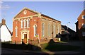
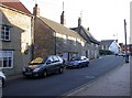
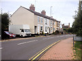
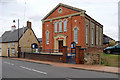
Photos of NN29 7EB
Area Information
NN29 7EB is a compact residential cluster in England, covering 7,279 square metres and home to 1,787 residents. With a population density of 1,016 people per square kilometre, it is a tightly knit area where daily life is shaped by proximity to essential services and a low-key, community-oriented rhythm. The area’s small size means residents are likely to know their neighbours, and the presence of a single railway station at Wellingborough offers access to broader networks without the need for a car. The demographic profile suggests a mature population, with a median age of 47 and a strong presence of adults aged 30–64. This mix of older and middle-aged residents contributes to a stable, low-maintenance environment, where the primary housing stock consists of owner-occupied homes. The area’s compact nature ensures that amenities are within practical reach, making it ideal for those seeking a quiet, self-contained lifestyle without sacrificing convenience.
- Area Type
- Postcode
- Area Size
- 7279 m²
- Population
- 1787
- Population Density
- 1016 people/km²
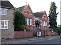
The property market in NN29 7EB is defined by a high rate of home ownership—82% of residents live in owner-occupied homes. This suggests a strong preference for long-term residency over rental properties, which is typical in smaller, established communities. The area’s housing stock consists entirely of houses, with no flats or apartments present. This makes it an attractive option for buyers seeking single-family homes, though the small size of the area means the housing stock is limited. Prospective buyers should consider the immediate surroundings for additional options, as the postcode itself covers a residential cluster rather than a broader estate. The high home ownership rate also indicates a stable market with little turnover, which can be advantageous for those looking for a reliable investment. However, the limited availability of properties may require buyers to look beyond the postcode for more choices.
House Prices in NN29 7EB
Showing 16 properties
| Address | Type | Beds | Baths | Last Sale Price | Last Sale Date | |
|---|---|---|---|---|---|---|
| 7 Denton Close, Irchester, NN29 7EB | Semi-detached | 3 | 1 | £240,000 | Apr 2024 | |
| 9 Denton Close, Irchester, NN29 7EB | Semi-detached | 3 | 1 | £290,000 | Oct 2023 | |
| 10 Denton Close, Irchester, NN29 7EB | Retail | 3 | 1 | £290,000 | Jun 2022 | |
| 15 Denton Close, Irchester, NN29 7EB | Bungalow | 3 | 1 | £156,000 | Nov 2016 | |
| 8 Denton Close, Irchester, NN29 7EB | Semi-detached | - | - | £179,500 | Jul 2008 | |
| 6 Denton Close, Irchester, NN29 7EB | Terraced | - | - | £162,500 | Feb 2008 | |
| 13 Denton Close, Irchester, NN29 7EB | Terraced | - | - | £166,000 | May 2007 | |
| 12 Denton Close, Irchester, NN29 7EB | Semi-detached | - | - | £95,000 | Feb 2004 | |
| 1 Denton Close, Irchester, NN29 7EB | Bungalow | 2 | 1 | £57,000 | Jun 1999 | |
| 2 Denton Close, Irchester, NN29 7EB | Semi-detached | - | - | £40,000 | Nov 1996 |
Energy Efficiency in NN29 7EB
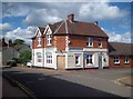
Living in NN29 7EB offers access to a range of local amenities within practical reach. The area is served by five retail outlets, including Co-op Irchester, Spar, and Budgens Rushden, providing essential shopping options for daily needs. These stores cater to a variety of preferences, from convenience shopping to larger grocery purchases. The nearest railway station, Wellingborough, connects residents to broader regional networks, facilitating travel for work, leisure, or social purposes. While the area’s small size means it lacks large-scale leisure facilities, the presence of nearby retail and transport hubs ensures a functional lifestyle. The compact nature of NN29 7EB also fosters a sense of community, with residents able to access services without lengthy commutes. This balance of convenience and local character makes it appealing for those prioritising practicality over sprawling urban amenities.
Amenities
Schools
| Rank | School | Type | Entry gender | Ages |
|---|
Explore more schools in this area
Go to Schools tabDemographics
The community in NN29 7EB is predominantly composed of adults aged 30–64, reflecting a median age of 47. This age group dominates, indicating a population that is largely established in careers and family life. Home ownership is high, with 82% of residents living in properties they own, a figure that underscores the area’s appeal to long-term residents. The accommodation type is exclusively houses, suggesting a preference for single-family homes over flats or apartments. The predominant ethnic group is White, which aligns with broader trends in the region. The data does not include specific information on deprivation levels, but the high home ownership rate and low population density imply a relatively stable socioeconomic environment. This stability supports a quality of life characterised by lower pressure on housing and services, though the area’s small size means it lacks the diversity of larger urban centres.
Household Size
Accommodation Type
Tenure
Ethnic Group
Religion
Household Composition
Age
Household Deprivation
NS-SEC
Explore more demographic insights in this area
Go to Demographics tabPlanning
Planning Constraints
- Flood RiskPremium
- Ramsar Wetland SitesPremium
- Area of Outstanding Natural BeautyPremium
- Protected Nature ReservePremium
- Protected WoodlandPremium