Area Overview for NN29 7BX
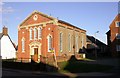
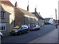
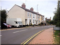
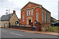
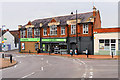
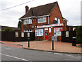
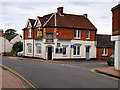
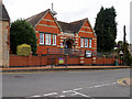
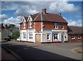
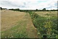
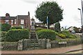
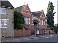
Photos of NN29 7BX
Area Information
Living in NN29 7BX offers a quiet, tightly knit residential experience in a small cluster of homes. With a population of 1,468 spread across 5,415 square metres, the area maintains a low density of 579 people per square kilometre, ensuring a sense of space and privacy. This postcode is characterised by its predominantly owner-occupied housing stock, with 86% of homes owned by residents rather than rented. The community is largely composed of adults aged 30–64, reflecting a mature demographic with established roots. Daily life here is shaped by proximity to Wellingborough Railway Station, which connects residents to broader regional networks, and nearby retail hubs like Co-op Irchester and Tesco Wellingborough. The area’s low flood risk and absence of environmental constraints such as AONB or protected woodlands make it a practical choice for families seeking stability. With a safety score of 92, it ranks among the lowest crime risk areas, offering reassurance for those prioritising security. NN29 7BX is ideal for buyers seeking a peaceful, well-connected small community with minimal planning complexities.
- Area Type
- Postcode
- Area Size
- 5415 m²
- Population
- 1468
- Population Density
- 579 people/km²
The property market in NN29 7BX is dominated by owner-occupied homes, with 86% of properties owned by residents. This high ownership rate suggests a community of long-term residents rather than a rental market, which can stabilise property values and reduce turnover. The accommodation type is exclusively houses, indicating a focus on family homes and single-family living. Given the area’s small size and low population density, the housing stock is likely to be limited in volume, making it a niche market for buyers seeking a quiet, established residential environment. The absence of planning constraints such as AONB or protected woodlands may also make it easier to acquire or develop property compared to more restricted areas. For buyers, this means a market with fewer speculative pressures and a strong emphasis on permanence, though the limited size of the area may restrict options for those seeking larger or more varied housing choices.
House Prices in NN29 7BX
Showing 12 properties
| Address | Type | Beds | Baths | Last Sale Price | Last Sale Date | |
|---|---|---|---|---|---|---|
| 2 Redwood Close, Irchester, NN29 7BX | house | - | - | £270,100 | Feb 2021 | |
| 4 Redwood Close, Irchester, NN29 7BX | Detached | 4 | 3 | £206,000 | Nov 2014 | |
| 11 Redwood Close, Irchester, NN29 7BX | house | - | - | £162,000 | Nov 2009 | |
| 5 Redwood Close, Irchester, NN29 7BX | Detached | - | - | £194,995 | May 2007 | |
| 3 Redwood Close, Irchester, NN29 7BX | Semi-detached | - | - | £105,000 | Jun 2002 | |
| 10 Redwood Close, Irchester, NN29 7BX | Semi-detached | - | - | £98,000 | Apr 2002 | |
| 9 Redwood Close, Irchester, NN29 7BX | Bungalow | 2 | 1 | £74,995 | Nov 2000 | |
| 8 Redwood Close, Irchester, NN29 7BX | Detached | - | - | £67,000 | Jul 1997 | |
| 7 Redwood Close, Irchester, NN29 7BX | Semi-detached | - | - | - | - | |
| 7A Redwood Close, Irchester, NN29 7BX | Detached | - | - | - | - |
Energy Efficiency in NN29 7BX
Residents of NN29 7BX have access to a range of essential amenities within practical reach. The retail landscape includes Co-op Irchester, Spar, and Tesco Wellingborough, providing everyday shopping needs from groceries to household items. These stores support a convenient, self-contained lifestyle, reducing the need for long journeys. The Wellingborough Railway Station adds further connectivity, enabling easy travel to nearby towns and cities. While the area lacks large-scale leisure or entertainment venues, the proximity to retail and transport hubs ensures a functional daily life. The low population density and absence of major planning constraints contribute to a relaxed, community-focused atmosphere. For those valuing convenience and practicality over sprawling leisure options, NN29 7BX offers a balanced mix of essential services and easy access to broader networks.
Amenities
Schools
| Rank | School | Type | Entry gender | Ages |
|---|
Explore more schools in this area
Go to Schools tabDemographics
The community in NN29 7BX is predominantly composed of adults aged 30–64, with a median age of 47, reflecting a mature, established population. Home ownership is exceptionally high at 86%, indicating a stable, long-term resident base. The area is characterised by houses rather than flats, suggesting a focus on family-friendly living. The predominant ethnic group is White, with no specific data provided on other demographics. The population density of 579 people per square kilometre is relatively low, contributing to a less crowded environment. This demographic profile suggests a community prioritising stability and long-term residency over transient populations. The absence of detailed diversity metrics means the area’s social composition remains largely homogenous, which may appeal to those seeking familiarity and continuity in their local environment.
Household Size
Accommodation Type
Tenure
Ethnic Group
Religion
Household Composition
Age
Household Deprivation
NS-SEC
Explore more demographic insights in this area
Go to Demographics tabPlanning
Planning Constraints
- Flood RiskPremium
- Ramsar Wetland SitesPremium
- Area of Outstanding Natural BeautyPremium
- Protected Nature ReservePremium
- Protected WoodlandPremium