Area Overview for NN29 7BA
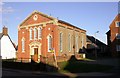
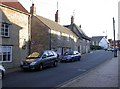
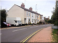
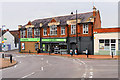
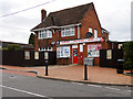
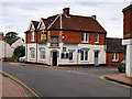
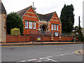
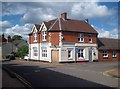
Photos of NN29 7BA

Area Information
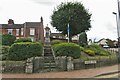
Living in NN29 7BA means being part of a small, tightly knit residential cluster in England. The area covers 16.8 hectares and is home to 1,658 people, with a population density of 237 people per square kilometre. This compact postcode area is characterised by a mature demographic, with a median age of 47 and a strong presence of adults aged 30–64. The community is predominantly home-owning, with 60% of properties owned outright, and most dwellings are houses rather than flats. Daily life here is shaped by proximity to local amenities and schools, though the area’s size means it is best suited for those prioritising convenience over expansive open spaces. The low flood risk and absence of environmental constraints make it a stable place to live, though residents should be mindful of the medium crime risk. For those seeking a quiet, established neighbourhood with practical access to essentials, NN29 7BA offers a straightforward, no-frills living experience.
- Area Type
- Postcode
- Area Size
- 16.8 hectares
- Population
- 1658
- Population Density
- 237 people/km²
The property market in NN29 7BA is characterised by a high rate of home ownership—60% of properties are owner-occupied—suggesting a community of long-term residents rather than a rental-heavy area. The accommodation type is predominantly houses, which is typical of smaller rural or semi-rural postcode areas. This means the housing stock is likely to be older, with limited new builds, and buyers should expect a limited selection of properties. The small area size—just 16.8 hectares—means the market is confined to a narrow geographic range, with little scope for expansion. For buyers, this translates to a focus on existing homes rather than speculative development. The lack of flats or apartments also means the area is less suited to younger or more transient buyers. Those considering NN29 7BA should prioritise proximity to local amenities and schools, as property values are likely tied to these factors.
House Prices in NN29 7BA
Showing 60 properties
| Address | Type | Beds | Baths | Last Sale Price | Last Sale Date | |
|---|---|---|---|---|---|---|
| 87 Baker Crescent, Irchester, NN29 7BA | Detached | 3 | 1 | £222,000 | Aug 2025 | |
| 31 Baker Crescent, Irchester, NN29 7BA | house | - | - | £240,000 | Apr 2025 | |
| 33 Baker Crescent, Irchester, NN29 7BA | Semi-detached | 3 | 1 | £240,000 | Apr 2025 | |
| 13 Baker Crescent, Irchester, NN29 7BA | Semi-detached | 3 | 1 | £190,000 | Jun 2024 | |
| 41 Baker Crescent, Irchester, NN29 7BA | Semi-detached | 3 | 1 | £255,000 | May 2023 | |
| 83 Baker Crescent, Irchester, NN29 7BA | Semi-detached | 3 | 1 | £205,000 | May 2023 | |
| 95 Baker Crescent, Irchester, NN29 7BA | house | - | - | £235,500 | Mar 2023 | |
| 111 Baker Crescent, Irchester, NN29 7BA | house | - | - | £215,000 | Oct 2021 | |
| 43 Baker Crescent, Irchester, NN29 7BA | house | - | - | £172,500 | Oct 2021 | |
| 103 Baker Crescent, Irchester, NN29 7BA | Semi-detached | 3 | 1 | £220,000 | Feb 2020 |
Energy Efficiency in NN29 7BA
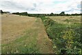
The lifestyle in NN29 7BA is defined by proximity to practical amenities. Within reach are five retail outlets, including Co-op Irchester, Spar, and Tesco Wellingborough, offering essential shopping options. The Wellingborough Railway Station provides access to broader regional networks, though the area itself has no major leisure or entertainment venues. Parks or recreational spaces are not explicitly mentioned, but the absence of environmental constraints suggests open space may be limited. The character of the area is modest, with amenities focused on daily necessities rather than luxury or leisure. For residents, this means a straightforward, no-frills lifestyle with easy access to essentials. The small size of the area means amenities are concentrated, reducing the need for long commutes but limiting variety.
Amenities
Schools
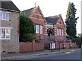
Residents of NN29 7BA have access to several primary schools, including Irchester Junior School, Irchester Infant School, and Irchester Community Primary School, which appears listed twice in the data. A further school, Knuston Hall, is categorised as ‘other’ but is likely to serve the area’s educational needs. The presence of multiple primary schools suggests a focus on local education, though no Ofsted ratings are provided to assess quality. The concentration of primary schools makes the area appealing to families with young children, as it reduces the need for long commutes to secondary education. However, the absence of secondary schools or further education institutions means parents may need to look beyond NN29 7BA for comprehensive schooling. The mix of schools indicates a community prioritising early education, though buyers should investigate further to confirm the standards and availability of places.
| Rank | School | Type | Entry gender | Ages |
|---|
Explore more schools in this area
Go to Schools tabDemographics
The community in NN29 7BA is predominantly composed of adults aged 30–64, with a median age of 47. This suggests a mature, settled population, likely with long-term ties to the area. Home ownership is high, at 60%, indicating a stable housing market with few renters. The accommodation type is primarily houses, reflecting a preference for single-family homes over flats or apartments. The predominant ethnic group is White, though no specific data on diversity or deprivation is provided. The age profile and home ownership figures suggest a community focused on long-term residency rather than transient living. With no data on income levels or deprivation, it is difficult to assess the area’s economic challenges, but the high home ownership rate implies a degree of financial stability among residents.
Household Size
Accommodation Type
Tenure
Ethnic Group
Religion
Household Composition
Age
Household Deprivation
NS-SEC
Explore more demographic insights in this area
Go to Demographics tabPlanning
Planning Constraints
- Flood RiskPremium
- Ramsar Wetland SitesPremium
- Area of Outstanding Natural BeautyPremium
- Protected Nature ReservePremium
- Protected WoodlandPremium