Area Overview for NN2 8XE
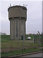
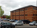
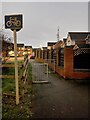
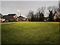
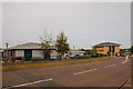
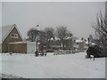
Photos of NN2 8XE


Area Information
NN2 8XE is a compact residential area in England, spanning 3.7 hectares and home to 1634 residents. Its small size fosters a close-knit community, with a population density of 183 people per square kilometre. This postcode covers a cluster of homes, primarily owner-occupied, reflecting a stable demographic. Daily life here is shaped by proximity to local amenities, schools, and transport links. The area’s modest scale means residents often know their neighbours, creating a sense of familiarity. With no major environmental constraints or flood risks, it offers a straightforward living experience. The presence of two primary schools and a railway station within reach adds practicality. While not a bustling urban hub, NN2 8XE balances simplicity with accessibility, appealing to those seeking a quiet, functional place to live without sacrificing connectivity to nearby towns and services.
- Area Type
- Postcode
- Area Size
- 3.7 hectares
- Population
- 1634
- Population Density
- 183 people/km²
NN2 8XE is a predominantly owner-occupied area, with 86% of homes owned by residents rather than rented. The housing stock is largely composed of houses, which is unusual for smaller postcode areas and may indicate a focus on family homes or detached properties. This mix suggests a market where buyers can expect stable property values and a low turnover of listings. The small size of the area means the housing stock is limited, so buyers should consider the proximity to surrounding regions for more options. The high home ownership rate also implies a community with long-term residents, which can contribute to a sense of security and continuity. For those seeking a home here, the availability of houses may appeal to buyers prioritising space and privacy over high-density living.
House Prices in NN2 8XE
Showing 57 properties
| Address | Type | Beds | Baths | Last Sale Price | Last Sale Date | |
|---|---|---|---|---|---|---|
| 44 Dixon Road, Boughton, NN2 8XE | Detached | 3 | 2 | £375,000 | Aug 2025 | |
| 38 Dixon Road, Boughton, NN2 8XE | Detached | 5 | 3 | £450,000 | May 2025 | |
| 1 Dixon Road, Boughton, NN2 8XE | Semi-detached | 2 | 1 | £205,000 | Feb 2025 | |
| 41 Dixon Road, Boughton, NN2 8XE | Detached | 5 | 3 | £410,000 | Jan 2025 | |
| 47 Dixon Road, Boughton, NN2 8XE | Detached | 5 | 2 | £415,000 | Jan 2023 | |
| 20 Dixon Road, Boughton, NN2 8XE | house | 3 | 2 | £304,000 | Oct 2022 | |
| 22 Dixon Road, Boughton, NN2 8XE | Detached | 3 | 1 | £260,000 | Aug 2022 | |
| 24 Dixon Road, Boughton, NN2 8XE | Semi-detached | 3 | 2 | £285,000 | Aug 2021 | |
| 40 Dixon Road, Boughton, NN2 8XE | Detached | 4 | 2 | £370,000 | Mar 2021 | |
| 29 Dixon Road, Boughton, NN2 8XE | Detached | 4 | 2 | £362,000 | Feb 2021 |
Energy Efficiency in NN2 8XE
Daily life in NN2 8XE is supported by nearby amenities that cater to practical needs. Retail options include M&S Harborough BP, Morrisons Daily, and Tesco Northampton, offering everything from groceries to clothing. The two bus interchanges provide access to broader transport networks, while Northampton Railway Station connects residents to urban centres. Though the area is small, these amenities ensure residents can shop, travel, and access services without long commutes. The presence of multiple schools and transport hubs also contributes to a balanced lifestyle, where convenience and accessibility are prioritised. While the area lacks large leisure facilities, its proximity to Northampton suggests opportunities for dining, entertainment, and cultural activities beyond the immediate postcode.
Amenities
Schools
Residents of NN2 8XE have access to a range of educational options. Boughton Primary School and Pitsford Primary School, both rated 'good' by Ofsted, serve the area’s younger population. These state-funded schools provide a solid foundation for primary education. For those seeking independent education, Pitsford School offers an alternative. The mix of school types ensures families can choose between state and private education, depending on their needs. The presence of two primary schools with strong ratings suggests a commitment to local education quality. For parents, this variety reduces the need to commute long distances for schooling. The proximity of these institutions also supports a family-friendly environment, where children can attend school without significant travel.
| Rank | School | Type | Entry gender | Ages |
|---|
Explore more schools in this area
Go to Schools tabDemographics
The population of NN2 8XE is predominantly adults aged 30–64, with a median age of 47. This suggests a mature, established community, likely with long-term residents. Home ownership is high, at 86%, indicating a strong preference for property stability. The area is largely composed of houses, which aligns with the age profile of homeowners seeking family-friendly or long-term housing. The predominant ethnic group is White, though no specific data on diversity or deprivation is provided. The low population density and age range suggest a community focused on comfort and routine rather than rapid growth. For buyers, this profile implies a neighbourhood with minimal turnover and a steady demand for well-maintained homes. The absence of significant demographic shifts or challenges means the area remains consistent in character.
Household Size
Accommodation Type
Tenure
Ethnic Group
Religion
Household Composition
Age
Household Deprivation
NS-SEC
Explore more demographic insights in this area
Go to Demographics tabPlanning
Planning Constraints
- Flood RiskPremium
- Ramsar Wetland SitesPremium
- Area of Outstanding Natural BeautyPremium
- Protected Nature ReservePremium
- Protected WoodlandPremium