Area Overview for NN2 8UB
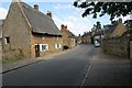
Photos of NN2 8UB


Area Information
Living in NN2 8UB means inhabiting a compact, residential postcode area in England, where 1,369 people reside across 2,190 square metres. The density of 625,245 people per square kilometre reflects a tightly knit community, ideal for those seeking proximity to local amenities without urban sprawl. This area is characterised by a mature demographic, with a median age of 47 and most residents aged between 30 and 64. The high home ownership rate of 78% suggests a stable, long-term resident base, with houses forming the primary accommodation type. Daily life here is shaped by nearby retail options, including Morrisons Daily and Tesco Northampton, and transport links such as Northampton Railway Station. The area’s safety profile is strong, with a crime risk score of 79 (low) and no flood risk. For families, the presence of two primary schools within reach adds to its appeal, though the small size of the area means residents must balance convenience with limited expansion. NN2 8UB is a place where community ties are evident, and practical living meets a reasonable quality of life.
- Area Type
- Postcode
- Area Size
- 2190 m²
- Population
- 1369
- Population Density
- 5595 people/km²
The property market in NN2 8UB is dominated by owner-occupied homes, with 78% of residents owning their properties. This high home ownership rate indicates a stable market with limited rental activity, suggesting that the area is more suited to long-term buyers than investors seeking short-term returns. The primary accommodation type is houses, which is uncommon in smaller postcode areas but reflects a preference for family-friendly living. Given the area’s compact size, the housing stock is likely limited, meaning buyers must consider nearby regions for more options. The absence of flats or apartments suggests a focus on single-family homes, which may appeal to those prioritising space and privacy. However, the small area size means property availability is constrained, and buyers should assess the broader local market for comparable listings. The market’s stability and safety profile make it attractive for those seeking secure, established housing.
House Prices in NN2 8UB
Showing 2 properties
| Address | Type | Beds | Baths | Last Sale Price | Last Sale Date | |
|---|---|---|---|---|---|---|
| 310 Obelisk Rise, Northampton, NN2 8UB | Detached | - | - | - | - | |
| 308 Obelisk Rise, Northampton, NN2 8UB | Detached | - | - | - | - |
Energy Efficiency in NN2 8UB
The lifestyle in NN2 8UB is shaped by its proximity to retail and transport hubs. Nearby shops include Morrisons Daily, M&S Harborough BP, and Tesco Northampton, offering a range of grocery and retail options within easy reach. These stores cater to daily needs, reducing the necessity for long trips to larger centres. The area’s transport links, including Northampton Railway Station and two bus interchanges, provide access to broader networks, though leisure and recreational facilities are not detailed in the data. The compact nature of the area means residents must balance convenience with limited local amenities, relying on nearby towns for additional services. The presence of retail and transport options supports a practical lifestyle, though those seeking extensive leisure or cultural facilities may need to look beyond the immediate vicinity.
Amenities
Schools
Residents of NN2 8UB have access to two primary schools within practical reach: Sunnyside Primary School and Sunnyside Primary Academy. Both institutions cater to younger children, with the latter holding an Ofsted rating of ‘good’. The presence of two primary schools in close proximity is a significant advantage for families, reducing the need for long commutes and providing multiple educational options. The ‘good’ rating at Sunnyside Primary Academy suggests a standard of teaching and facilities that meets regulatory benchmarks. However, no secondary schools are listed in the data, which may require families to look further afield for comprehensive education. The school mix here is focused on early years, which is typical for smaller residential areas but may necessitate planning for future educational needs as children grow.
| Rank | School | Type | Entry gender | Ages |
|---|
Explore more schools in this area
Go to Schools tabDemographics
The community in NN2 8UB is predominantly composed of adults aged 30 to 64, with a median age of 47. This suggests a population skewed towards middle-aged individuals, likely including families and professionals. Home ownership is high at 78%, indicating a stable housing market and a focus on long-term residency rather than rental properties. The area is primarily composed of houses, which aligns with the demographic profile of established households. The predominant ethnic group is White, though no specific data on diversity or deprivation is provided. The absence of detailed diversity statistics means the area’s social composition remains largely unexplored in this context. The low crime risk score of 79 (low) and no flood risk further support a quality of life that prioritises safety and stability. For buyers, this demographic profile suggests a community that values security, familiarity, and proximity to essential services.
Household Size
Accommodation Type
Tenure
Ethnic Group
Religion
Household Composition
Age
Household Deprivation
NS-SEC
Explore more demographic insights in this area
Go to Demographics tabPlanning
Planning Constraints
- Flood RiskPremium
- Ramsar Wetland SitesPremium
- Area of Outstanding Natural BeautyPremium
- Protected Nature ReservePremium
- Protected WoodlandPremium