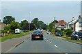
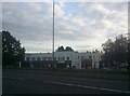
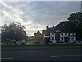
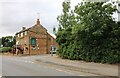
Area Overview for NN2 8GF
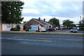
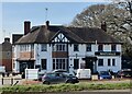
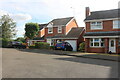
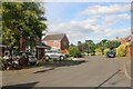
Photos of NN2 8GF

Area Information
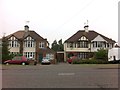
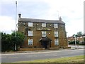
Living in NN2 8GF means being part of a small, tightly knit residential cluster in England. The area covers 8,077 square metres and is home to 1,381 people, giving it a population density of 591 people per square kilometre. This compact postcode area is characterised by a mix of established housing and a community that reflects the broader demographic trends of the region. With a median age of 47, the area is predominantly populated by adults aged 30–64, many of whom are homeowners. The high home ownership rate—86%—suggests a stable, long-term resident base. Daily life here is shaped by proximity to essential services, including retail hubs and transport links, while the low crime risk and absence of environmental constraints make it an appealing option for those seeking a balanced lifestyle. The area’s small size means it is easy to navigate, and its location offers access to nearby amenities without the congestion of larger urban centres.
- Area Type
- Postcode
- Area Size
- 8077 m²
- Population
- 1381
- Population Density
- 591 people/km²
The property market in NN2 8GF is dominated by owner-occupied homes, with 86% of residents living in houses rather than flats or rented accommodation. This suggests a market where long-term residency is the norm, and property values are likely to be stable due to limited turnover. The area’s small size means the housing stock is finite, which could make it a competitive market for buyers. The predominance of houses over other accommodation types indicates a preference for traditional, family-friendly homes, which may appeal to those seeking space and privacy. For buyers, this means fewer rental properties and a focus on purchasing rather than leasing. The compact nature of the area also means that properties are closely spaced, which could be a consideration for those prioritising larger plots or open space. The lack of planning constraints, such as protected areas or environmental restrictions, further supports the idea that the area is accessible for both residential and potential development purposes.
House Prices in NN2 8GF
Showing 23 properties
| Address | Type | Beds | Baths | Last Sale Price | Last Sale Date | |
|---|---|---|---|---|---|---|
| 28 Jacquest Road, Boughton, NN2 8GF | house | - | - | £259,950 | Mar 2022 | |
| 7 Jacquest Road, Boughton, NN2 8GF | Detached | - | - | - | - | |
| 15 Jacquest Road, Boughton, NN2 8GF | Detached | - | - | - | - | |
| 9 Jacquest Road, Boughton, NN2 8GF | Detached | - | - | - | - | |
| 5 Jacquest Road, Boughton, NN2 8GF | Detached | - | - | - | - | |
| 1 Jacquest Road, Boughton, NN2 8GF | Detached | - | - | - | - | |
| 3 Jacquest Road, Boughton, NN2 8GF | Detached | - | - | - | - | |
| 17 Jacquest Road, Boughton, NN2 8GF | Detached | - | - | - | - | |
| 11 Jacquest Road, Boughton, NN2 8GF | Detached | - | - | - | - | |
| 10 Jacquest Road, Boughton, NN2 8GF | Maisonette | - | - | - | - |
Energy Efficiency in NN2 8GF
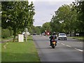
The lifestyle in NN2 8GF is shaped by its proximity to essential amenities. Retail options include Tesco Buckton, Tesco Northampton, and Morrisons Daily, providing a range of grocery and convenience shopping choices. These stores are within practical reach, making daily errands straightforward. The area’s transport links also enhance its lifestyle appeal, with the University and Northampton Bus Interchanges offering access to broader networks, while Northampton Railway Station connects residents to regional destinations. Although the data does not mention parks or leisure facilities, the absence of environmental constraints like protected woodlands or AONB areas suggests that development has prioritised residential and commercial needs. The compact nature of the area means that amenities are clustered closely, reducing the need for long commutes. This balance of retail, transport, and accessibility supports a convenient, community-oriented lifestyle where residents can meet daily needs without significant travel.
Amenities
Schools
The nearest school to NN2 8GF is Buckton Fields Primary School, which holds a good Ofsted rating. This primary school serves the local community, offering education for younger children and providing a foundation for families settling in the area. The absence of secondary schools in the immediate vicinity means that students may need to commute to nearby towns for further education, but the quality of the primary school suggests a strong start to academic life. The presence of a well-rated primary school is a key consideration for families, as it reduces the need to travel long distances for early education. While the data does not include information on other schools, the availability of a good primary institution indicates that the area is family-friendly and prioritises educational needs. Parents may find it beneficial to research secondary school options in nearby towns to plan for their children’s long-term schooling.
| Rank | School | Type | Entry gender | Ages |
|---|
Explore more schools in this area
Go to Schools tabDemographics
The community in NN2 8GF is defined by its age profile and home ownership statistics. With a median age of 47, the area is primarily inhabited by adults aged 30–64, reflecting a mature demographic. The high home ownership rate—86%—indicates that most residents are long-term occupants, contributing to a sense of stability. The predominant accommodation type is houses, which aligns with the area’s residential character. The ethnic composition is largely White, though specific data on diversity is not provided. The population density of 591 people per square kilometre suggests a moderately sized community, neither overly crowded nor isolated. This demographic profile implies a neighbourhood where families and professionals coexist, with a focus on established living rather than transient populations. The absence of detailed deprivation data means that quality of life is inferred from the low crime risk and access to essential services, which are key factors for residents.
Household Size
Accommodation Type
Tenure
Ethnic Group
Religion
Household Composition
Age
Household Deprivation
NS-SEC
Explore more demographic insights in this area
Go to Demographics tabPlanning
Planning Constraints
- Flood RiskPremium
- Ramsar Wetland SitesPremium
- Area of Outstanding Natural BeautyPremium
- Protected Nature ReservePremium
- Protected WoodlandPremium