Area Overview for NN2 8FW
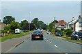
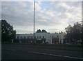
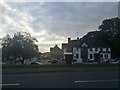
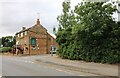
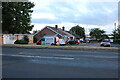
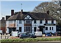
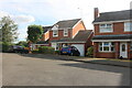
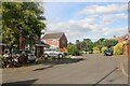
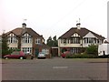
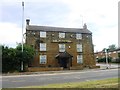
Photos of NN2 8FW


Area Information
Living in NN2 8FW means being part of a tightly knit residential cluster in England, where 2,078 people reside across just 1.6 hectares. The area’s population density of 132,547 people per square kilometre reflects a compact, community-focused environment. Daily life here is shaped by proximity to essential services, with Northampton Railway Station and nearby bus interchanges providing reliable transport links. The area’s broadband score of 99 ensures seamless digital connectivity, supporting both remote work and household needs. While the population skews older, with a median age of 47, the presence of adults aged 30–64 suggests a stable, established community. NN2 8FW’s small size means residents are close to amenities like Tesco Northampton and M&S Harborough BP, blending convenience with the quiet character of a low-density postcode. This is a place where practicality meets accessibility, ideal for those seeking a balance between urban proximity and residential tranquillity.
- Area Type
- Postcode
- Area Size
- 1.6 hectares
- Population
- 2078
- Population Density
- 5067 people/km²
The property market in NN2 8FW is characterised by a 56% home ownership rate, with houses being the primary accommodation type. This indicates a community where long-term residency is common, and the housing stock is likely to be established rather than newly developed. Given the area’s small size of 1.6 hectares, the number of properties is limited, which may create a competitive market for buyers. The focus on owner-occupied homes suggests a stable demand, though the absence of rental data means the extent of the rental market is unclear. Buyers should consider the proximity to Northampton’s amenities, including retail and transport hubs, as these factors may influence property value. The compact nature of the area also means that properties are likely to be close to essential services, offering convenience for those prioritising accessibility over larger living spaces.
House Prices in NN2 8FW
Showing 61 properties
| Address | Type | Beds | Baths | Last Sale Price | Last Sale Date | |
|---|---|---|---|---|---|---|
| 7 Hodder Street, Northampton, NN2 8FW | Detached | 3 | 2 | £340,000 | May 2025 | |
| 42 Hodder Street, Northampton, NN2 8FW | house | - | - | £290,000 | Feb 2025 | |
| 38 Hodder Street, Northampton, NN2 8FW | Terraced | 3 | 1 | £235,000 | Nov 2024 | |
| 21 Hodder Street, Northampton, NN2 8FW | Semi-detached | 3 | 1 | £252,000 | May 2024 | |
| 15 Hodder Street, Northampton, NN2 8FW | Semi-detached | 3 | 1 | £250,000 | Mar 2024 | |
| 49 Hodder Street, Northampton, NN2 8FW | Semi-detached | 4 | 2 | £325,000 | Nov 2023 | |
| 37 Hodder Street, Northampton, NN2 8FW | Semi-detached | 3 | 2 | £255,000 | Jul 2023 | |
| 25 Hodder Street, Northampton, NN2 8FW | Retail | 2 | 1 | £227,000 | Jun 2022 | |
| 31 Hodder Street, Northampton, NN2 8FW | house | 4 | 2 | £337,950 | Dec 2018 | |
| 35 Hodder Street, Northampton, NN2 8FW | house | - | - | £244,950 | Dec 2018 |
Energy Efficiency in NN2 8FW
Residents of NN2 8FW have access to a range of nearby amenities within practical reach. Retail options include M&S Harborough BP, Tesco Northampton, and Heron Kingsthorpe, offering shopping and dining convenience. The area’s transport links, such as the University Bus Interchange and Northampton Bus Interchange, provide easy access to public transport, connecting to Northampton Railway Station for rail travel. While specific parks or leisure facilities are not detailed in the data, the proximity to urban centres suggests a variety of recreational opportunities. The compact nature of the area means daily life is efficient, with essential services and transport points within walking or short driving distance. This blend of retail, transport, and urban connectivity supports a lifestyle that prioritises practicality and ease of access.
Amenities
Schools
| Rank | School | Type | Entry gender | Ages |
|---|
Explore more schools in this area
Go to Schools tabDemographics
The community in NN2 8FW is predominantly composed of adults aged 30–64, with a median age of 47. Home ownership sits at 56%, indicating a mix of long-term residents and those seeking stable housing. The area’s accommodation type is primarily houses, reflecting a traditional, family-oriented demographic. The predominant ethnic group is White, and while specific diversity metrics are not provided, the population density suggests a tightly woven social fabric. With 132,547 people per square kilometre, interactions within the community are likely frequent and localized. The absence of detailed deprivation data means quality of life is inferred from infrastructure: reliable transport, high broadband scores, and proximity to retail hubs. This suggests a pragmatic, service-oriented lifestyle where daily needs are met within a short radius.
Household Size
Accommodation Type
Tenure
Ethnic Group
Religion
Household Composition
Age
Household Deprivation
NS-SEC
Explore more demographic insights in this area
Go to Demographics tabPlanning
Planning Constraints
- Flood RiskPremium
- Ramsar Wetland SitesPremium
- Area of Outstanding Natural BeautyPremium
- Protected Nature ReservePremium
- Protected WoodlandPremium