Area Overview for NN2 8BU
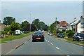
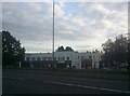
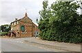
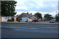
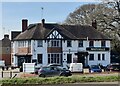
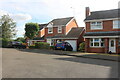
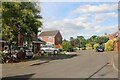
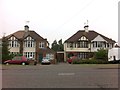
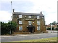
Photos of NN2 8BU


Area Information
NN2 8BU is a compact residential postcode area in England, covering just 9,965 square metres and home to 1,539 residents. Its high population density — 154,436 people per square kilometre — reflects a tightly knit community, though the area remains small enough to feel intimate. Located near Northampton Railway Station and major retail hubs like Tesco Northampton, it offers practical access to urban amenities while retaining a local character. The area’s proximity to bus interchanges and the University Bus Interchange ensures connectivity, though its size means it is best suited for those prioritising convenience over expansive living space. With a median age of 47 and a population skewed towards adults aged 30–64, the community is stable and established. Daily life here balances proximity to services with the quietude of a residential cluster, making it appealing for those seeking a manageable, well-connected environment without the sprawl of larger towns.
- Area Type
- Postcode
- Area Size
- 9965 m²
- Population
- 1539
- Population Density
- 3887 people/km²
NN2 8BU is primarily an owner-occupied area, with 85% of homes owned by residents rather than rented. The housing stock consists mainly of houses, which is unusual for smaller postcode areas that often include more flats or terraced properties. This suggests a focus on traditional, standalone homes, possibly attracting buyers seeking space and privacy within a compact footprint. The area’s small size means the property market is limited, with few new developments likely to emerge. For buyers, this could mean competition for existing homes, but also a stable market with little fluctuation. The proximity to Northampton’s amenities — including retail and transport hubs — may enhance the area’s appeal, though its size means it is best suited for those prioritising convenience over expansive living space.
House Prices in NN2 8BU
Showing 26 properties
| Address | Type | Beds | Baths | Last Sale Price | Last Sale Date | |
|---|---|---|---|---|---|---|
| 83 Acre Lane, Northampton, NN2 8BU | Detached | 3 | 1 | £340,000 | May 2024 | |
| 90 Acre Lane, Northampton, NN2 8BU | Detached | 3 | 1 | £260,550 | May 2024 | |
| 101 Acre Lane, Northampton, NN2 8BU | Semi-detached | 4 | 2 | £319,000 | Sep 2023 | |
| Kingscroft, 81 Acre Lane, Northampton, NN2 8BU | Detached | 3 | 1 | £279,000 | Aug 2021 | |
| 88 Acre Lane, Northampton, NN2 8BU | Detached | 4 | 1 | £324,000 | May 2020 | |
| 84 Acre Lane, Northampton, NN2 8BU | Detached | 3 | - | £227,000 | Dec 2016 | |
| 97 Acre Lane, Northampton, NN2 8BU | Semi-detached | 3 | - | £168,000 | Mar 2016 | |
| 94 Acre Lane, Northampton, NN2 8BU | Detached | 3 | 1 | £215,000 | Nov 2015 | |
| 79 Acre Lane, Northampton, NN2 8BU | house | - | - | £175,000 | Mar 2013 | |
| 98 Acre Lane, Northampton, NN2 8BU | house | - | - | £158,000 | Dec 2012 |
Energy Efficiency in NN2 8BU
Living in NN2 8BU offers access to essential retail and transport hubs within practical reach. The area is served by major supermarkets such as Tesco Northampton, Morrisons Daily, and Tesco Buckton, ensuring daily shopping needs are met without long journeys. For transport, the University Bus Interchange and Northampton Bus Interchange provide regular services, while Northampton Railway Station connects residents to broader regional networks. Though the area itself is small, its proximity to Northampton’s central amenities means residents can enjoy a balance of local convenience and urban accessibility. The lack of detailed information on parks or leisure facilities suggests a focus on practicality over recreational spaces, but the availability of shops and transport links ensures a functional, efficient lifestyle.
Amenities
Schools
| Rank | School | Type | Entry gender | Ages |
|---|
Explore more schools in this area
Go to Schools tabDemographics
The population of NN2 8BU is predominantly adults aged 30–64, with a median age of 47. This suggests a mature, settled community with strong family ties and a focus on long-term stability. Home ownership is high, at 85%, indicating a strong preference for private property over rentals. The area is composed largely of houses, reflecting a traditional housing stock rather than apartments or flats. The predominant ethnic group is White, though no specific data on diversity or deprivation is provided. The high home ownership rate and age profile suggest a community prioritising security and continuity, with residents likely to have established careers and family networks. The absence of detailed diversity metrics means the area’s social fabric remains less defined in terms of cultural or generational variety.
Household Size
Accommodation Type
Tenure
Ethnic Group
Religion
Household Composition
Age
Household Deprivation
NS-SEC
Explore more demographic insights in this area
Go to Demographics tabPlanning
Planning Constraints
- Flood RiskPremium
- Ramsar Wetland SitesPremium
- Area of Outstanding Natural BeautyPremium
- Protected Nature ReservePremium
- Protected WoodlandPremium