Area Overview for NN2 8AZ
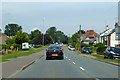
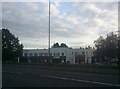
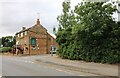
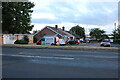
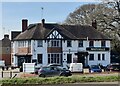
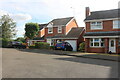
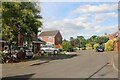
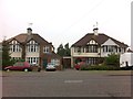
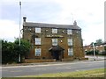
Photos of NN2 8AZ


Area Information
Living in NN2 8AZ means inhabiting a tightly packed residential cluster in England, where 1.5 hectares of land house 1,539 residents at a density of 102,461 people per square kilometre. This is a compact, high-density area, typical of urban or semi-urban planning. The community is predominantly composed of homeowners, with 85% of properties occupied by their owners, suggesting a stable, long-term presence. The area’s proximity to retail, transport hubs, and a railway station makes it practical for daily life, though its small size means amenities are concentrated. The median age of 47 indicates a mature population, with most residents aged 30–64, reflecting a mix of working professionals and families. Daily life here is defined by accessibility: a short walk or bus ride to shops like Tesco Northampton or Morrisons, and easy access to Northampton Bus Interchange and Northampton Railway Station. While the area lacks natural landscapes or protected sites, its safety profile—low flood risk and below-average crime rates—makes it appealing for those prioritising security and convenience.
- Area Type
- Postcode
- Area Size
- 1.5 hectares
- Population
- 1539
- Population Density
- 3887 people/km²
NN2 8AZ is a predominantly owner-occupied area, with 85% of properties in private hands. The housing stock is almost entirely composed of houses, not flats or apartments, which is unusual for a high-density postcode. This suggests a demand for family homes or larger residences, possibly serving a local workforce that prioritises space. The area’s small size—just 1.5 hectares—means the property market is limited, with few new developments. Buyers should expect a competitive market, as the high home ownership rate implies limited availability of rental properties. The proximity to Northampton Bus Interchange and Northampton Railway Station adds value, particularly for commuters. However, the area’s compact nature means buyers must consider the immediate surroundings for additional housing options. For those seeking a house with security and convenience, NN2 8AZ offers a stable, though constrained, market.
House Prices in NN2 8AZ
Showing 21 properties
| Address | Type | Beds | Baths | Last Sale Price | Last Sale Date | |
|---|---|---|---|---|---|---|
| 19A Yeoman Drive, Northampton, NN2 8AZ | house | 4 | 2 | £475,000 | Jun 2025 | |
| 4 Yeoman Drive, Northampton, NN2 8AZ | house | 4 | 1 | £299,995 | Aug 2023 | |
| 11 Yeoman Drive, Northampton, NN2 8AZ | house | - | - | £236,000 | Dec 2020 | |
| 17 Yeoman Drive, Northampton, NN2 8AZ | Semi-detached | 2 | - | £185,000 | Nov 2019 | |
| 7 Yeoman Drive, Northampton, NN2 8AZ | house | - | - | £160,000 | Dec 2013 | |
| 1 Yeoman Drive, Northampton, NN2 8AZ | Semi-detached | 3 | - | £150,000 | May 2013 | |
| 8 Yeoman Drive, Northampton, NN2 8AZ | Semi-detached | - | - | £195,000 | Apr 2008 | |
| 6 Yeoman Drive, Northampton, NN2 8AZ | house | 3 | - | £157,000 | Jun 2005 | |
| 12 Yeoman Drive, Northampton, NN2 8AZ | Semi-detached | - | - | £128,000 | Apr 2005 | |
| 9 Yeoman Drive, Northampton, NN2 8AZ | Semi-detached | - | - | £99,000 | Oct 2001 |
Energy Efficiency in NN2 8AZ
Residents of NN2 8AZ have access to a range of nearby amenities within practical reach. Retail options include major stores like Tesco Northampton, M&S Harborough BP, and Morrisons Daily, ensuring daily shopping needs are met without long journeys. The area’s proximity to Northampton Bus Interchange and University Bus Interchange provides easy access to public transport, while Northampton Railway Station connects to broader regional networks. Though the area itself is small, its location likely places it near parks or open spaces not explicitly listed in the data. The convenience of retail and transport hubs creates a lifestyle focused on efficiency, with minimal need for car ownership. For those who prefer walking or cycling, the compact layout reduces travel time between amenities. This balance of accessibility and limited space defines the area’s character as practical and community-oriented.
Amenities
Schools
| Rank | School | Type | Entry gender | Ages |
|---|
Explore more schools in this area
Go to Schools tabDemographics
The population of NN2 8AZ is 1,539, with a median age of 47, meaning most residents are adults in their 30s to 60s. This age range suggests a community of established professionals and families, with fewer younger or elderly residents. Home ownership is exceptionally high at 85%, indicating a preference for long-term residency over renting. The area’s accommodation is predominantly houses, not flats, which aligns with the demographic’s likely need for space. The predominant ethnic group is White, though the data does not specify further diversity metrics. The high population density—over 100,000 people per square kilometre—means the area is intensely populated, yet the low crime risk score of 76/100 suggests a safe, orderly environment. This combination of stability, homeownership, and proximity to transport and retail creates a practical, low-maintenance lifestyle for its residents.
Household Size
Accommodation Type
Tenure
Ethnic Group
Religion
Household Composition
Age
Household Deprivation
NS-SEC
Explore more demographic insights in this area
Go to Demographics tabPlanning
Planning Constraints
- Flood RiskPremium
- Ramsar Wetland SitesPremium
- Area of Outstanding Natural BeautyPremium
- Protected Nature ReservePremium
- Protected WoodlandPremium