Area Overview for NN2 7TJ
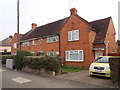
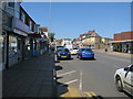
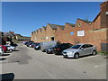
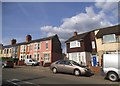
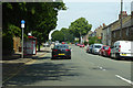
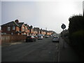
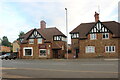
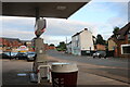
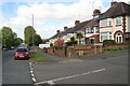
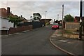
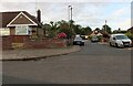
Photos of NN2 7TJ

Area Information
NN2 7TJ is a small, tightly packed residential area in England, spanning just 4,757 square metres and home to 1,746 people. Its high population density—367,052 people per square kilometre—reflects a compact, community-focused layout. This postcode area is part of a broader residential cluster, with homes predominantly in single-family structures. The median age of 47 suggests a mature population, with adults aged 30–64 forming the largest demographic group. Daily life here is likely characterised by a quiet, settled rhythm, with local amenities and schools within practical reach. The area’s proximity to Northampton Railway Station and nearby bus interchanges ensures connectivity to the city and beyond. While the community is small, it offers a mix of retail options, including Heron Kingsthorpe and Waitrose, which may support a range of shopping and dining needs. The area’s low flood risk and absence of protected natural sites suggest a stable, low-constraint environment for residents. However, the medium crime risk score means standard security measures remain advisable. For buyers seeking a compact, established neighbourhood with access to urban services, NN2 7TJ presents a focused, if densely populated, option.
- Area Type
- Postcode
- Area Size
- 4757 m²
- Population
- 1746
- Population Density
- 6474 people/km²
NN2 7TJ’s property market is defined by a 46% home ownership rate, with houses forming the predominant accommodation type. This indicates a market skewed towards owner-occupied homes rather than rental properties, though the relatively low home ownership rate suggests a significant portion of the housing stock is rented. The area’s compact size and high population density imply a limited number of properties, which could create competition among buyers. The presence of single-family homes may appeal to those seeking traditional housing, though the small size of the area means buyers must consider proximity to surrounding regions for additional options. The market’s character is likely shaped by its mature demographic, with properties potentially valued for their stability and established community feel. For first-time buyers or investors, the mix of owner-occupied and rental properties could present opportunities, though the limited scale of the area may restrict choice.
House Prices in NN2 7TJ
Showing 19 properties
| Address | Type | Beds | Baths | Last Sale Price | Last Sale Date | |
|---|---|---|---|---|---|---|
| 101 Nursery Lane, Northampton, NN2 7TJ | Terraced | 2 | - | £210,000 | Apr 2025 | |
| 114 Nursery Lane, Northampton, NN2 7TJ | Terraced | 2 | 1 | £190,000 | May 2024 | |
| 105 Nursery Lane, Northampton, NN2 7TJ | Bungalow | 2 | 1 | £169,000 | Jan 2023 | |
| 100 Nursery Lane, Northampton, NN2 7TJ | Terraced | 3 | 1 | £215,000 | May 2022 | |
| 110 Nursery Lane, Northampton, NN2 7TJ | Terraced | 2 | 1 | £140,000 | May 2019 | |
| 112 Nursery Lane, Northampton, NN2 7TJ | house | 3 | - | £177,500 | Aug 2018 | |
| 98 Nursery Lane, Northampton, NN2 7TJ | Terraced | 2 | 1 | £142,000 | Aug 2016 | |
| 103 Nursery Lane, Northampton, NN2 7TJ | Semi-detached | 2 | 1 | £139,000 | Mar 2016 | |
| 116 Nursery Lane, Northampton, NN2 7TJ | house | - | - | £122,000 | Dec 2007 | |
| 118 Nursery Lane, Northampton, NN2 7TJ | house | - | - | - | - |
Energy Efficiency in NN2 7TJ
Residents of NN2 7TJ have access to a range of local amenities, including five retail outlets such as Heron Kingsthorpe, Waitrose Kingsthorpe, and Cook Kingsthorpe, which cater to everyday shopping and dining needs. The area’s proximity to Northampton Bus Interchange and University Bus Interchange ensures easy access to public transport, connecting residents to the city’s cultural and commercial hubs. While the postcode lacks parks or leisure facilities within its boundaries, the surrounding area likely offers recreational spaces. The presence of multiple schools and retail options suggests a functional, community-oriented lifestyle, where daily errands and family needs can be met locally. However, the high population density means amenities are concentrated, requiring residents to navigate a compact, possibly busy environment. For those valuing convenience and proximity to urban services, NN2 7TJ provides a practical, if small-scale, living experience.
Amenities
Schools
Residents of NN2 7TJ have access to several primary schools, including Kingsthorpe Grove Primary School and The Good Shepherd Catholic Primary School, both rated 'good' by Ofsted. St David’s Catholic Middle School is also within the area, though its Ofsted rating is not specified. The concentration of primary schools suggests a family-friendly environment, with multiple options for early education. The presence of two 'good' rated schools may be a key draw for families prioritising quality education. However, the absence of secondary schools within the postcode means students may need to travel to nearby areas for further education. The mix of state and Catholic schools reflects a diverse educational landscape, though the lack of data on school capacity or catchment areas limits a full assessment of their accessibility. For prospective buyers, the availability of multiple primary schools is a practical advantage, though broader educational needs may require planning beyond the immediate area.
| Rank | School | Type | Entry gender | Ages |
|---|
Explore more schools in this area
Go to Schools tabDemographics
The population of NN2 7TJ is predominantly adults aged 30–64, with a median age of 47. This suggests a mature, settled community with a strong presence of middle-aged residents. Home ownership sits at 46%, indicating a mix of owner-occupied properties and rental stock. The area is characterised by houses rather than flats, which may appeal to those seeking traditional family homes. The predominant ethnic group is White, reflecting a homogenous demographic profile. While no specific deprivation data is provided, the high population density and availability of local amenities suggest a functional, if small-scale, infrastructure. The presence of multiple primary schools, including two rated 'good' by Ofsted, hints at a family-oriented environment. However, the lack of diversity data means the full extent of the community’s social composition remains unclear. For buyers, the age profile and housing stock suggest a focus on stability and long-term residency over transient populations.
Household Size
Accommodation Type
Tenure
Ethnic Group
Religion
Household Composition
Age
Household Deprivation
NS-SEC
Explore more demographic insights in this area
Go to Demographics tabPlanning
Planning Constraints
- Flood RiskPremium
- Ramsar Wetland SitesPremium
- Area of Outstanding Natural BeautyPremium
- Protected Nature ReservePremium
- Protected WoodlandPremium