Area Overview for NN2 7TA
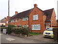
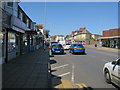
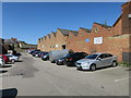
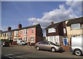
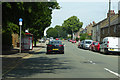
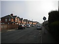
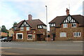
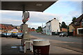
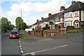
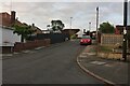
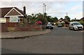
Photos of NN2 7TA

Area Information
Living in NN2 7TA means inhabiting a compact, densely populated residential cluster in England. The area covers just 2.2 hectares, housing 2,552 people in a space that feels more like a tight-knit village than a sprawling suburb. With a population density of 113,778 people per square kilometre, the community is highly concentrated, creating a mix of proximity and intimacy. The area’s demographic profile is notable: while the median age is 22, the most common age range is 30–64, suggesting a balance between younger residents and families. This blend of age groups contributes to a dynamic, if small, social fabric. Daily life here is shaped by proximity to essential services, with nearby schools, retail outlets, and transport links forming the backbone of the area. The compact size means residents are never far from amenities, though the limited space also defines the area’s character—a place where community ties are strong, and the pace of life remains steady.
- Area Type
- Postcode
- Area Size
- 2.2 hectares
- Population
- 2552
- Population Density
- 3066 people/km²
The property market in NN2 7TA is characterised by a high rate of home ownership—70% of residents own their homes. This suggests a stable, owner-occupied market rather than a rental-dominated one. The predominant accommodation type is houses, which, in such a small area, implies a limited but focused housing stock. Given the compact size of NN2 7TA (2.2 hectares), the immediate surroundings may offer similar housing options, but the small footprint means competition for properties could be fierce. For buyers, this translates to a market where availability is constrained, and properties are likely to be in high demand. The high home ownership rate also indicates that the area is not a transient rental hub, which may appeal to those seeking long-term stability. However, the limited space means buyers must consider the area’s proximity to amenities and transport as critical factors in their decision.
House Prices in NN2 7TA
Showing 40 properties
| Address | Type | Beds | Baths | Last Sale Price | Last Sale Date | |
|---|---|---|---|---|---|---|
| 158 Ruskin Road, Northampton, NN2 7TA | house | - | - | £237,500 | Mar 2025 | |
| 133 Ruskin Road, Northampton, NN2 7TA | Semi-detached | 4 | 1 | £200,000 | Jul 2024 | |
| 125 Ruskin Road, Northampton, NN2 7TA | Semi-detached | 2 | 1 | £168,000 | Dec 2021 | |
| 172 Ruskin Road, Northampton, NN2 7TA | house | - | - | £335,000 | Dec 2021 | |
| 131 Ruskin Road, Northampton, NN2 7TA | Bungalow | 2 | 1 | £170,000 | Aug 2021 | |
| 156 Ruskin Road, Northampton, NN2 7TA | Semi-detached | 3 | 1 | £194,000 | Jun 2021 | |
| 170 Ruskin Road, Northampton, NN2 7TA | house | - | - | £295,000 | May 2021 | |
| 178 Ruskin Road, Northampton, NN2 7TA | house | 4 | - | £280,000 | Mar 2021 | |
| 150 Ruskin Road, Northampton, NN2 7TA | Semi-detached | 2 | 1 | £160,000 | Feb 2021 | |
| 145 Ruskin Road, Northampton, NN2 7TA | Bungalow | - | - | £150,000 | Apr 2019 |
Energy Efficiency in NN2 7TA
The lifestyle in NN2 7TA is shaped by its proximity to retail, transport, and essential services. Retail options include M&S Harborough BP, Heron Kingsthorpe, and Waitrose Kingsthorpe, offering a mix of high-street brands and supermarkets. These shops are within walking or short driving distance, making daily errands efficient. The area’s transport links are a key feature: Northampton Railway Station provides direct connections to nearby cities, while the University Bus Interchange and Northampton Bus Interchange offer frequent local routes. These links are particularly valuable for commuters and students. The compact nature of NN2 7TA means that amenities are concentrated, which can be both a convenience and a limitation. While the area lacks expansive parks or leisure facilities, its proximity to Northampton suggests that larger recreational options are accessible. Overall, the lifestyle here balances practicality with the constraints of a small, densely populated space.
Amenities
Schools
Residents of NN2 7TA have access to a range of schools, including primary and special education institutions. Green Oaks Primary School and Bective Middle School serve the area, though both are categorised as primary schools, which may indicate a focus on early education. Kingsthorpe College is also listed, but its classification as a primary school appears to be an error, as the name suggests a secondary institution. All Saints CofE VA Primary School holds a 'good' Ofsted rating, offering families a reputable option for primary education. Whiston Special School provides tailored support for students with specific needs. The mix of school types ensures that families have choices, from mainstream primary education to specialist provision. However, the absence of secondary schools in the data suggests that older students may need to travel further for secondary education, which could be a consideration for families planning long-term in the area.
| Rank | School | Type | Entry gender | Ages |
|---|
Explore more schools in this area
Go to Schools tabDemographics
NN2 7TA has a median age of 22, but the most common age range among residents is 30–64 years. This suggests a community skewed towards working-age adults, many of whom may be in their prime earning years. Home ownership is high, with 70% of households owning their homes, a figure that indicates stability and long-term commitment to the area. The predominant accommodation type is houses, which aligns with the higher home ownership rate and the area’s residential character. The predominant ethnic group is White, though the data does not provide further breakdowns of diversity. The high population density—113,778 people per square kilometre—means the area is intensely populated, which can influence the cost of living and the sense of community. For families, the mix of age groups and the availability of schools may create a balanced environment, though the density could also mean limited private outdoor space.
Household Size
Accommodation Type
Tenure
Ethnic Group
Religion
Household Composition
Age
Household Deprivation
NS-SEC
Explore more demographic insights in this area
Go to Demographics tabPlanning
Planning Constraints
- Flood RiskPremium
- Ramsar Wetland SitesPremium
- Area of Outstanding Natural BeautyPremium
- Protected Nature ReservePremium
- Protected WoodlandPremium