Area Overview for NN2 7NN
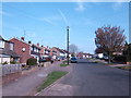
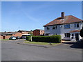
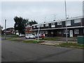
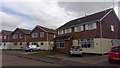
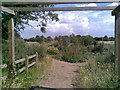
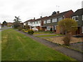
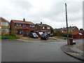
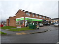
Photos of NN2 7NN


Area Information
NN2 7NN is a compact residential postcode area in England, covering just 1.6 hectares and home to 1,363 people. Its high population density of 84,874 people per square kilometre reflects its small, tightly knit character. This area is part of a larger residential cluster, offering a mix of convenience and proximity to Northampton’s transport hubs. Residents benefit from nearby amenities such as Northampton Railway Station, which connects to broader regional networks, and two bus interchanges that provide local and regional routes. The area’s proximity to retail hubs like Morrisons Kingsley and Tesco Spinny ensures daily essentials are within easy reach. While the community is small, it sits within a larger urban context, blending residential tranquillity with access to city amenities. For those seeking a balance between seclusion and connectivity, NN2 7NN offers a defined, self-contained living environment with clear boundaries and practical access to essential services.
- Area Type
- Postcode
- Area Size
- 1.6 hectares
- Population
- 1363
- Population Density
- 3473 people/km²
The property market in NN2 7NN is characterised by high home ownership (84%) and a predominance of houses over flats. This suggests a community of long-term residents who have invested in their homes, likely prioritising stability and space. The absence of rental properties implies limited turnover, which can make the market less dynamic for buyers seeking short-term investment opportunities. The compact size of the area means housing stock is limited, and properties are likely to be in close proximity to each other. For buyers, this presents a challenge: the small footprint of NN2 7NN means competition for available homes, and the immediate surroundings may hold more options. The focus on owner-occupation also indicates that properties are likely to be well-maintained, with residents having a vested interest in preserving their value.
House Prices in NN2 7NN
Showing 51 properties
| Address | Type | Beds | Baths | Last Sale Price | Last Sale Date | |
|---|---|---|---|---|---|---|
| 22 Hollingside Drive, Northampton, NN2 7NN | house | - | - | £260,000 | Aug 2024 | |
| 27 Hollingside Drive, Northampton, NN2 7NN | Semi-detached | 2 | 1 | £235,000 | May 2023 | |
| 14 Hollingside Drive, Northampton, NN2 7NN | Bungalow | - | - | £215,000 | Jan 2023 | |
| 38 Hollingside Drive, Northampton, NN2 7NN | Bungalow | 2 | 1 | £235,000 | Oct 2022 | |
| 33 Hollingside Drive, Northampton, NN2 7NN | Bungalow | - | - | £203,000 | Oct 2020 | |
| 28 Hollingside Drive, Northampton, NN2 7NN | Semi-detached | 3 | - | £170,000 | Aug 2020 | |
| 29 Hollingside Drive, Northampton, NN2 7NN | Bungalow | - | - | £165,000 | Aug 2019 | |
| 36 Hollingside Drive, Northampton, NN2 7NN | Semi-detached | 2 | 1 | £182,500 | May 2018 | |
| 54 Hollingside Drive, Northampton, NN2 7NN | Bungalow | 2 | - | £200,000 | Dec 2017 | |
| 37 Hollingside Drive, Northampton, NN2 7NN | Semi-detached | 2 | - | £159,950 | Jun 2016 |
Energy Efficiency in NN2 7NN
Living in NN2 7NN offers access to a range of local amenities within practical reach. Retail options include Morrisons Kingsley and Tesco Spinny, providing essential shopping and dining choices. The area’s transport links, such as Northampton Bus Interchange and Northampton Railway Station, connect residents to broader networks, enabling easy access to cultural, leisure, and professional opportunities in Northampton. While the data does not specify parks or recreational spaces, the proximity to urban centres suggests nearby green spaces or leisure facilities. The presence of two bus interchanges and a railway station also enhances mobility for social or professional engagements. This area is ideal for those who value a compact, well-serviced environment with direct access to transport and retail, though it may lack extensive natural landscapes or large-scale leisure amenities.
Amenities
Schools
| Rank | School | Type | Entry gender | Ages |
|---|
Explore more schools in this area
Go to Schools tabDemographics
The population of NN2 7NN has a median age of 47, with the majority of residents aged between 30 and 64. This suggests a community skewed towards middle-aged adults, likely with established careers and families. Home ownership is high at 84%, indicating a stable, long-term resident base. The area is predominantly composed of houses rather than flats, reflecting a traditional housing stock. The predominant ethnic group is White, which aligns with broader demographic trends in the region. With no data on deprivation levels, it is unclear how this impacts quality of life, but the high home ownership rate and age profile suggest a relatively settled, low-turnover community. The absence of younger or older demographics may influence local services and amenities, though the area’s compact size means it caters to a specific demographic niche.
Household Size
Accommodation Type
Tenure
Ethnic Group
Religion
Household Composition
Age
Household Deprivation
NS-SEC
Explore more demographic insights in this area
Go to Demographics tabPlanning
Planning Constraints
- Flood RiskPremium
- Ramsar Wetland SitesPremium
- Area of Outstanding Natural BeautyPremium
- Protected Nature ReservePremium
- Protected WoodlandPremium