Area Overview for NN2 7JA
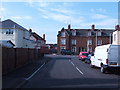
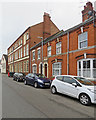
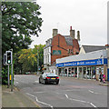
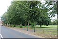
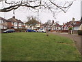
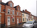
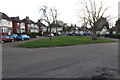
Photos of NN2 7JA


Area Information
NN2 7JA is a small, tightly packed residential postcode in England, covering just 4,861 square metres and home to 1,797 residents. Its high population density of 369,651 people per square kilometre reflects a compact, urbanised cluster. This area is defined by its proximity to essential services and transport links, making it practical for daily life. The community is predominantly composed of adults aged 30–64, with a median age of 47, suggesting a mature, stable population. While the area lacks natural landscapes or protected sites, its accessibility to retail, public transport, and rail networks positions it as a functional hub for commuters and families. Living here means navigating a densely populated environment with limited open space, but the presence of nearby shops, bus routes, and Northampton Railway Station ensures convenience. The area’s small size means every resident is close to amenities, though the high density may impact privacy. For buyers, NN2 7JA offers a mix of owner-occupied homes and proximity to urban infrastructure, though its character is shaped more by practicality than scenic appeal.
- Area Type
- Postcode
- Area Size
- 4861 m²
- Population
- 1797
- Population Density
- 7861 people/km²
NN2 7JA is primarily an owner-occupied area, with 59% of residents living in their own homes. The accommodation type is predominantly houses, which is unusual for a densely populated postcode and may indicate a mix of semi-detached or terraced properties. Given the small area size of 4,861 square metres and high population density, the housing stock is likely limited, with little scope for new developments. This makes the property market competitive, particularly for buyers seeking larger homes or specific features. The proximity to retail, transport, and Northampton Railway Station may attract buyers prioritising convenience over space. However, the area’s compact nature means properties are likely to be close to each other, with limited scope for expansion. For those considering the area, the focus should be on existing housing stock and its alignment with local infrastructure, rather than growth potential.
House Prices in NN2 7JA
Showing 19 properties
| Address | Type | Beds | Baths | Last Sale Price | Last Sale Date | |
|---|---|---|---|---|---|---|
| 36 Junction Road, Northampton, NN2 7JA | Terraced | 2 | 1 | £225,000 | Oct 2025 | |
| 35 Junction Road, Northampton, NN2 7JA | Terraced | 2 | - | £182,500 | Sep 2024 | |
| 40 Junction Road, Northampton, NN2 7JA | Terraced | 3 | 1 | £240,000 | Sep 2022 | |
| 37 Junction Road, Northampton, NN2 7JA | Terraced | 3 | 1 | £242,000 | Aug 2022 | |
| 41 Junction Road, Northampton, NN2 7JA | house | - | - | £320,000 | Jun 2022 | |
| 42 Junction Road, Northampton, NN2 7JA | house | - | - | £320,000 | Jun 2022 | |
| 38 Junction Road, Northampton, NN2 7JA | Retail | 3 | 1 | £275,000 | Jun 2022 | |
| 45 Junction Road, Northampton, NN2 7JA | Retail | 3 | 1 | £167,598 | May 2022 | |
| 43 Junction Road, Northampton, NN2 7JA | house | - | - | £195,000 | Aug 2021 | |
| 49A Junction Road, Northampton, NN2 7JA | house | 3 | 1 | £175,000 | Aug 2009 |
Energy Efficiency in NN2 7JA
Living in NN2 7JA provides access to a range of practical amenities within close proximity. Retail options include major chains such as Tesco Kingsley, Morrisons Kingsley, and M&S Abington Ave Northampton BP, ensuring daily shopping needs are met. The area’s transport infrastructure is equally convenient, with the University Bus Interchange and Northampton Bus Interchange offering connections to nearby towns and cities. Northampton Railway Station provides rail access to larger urban centres. While the area lacks parks or leisure facilities, its compact design means residents can reach shops, transport hubs, and workplaces without relying heavily on cars. The presence of multiple retail outlets and transport options contributes to a functional, urban lifestyle, though the absence of green spaces or recreational areas may be a drawback for those prioritising outdoor activities.
Amenities
Schools
| Rank | School | Type | Entry gender | Ages |
|---|
Explore more schools in this area
Go to Schools tabDemographics
The population of NN2 7JA is overwhelmingly composed of adults aged 30–64, with a median age of 47. This suggests a community of established professionals and families, rather than students or retirees. Home ownership stands at 59%, indicating a mix of owner-occupied properties and rental units. The area is predominantly composed of houses, which contrasts with higher-density housing typologies. The predominant ethnic group is White, reflecting a homogenous demographic profile. The population density of 369,651 people per square kilometre is exceptionally high, which may influence the character of daily life, with limited private space and a focus on shared amenities. While no specific data on deprivation is provided, the high density and reliance on public transport suggest that residents may depend on communal resources. This profile paints a picture of a stable, middle-aged population living in a compact, urbanised environment with limited natural or recreational spaces.
Household Size
Accommodation Type
Tenure
Ethnic Group
Religion
Household Composition
Age
Household Deprivation
NS-SEC
Explore more demographic insights in this area
Go to Demographics tabPlanning
Planning Constraints
- Flood RiskPremium
- Ramsar Wetland SitesPremium
- Area of Outstanding Natural BeautyPremium
- Protected Nature ReservePremium
- Protected WoodlandPremium