Area Overview for NN2 7FL
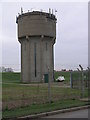
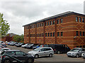
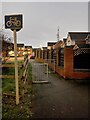
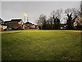
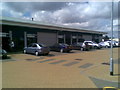
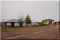
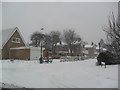
Photos of NN2 7FL

Area Information
Living in NN2 7FL means inhabiting a tightly packed residential cluster in England, where 2,552 people reside across just 1.2 hectares. This compact area is characterised by high population density — over 211,846 people per square kilometre — suggesting a mix of close-knit communities and shared spaces. The area’s small footprint means it is likely to feel intimate, with homes closely spaced. While the median age is 22, the most common age range among residents is 30–64, indicating a mature demographic with established households. This mix of younger and older residents creates a dynamic local environment, where daily life is shaped by proximity to amenities and a reliance on nearby services. The area’s residential focus, with 70% of homes owner-occupied, suggests stability, though its limited size means that residents may need to look beyond NN2 7FL for broader opportunities. The presence of schools, transport links, and retail options within practical reach further defines the rhythm of life here, balancing convenience with the constraints of a small postcode.
- Area Type
- Postcode
- Area Size
- 1.2 hectares
- Population
- 2552
- Population Density
- 3066 people/km²
The property market in NN2 7FL is defined by a strong emphasis on owner-occupation, with 70% of homes owned by their residents. This contrasts with areas where rental markets dominate, indicating a community focused on long-term residency. The accommodation type is predominantly houses, which is notable for a small postcode area. This suggests a mix of larger properties, possibly family homes, rather than flats or apartments. The limited area size means that the housing stock is finite, which could create competition among buyers. For those considering the area, the presence of houses may appeal to families seeking space, though the compact nature of NN2 7FL means that buyers may need to look to adjacent postcode areas for additional options. The high home ownership rate also implies a stable market, but the small size of the area may mean that property values are influenced more by local factors than broader regional trends.
House Prices in NN2 7FL
Showing 34 properties
| Address | Type | Beds | Baths | Last Sale Price | Last Sale Date | |
|---|---|---|---|---|---|---|
| 21 Campus Drive, Northampton, NN2 7FL | Semi-detached | 4 | 1 | £144,000 | Dec 2024 | |
| 3 Campus Drive, Northampton, NN2 7FL | house | - | - | £389,950 | Mar 2023 | |
| 7 Campus Drive, Northampton, NN2 7FL | house | - | - | £347,950 | Feb 2023 | |
| 47 Campus Drive, Northampton, NN2 7FL | Terraced | 3 | 2 | £270,950 | Jan 2022 | |
| 43 Campus Drive, Northampton, NN2 7FL | house | - | - | £326,950 | Dec 2021 | |
| 49 Campus Drive, Northampton, NN2 7FL | Terraced | 3 | 2 | £273,950 | Dec 2021 | |
| 41 Campus Drive, Northampton, NN2 7FL | house | - | - | £321,950 | Nov 2021 | |
| 45 Campus Drive, Northampton, NN2 7FL | house | - | - | £273,950 | Nov 2021 | |
| 37 Campus Drive, Northampton, NN2 7FL | house | - | - | £459,950 | Sep 2021 | |
| 35 Campus Drive, Northampton, NN2 7FL | house | - | - | £349,950 | Jun 2021 |
Energy Efficiency in NN2 7FL
Daily life in NN2 7FL is shaped by its proximity to retail, dining, and transport hubs. The area has five notable retail venues, including M&S Harborough BP, Morrisons Daily, and Heron Kingsthorpe, offering a range of shopping and dining options. These locations provide convenience for everyday needs, from groceries to casual meals. The two bus stops, including the University Bus Interchange, connect residents to larger retail and leisure centres beyond the immediate area. While the postcode is small, the presence of these amenities suggests a focus on practicality, with residents able to access essentials without long journeys. The lack of detailed information on parks or leisure facilities means that the character of the area is defined more by its compact, service-oriented layout. For those prioritising convenience over expansive recreational spaces, NN2 7FL offers a functional lifestyle with minimal need for travel.
Amenities
Schools
Residents of NN2 7FL have access to a range of educational institutions, including primary schools and a special school. Green Oaks Primary School and Bective Middle School cater to younger children, while Kingsthorpe College serves as a primary school for older students. All Saints CofE VA Primary School holds an Ofsted rating of ‘good’, indicating a reliable standard of education. Whiston Special School provides tailored support for students with specific needs. The mix of school types ensures that families have options for both mainstream and specialist education. This diversity is particularly valuable for parents seeking a school that matches their child’s requirements, whether for academic, social, or developmental reasons. The proximity of these schools to NN2 7FL means that daily commutes for students are likely to be short, reducing the burden on families. The presence of multiple schools also suggests a community that prioritises education, with a focus on accessibility and quality.
| Rank | School | Type | Entry gender | Ages |
|---|
Explore more schools in this area
Go to Schools tabDemographics
The community in NN2 7FL is predominantly composed of adults aged 30–64, with a median age of 22. This suggests a mix of younger individuals and established families, though the exact proportion of younger residents is unclear. Home ownership is strong, with 70% of properties owner-occupied, reflecting a stable housing market. The area is primarily composed of houses, which is unusual for a small postcode, and the predominant ethnic group is White. This demographic profile indicates a community with a focus on long-term residency and family living. The high population density — over 211,846 people per square kilometre — means that the area is intensely populated, which can influence social dynamics and access to shared resources. While no specific data on deprivation is provided, the high home ownership rate and presence of schools suggest a relatively stable quality of life. However, the small size of the area may limit opportunities for those seeking more diverse social or economic environments.
Household Size
Accommodation Type
Tenure
Ethnic Group
Religion
Household Composition
Age
Household Deprivation
NS-SEC
Explore more demographic insights in this area
Go to Demographics tabPlanning
Planning Constraints
- Flood RiskPremium
- Ramsar Wetland SitesPremium
- Area of Outstanding Natural BeautyPremium
- Protected Nature ReservePremium
- Protected WoodlandPremium