Area Overview for NN2 7ER
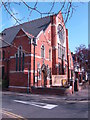
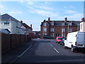
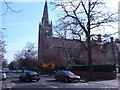
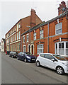
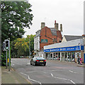
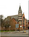
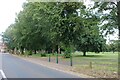
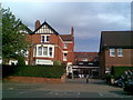
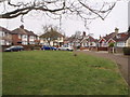
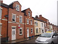
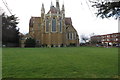
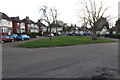
Photos of NN2 7ER
Area Information
NN2 7ER is a compact residential postcode in England, covering just 5,460 square metres and home to 1,946 residents. Its high population density of 356,419 people per square kilometre reflects a tightly knit community, likely centred around a mix of housing and local amenities. The area’s small size suggests a focused, practical layout, possibly with shared green spaces or communal areas. With a median age of 47 and a majority of residents aged 30–64, it is a community of established adults, many of whom may be raising families. The presence of a primary school and nursery nearby indicates a family-friendly environment, while proximity to transport hubs like Northampton Railway Station and multiple bus interchanges ensures connectivity to the wider region. Daily life here likely balances local convenience with access to regional services, making it appealing to those seeking a balance between urban and suburban living.
- Area Type
- Postcode
- Area Size
- 5460 m²
- Population
- 1946
- Population Density
- 4411 people/km²
NN2 7ER is characterised by a 60% home ownership rate, with houses forming the dominant accommodation type. This suggests a market skewed towards owner-occupied properties rather than rentals, though the exact proportion of rental units is not specified. Given the area’s small size and high population density, the housing stock is likely limited to a few small residential clusters, possibly with a mix of semi-detached or terraced homes. Buyers should consider the proximity to amenities and transport links, which may offset the area’s compact nature. The presence of nearby schools and retail options could make it attractive to families, but the small footprint means competition for properties may be intense. For those seeking a home with immediate access to services, this area offers a blend of practicality and convenience.
House Prices in NN2 7ER
Showing 15 properties
| Address | Type | Beds | Baths | Last Sale Price | Last Sale Date | |
|---|---|---|---|---|---|---|
| 10 Rothesay Terrace, Northampton, NN2 7ER | Semi-detached | 3 | 1 | £177,000 | Dec 2019 | |
| 17 Rothesay Terrace, Northampton, NN2 7ER | house | - | - | £114,000 | Nov 2005 | |
| 19 Rothesay Terrace, Northampton, NN2 7ER | Semi-detached | 3 | 1 | £117,995 | Nov 2003 | |
| 3 Rothesay Terrace, Northampton, NN2 7ER | Semi-detached | 1 | 1 | £107,500 | Nov 2003 | |
| 15 Rothesay Terrace, Northampton, NN2 7ER | Terraced | 3 | 1 | £56,000 | Jun 2001 | |
| 1 Rothesay Terrace, Northampton, NN2 7ER | Semi-detached | 1 | 1 | £31,000 | Sep 1995 | |
| 8 Rothesay Terrace, Northampton, NN2 7ER | house | - | - | - | - | |
| 11 Rothesay Terrace, Northampton, NN2 7ER | Semi-detached | - | - | - | - | |
| 5 Rothesay Terrace, Northampton, NN2 7ER | Terraced | - | - | - | - | |
| 9 Rothesay Terrace, Northampton, NN2 7ER | Semi-detached | - | - | - | - |
Energy Efficiency in NN2 7ER
Residents of NN2 7ER benefit from nearby retail options, including Morrisons Kingsley, Tesco Kingsley, and M&S Abington Ave Northampton BP, which cater to everyday shopping needs. The area’s proximity to transport hubs like Northampton Bus Interchange and the railway station ensures easy access to regional amenities, while the presence of a major bus interchange adds to the convenience of commuting. Though no parks or leisure facilities are explicitly listed, the compact layout suggests a focus on practical living over expansive recreational spaces. The combination of retail, transport, and nearby schools creates a lifestyle that prioritises accessibility and efficiency, ideal for those seeking a self-contained yet connected community.
Amenities
Schools
Residents of NN2 7ER have access to a nursery and a primary school within close proximity. Wallace Road Nursery School provides early education, while Kingsley Primary School, rated 'good' by Ofsted, offers primary-level schooling. The presence of a 'good' rated primary school suggests a strong foundation for local education, though no secondary schools are listed in the data. This mix of school types caters to families with young children but may require additional travel for older students. The concentration of educational facilities in the area reinforces its appeal to households prioritising convenient schooling options for their children.
| Rank | School | Type | Entry gender | Ages |
|---|
Explore more schools in this area
Go to Schools tabDemographics
The population of NN2 7ER is predominantly adults aged 30–64, with a median age of 47. This suggests a mature, stable community with fewer young families or retirees compared to other areas. Home ownership stands at 60%, with houses being the primary accommodation type, indicating a mix of owner-occupied properties and possibly some rental units. The predominant ethnic group is White, though no specific data on diversity or deprivation is provided. The high population density—over 350,000 people per square kilometre—implies a compact, possibly mixed-use area where residential and commercial spaces are closely integrated. While no figures on deprivation are available, the concentration of retail and transport options may support a quality of life that balances affordability with accessibility.
Household Size
Accommodation Type
Tenure
Ethnic Group
Religion
Household Composition
Age
Household Deprivation
NS-SEC
Explore more demographic insights in this area
Go to Demographics tabPlanning
Planning Constraints
- Flood RiskPremium
- Ramsar Wetland SitesPremium
- Area of Outstanding Natural BeautyPremium
- Protected Nature ReservePremium
- Protected WoodlandPremium