Area Overview for NN2 7EL
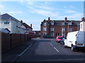
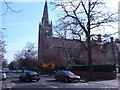
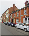
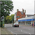
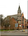
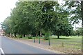
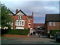
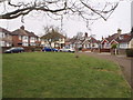
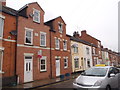
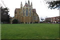
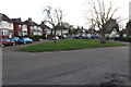
Photos of NN2 7EL

Area Information
Living in NN2 7EL means being part of a tightly knit residential cluster in England, where 1,946 people are spread across just 3.5 hectares. This high population density of 55,044 people per square kilometre reflects a compact, community-focused area. The postcode is characterised by its mix of family homes and proximity to essential services, making it practical for daily life. Residents benefit from nearby schools, retail outlets, and transport links, all within short distances. While the area is small, it offers a balance of convenience and quiet living, with no major environmental constraints like protected woodlands or wetlands. The presence of Kingsley Primary School, rated ‘good’ by Ofsted, and accessible transport hubs such as Northampton Railway Station highlight its appeal for families and commuters. However, the medium crime risk score of 50 means residents should remain vigilant, though the overall safety profile remains average. For those seeking a manageable, well-connected neighbourhood, NN2 7EL provides a distinct blend of practicality and community.
- Area Type
- Postcode
- Area Size
- 3.5 hectares
- Population
- 1946
- Population Density
- 4411 people/km²
The property market in NN2 7EL is defined by a 60% home ownership rate, with houses making up the majority of accommodation types. This indicates a community where many residents own their homes, often in family-oriented properties. The focus on houses rather than flats or apartments suggests a market that caters to established households rather than students or renters. Given the area’s small size and high population density, property availability is likely limited, and buyers may find competition for homes in this tightly packed postcode. The mix of owner-occupied and rental properties means there is some flexibility for buyers, though the small area size means the immediate surroundings are critical for assessing housing options. For those seeking a home, the emphasis on houses may appeal to families, but the compact nature of the area means proximity to amenities is a key consideration.
House Prices in NN2 7EL
Showing 39 properties
| Address | Type | Beds | Baths | Last Sale Price | Last Sale Date | |
|---|---|---|---|---|---|---|
| 39 Kenmuir Crescent, Northampton, NN2 7EL | Terraced | 2 | 1 | £205,000 | Sep 2025 | |
| 43 Kenmuir Crescent, Northampton, NN2 7EL | Terraced | 2 | 1 | £187,500 | Nov 2024 | |
| 5 Kenmuir Crescent, Northampton, NN2 7EL | Terraced | 2 | 1 | £220,000 | Mar 2024 | |
| 73 Kenmuir Crescent, Northampton, NN2 7EL | house | - | - | £167,500 | Nov 2020 | |
| 75 Kenmuir Crescent, Northampton, NN2 7EL | Semi-detached | 2 | - | £160,000 | Jan 2019 | |
| 47 Kenmuir Crescent, Northampton, NN2 7EL | Terraced | 3 | 1 | £215,000 | Jan 2019 | |
| 61 Kenmuir Crescent, Northampton, NN2 7EL | Terraced | 2 | 1 | £165,000 | Jul 2017 | |
| 35 Kenmuir Crescent, Northampton, NN2 7EL | Semi-detached | 3 | - | £193,500 | Mar 2017 | |
| 31 Kenmuir Crescent, Northampton, NN2 7EL | Terraced | 3 | - | £143,500 | Mar 2016 | |
| 51 Kenmuir Crescent, Northampton, NN2 7EL | Terraced | 3 | - | £137,500 | Jun 2015 |
Energy Efficiency in NN2 7EL
Daily life in NN2 7EL is shaped by its proximity to essential amenities. Residents can access Morrisons Kingsley, Tesco Kingsley, and Co-op Birchfield for groceries and household needs, all within a short walk or drive. The area’s small size ensures that these shops are not only convenient but also central to the local economy. For transport, the University Bus Interchange and Northampton Bus Interchange provide regular services, while Northampton Railway Station connects the area to broader regional networks. Although the data does not mention parks or leisure facilities, the absence of environmental constraints like protected woodlands or AONB status suggests that open spaces may be limited. Nonetheless, the mix of retail, transport, and educational options creates a functional lifestyle, ideal for those prioritising accessibility over expansive green spaces.
Amenities
Schools
Residents of NN2 7EL have access to a range of educational facilities, starting with Wallace Road Nursery School, which provides early years education for young children. For primary education, Kingsley Primary School serves the area, with an Ofsted rating of ‘good’ indicating a reliable standard of teaching and facilities. The presence of both a nursery and a primary school within the postcode suggests that families can access early education and primary schooling without needing to travel far. The mix of school types ensures continuity for children from nursery through to primary levels, reducing the need for long commutes. However, the data does not mention secondary schools or higher education institutions, so families planning for long-term schooling may need to consider nearby areas for secondary education options.
| Rank | School | Type | Entry gender | Ages |
|---|
Explore more schools in this area
Go to Schools tabDemographics
The community in NN2 7EL is predominantly composed of adults aged 30–64, with a median age of 47. This suggests a stable population of working-age individuals and families, rather than a younger or elderly demographic. Home ownership rates stand at 60%, indicating that a majority of residents live in their own homes, while the remaining 40% may be in rental properties. The accommodation type is primarily houses, reflecting a residential area focused on family homes rather than flats or apartments. The predominant ethnic group is White, though no specific diversity statistics are provided. With a population density of 55,044 per square kilometre, the area is densely populated, which may influence local amenities and community dynamics. The absence of specific deprivation data means the quality of life is not explicitly quantified, but the presence of schools and retail options suggests a functional, if compact, living environment.
Household Size
Accommodation Type
Tenure
Ethnic Group
Religion
Household Composition
Age
Household Deprivation
NS-SEC
Explore more demographic insights in this area
Go to Demographics tabPlanning
Planning Constraints
- Flood RiskPremium
- Ramsar Wetland SitesPremium
- Area of Outstanding Natural BeautyPremium
- Protected Nature ReservePremium
- Protected WoodlandPremium